Home
States
Colorado
Connecticut
Maine
Massachusetts
New Hampshire
New York
Rhode Island
Utah
Vermont
View All
Lists
NE 4,000 Footers
NE 100 Highest
NH 4,000 Footers
NH 100 Highest
NH 52 With A View
NH Belknap Range
NH Ossipee 10
Links
Trail Conditions
Trip Log
Sunrises
Sunsets
About
|
Blue Hill
Blue Hill, ME
Trailheads, measurements, times, distances, and maps are all approximate and relative to the hike(s) as shown below.
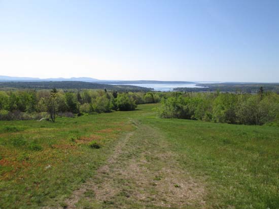
Looking down the lower Hayes Trail
Route: Hayes Trail, Tower Trail
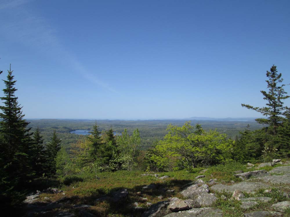
Trails were mostly dry and good shape. Upper Hayes Trail was a bit rugged, while the Tower Trail had odd footing in places (looks like someone is in the process of hand paving the trail, so it should be pretty neat to see someday). Fantastic views ascending the Hayes Trail to the southern ledges (near the communication tower), then some great views from the ledgy summit.
| Hike Ratings |
|
Getting To Trailhead: |
Easy |
| Destination: |
Blue Hill |
|
Length: |
Easy |
|
Steepness: |
Difficult |
|
Navigation: |
Easy |
|
Views: |
Excellent |
|
Crowds: |
Moderate |
|
| Hike Stats |
|
Date Hiked: |
Sunday, June 1, 2014 |
| Parking Elevation: |
400' |
| Destination: |
Blue Hill |
| Time Elapsed: |
00:19 |
| Trailhead Elevation: |
400' |
| Summit Elevation: |
934' |
| Vertical Gain: |
554' |
|
|
| Hike Time Elapsed: |
00:41 |
| Hike Vertical Gain: |
554' |
|
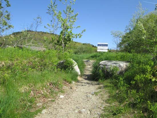
The Hayes Trail-Tower Trail trailhead off Mountain Road
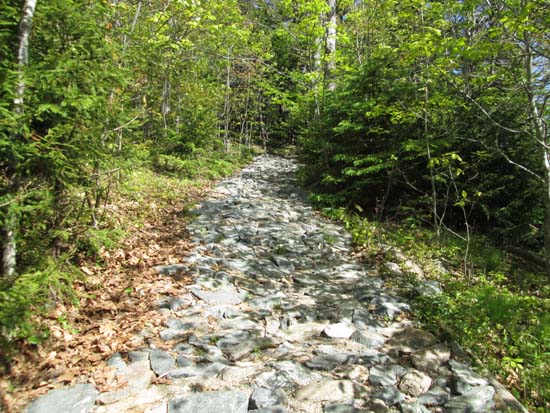
The Tower Trail
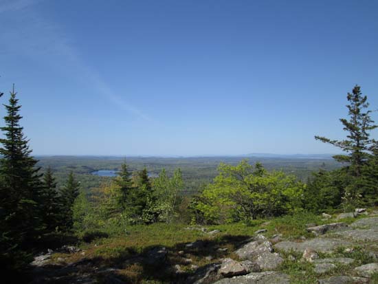
Looking southwest toward Camden from Blue Hill
Directions to trailhead: From Surry, take Route 172 southwest toward Blue Hill. Adjacent to the fairgrounds, take a right onto Mountain Road. A hiker parking lot will be on the left near a height of land, while the trailhead will be on the right, at the start of a large field.
Back to Blue Hill Profile
|