Home
States
Colorado
Connecticut
Maine
Massachusetts
New Hampshire
New York
Rhode Island
Utah
Vermont
View All
Lists
NE 4,000 Footers
NE 100 Highest
NH 4,000 Footers
NH 100 Highest
NH 52 With A View
NH Belknap Range
NH Ossipee 10
Links
Trail Conditions
Trip Log
Sunrises
Sunsets
About
|
Caribou Mountain
Batchelders Grant, ME, Mason, ME
Trailheads, measurements, times, distances, and maps are all approximate and relative to the hike(s) as shown below.
Looking down the Mud Brook Trail on the way to the Caribou Mountain summit
Route: Mud Brook Trail, (Caribou Mountain), Mud Brook Trail, Caribou Trail
After doing the long Owl's Head hike the day before, I wasn't exactly eager to get off the couch and do another hike. The weather forecast, however, called for an excellent day, so I couldn't let it go to waste. Thus, I looked for something with a great view - Caribou Mountain seemed to fit this profile.
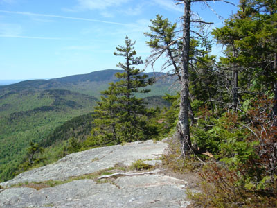
After enjoying the drive up Evans Notch, I pulled into the Caribou parking lot and quickly set off on the Mud Brook Trail. The first portion of the trail was rather gradual, as it followed the brook for a bit. It did eventually get moderate in pitch, but nonetheless not too steep.
After entering a softwood stand of trees, I soon emerged on some excellent ledges, which provided great views to points south and east. Beyond this, there were a few short steep sections as the trail continued up the ledgy terrain - I found the trail somewhat hard to follow a few times, as there were few blazes visible on the rock (yet there were multiple herd paths). Nonetheless, the summit was visible and not overly difficult to navigate to.
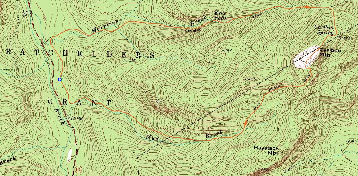
The views from the top were spectacular - whether it be the peaks near Grafton Notch, a white Mount Washington, or even Sebago Lake, it was very nice. If it weren't for the black flies, I would have hung out for a long time. I am starting to wonder if the Board of Directors of the company that makes Off! bug spray is actually composed of black flies, as their product hasn't been working that well for me this year.
For the descent, I took the Caribou Trail. Less than half a mile from the summit, I thought I saw a moose near the trail. As I quietly approached the moving animal, I quickly realized it seemed a bit too dark and stalky to be a moose - in fact, it looked like a large bear! Unfortunately, there were too many leaves around to get a clear photo.
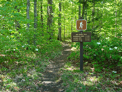
After that, the trail descended moderately, following a brook with some occasional cascades, including the neat Kees Falls.
The bottom of the trail was a bit long and boring for my liking, though it was neat to see the remains of the washed out bridge - hard to believe the brook was able to take that thing out, considering how tame it was today!
| Hike Ratings |
|
Getting To Trailhead: |
Moderate |
| Destination: |
Caribou Mountain |
|
Length: |
Moderate |
|
Steepness: |
Difficult |
|
Navigation: |
Moderate |
|
Views: |
Excellent |
|
Crowds: |
Moderate |
|
| Hike Stats |
|
Date Hiked: |
Sunday, May 25, 2008 |
| Hike Commenced: |
9:40 AM |
| Parking Elevation: |
935' |
| Destination: |
Caribou Mountain |
| Ascent Commenced: |
9:40 AM |
| Summit Reached: |
11:08 AM |
| Time Elapsed: |
01:28 |
| Trailhead Elevation: |
935' |
| Summit Elevation: |
2,840' |
| Distance: |
3 miles |
| Vertical Gain: |
2,025' |
|
|
| Hike Ended: |
1:16 PM |
| Hike Time Elapsed: |
03:36 |
| Hike Distance: |
6.4 miles |
| Hike Vertical Gain: |
2,165' |
|
The Mud Brook Trail trailhead
Looking down Kees Falls near the Caribou Trail
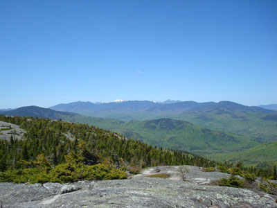
Looking toward the Presidential Range from the Caribou Mountain summit
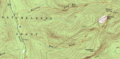

Directions to trailhead: From US 302, take Maine 113 North into Evans Notch. The Caribou WMNF parking area access road will eventually be on the right.
Back to Caribou Mountain Profile
|