Home
States
Colorado
Connecticut
Maine
Massachusetts
New Hampshire
New York
Rhode Island
Utah
Vermont
View All
Lists
NE 4,000 Footers
NE 100 Highest
NH 4,000 Footers
NH 100 Highest
NH 52 With A View
NH Belknap Range
NH Ossipee 10
Links
Trail Conditions
Trip Log
Sunrises
Sunsets
About
|
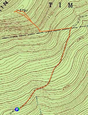
East Kennebago Mountain
Lang, ME, Tim Pond, ME
Trailheads, measurements, times, distances, and maps are all approximate and relative to the hike(s) as shown below.
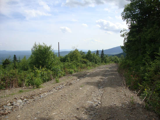
Looking down the logging road on the way to East Kennebago
Route: Logging road, boundary swath, herd path, bushwhack, (East Kennebago Mountain), herd path, boundary swath, logging road
Starting at a sharp turn in the main logging road around 2,500 feet, we followed a recently-used-again diagonal road through a fairly fresh cut. After passing by a grassy four wheeler type trail on the right, we continued diagonally uphill. The diagonal road eventually became a grassier road.
Reaching a boundary swath (yellow stake on the right), we took a left onto it, following yellow and blue blazes until we neared a height of land. At this point, an obvious herd path ran uphill. Aside from routing around some thicker spruce in one area, we generally were able to follow the herd path all the way to the summit canister, and then back again.
| Hike Ratings |
|
Getting To Trailhead: |
Moderate |
| Destination: |
East Kennebago Mountain |
|
Length: |
Moderate |
|
Steepness: |
Moderate |
|
Navigation: |
Difficult |
|
Views: |
Minimal |
|
Crowds: |
Minimal |
|
| Hike Stats |
|
Date Hiked: |
Friday, July 8, 2011 |
| Parking Elevation: |
2,490' |
| Destination: |
East Kennebago Mountain |
| Time Elapsed: |
01:15 |
| Trailhead Elevation: |
2,490' |
| Summit Elevation: |
3,791' |
| Vertical Gain: |
1,321' |
|
|
| Hike Time Elapsed: |
02:29 |
| Hike Vertical Gain: |
1,331' |
|
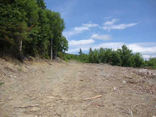
The beginning of the logging road walk
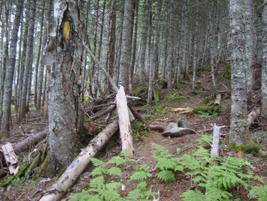
Departing the boundary swath onto a herd path
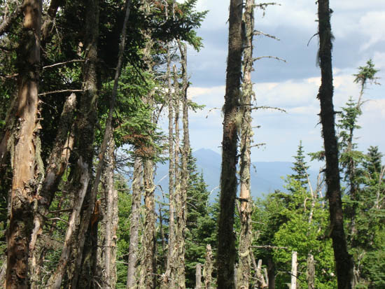
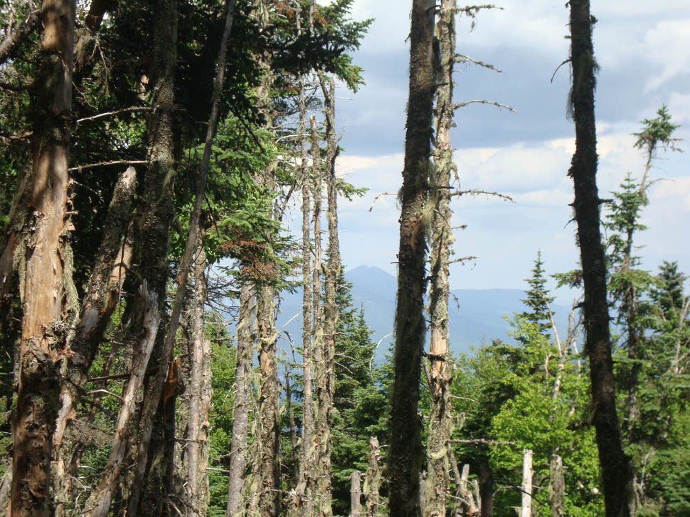
Slight views of the Bigelows as seen from the side of East Kennebago

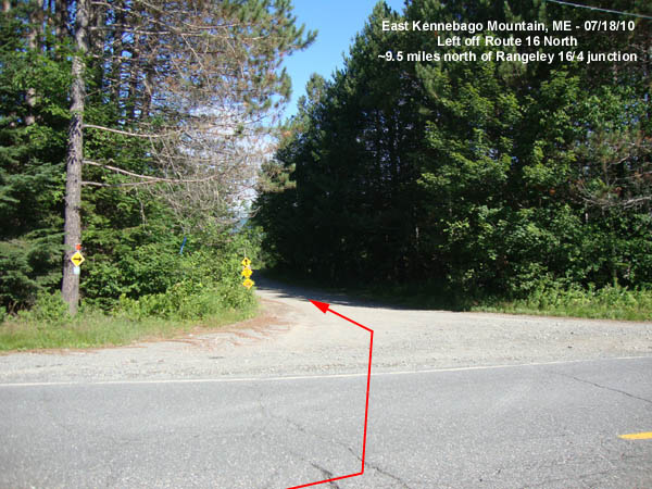
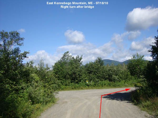
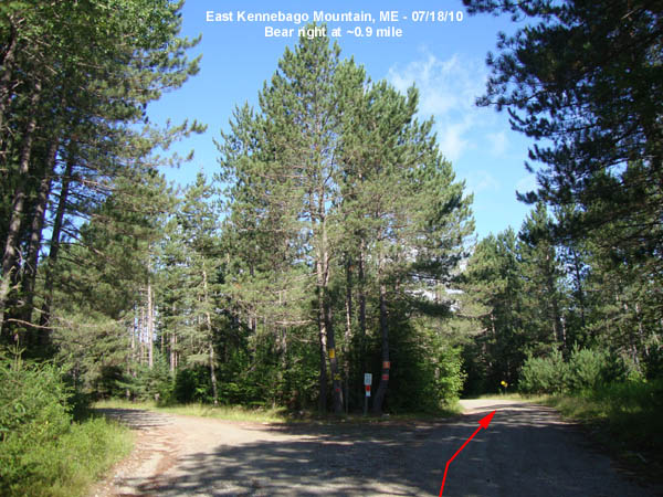
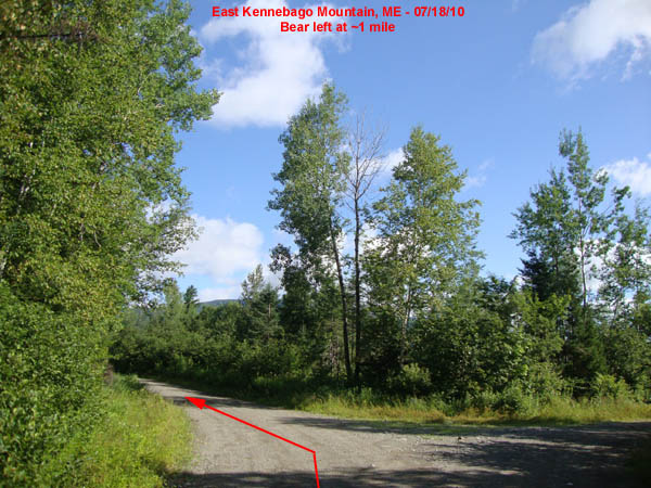
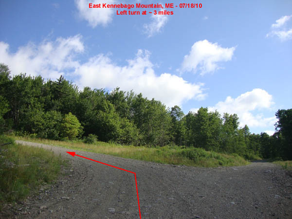
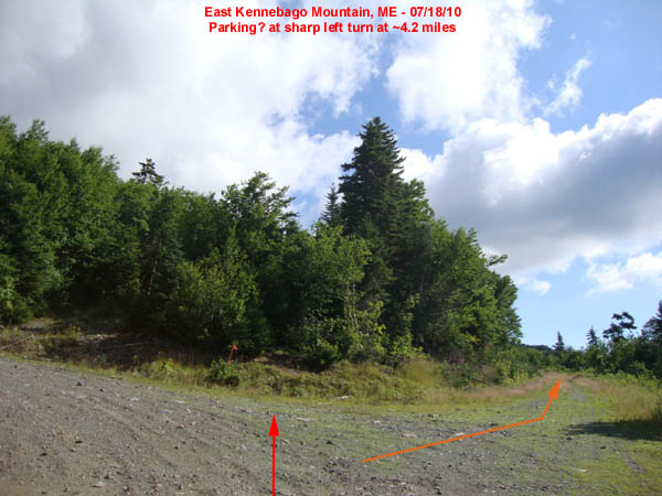
Directions to trailhead: From the Route 4/Route 16 junction in Rangeley, take Route 16 North for 9.5 miles. Take a left onto a dirt road (0.0 miles), almost immediately crossing a wood bridge. After crossing the bridge, take a right. At about 0.9 miles, bear right. At ~1 mile, bear left. At about 3 miles, take a left. At a sharp left turn at about 4.2 miles, there is room to park. Instead of following the sharp left hairpin turn, walk straight on the grassy logging road.
Back to East Kennebago Mountain Profile
|
