Home
States
Colorado
Connecticut
Maine
Massachusetts
New Hampshire
New York
Rhode Island
Utah
Vermont
View All
Lists
NE 4,000 Footers
NE 100 Highest
NH 4,000 Footers
NH 100 Highest
NH 52 With A View
NH Belknap Range
NH Ossipee 10
Links
Trail Conditions
Trip Log
Sunrises
Sunsets
About
|
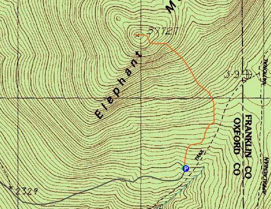
Elephant Mountain
Township C, ME
Trailheads, measurements, times, distances, and maps are all approximate and relative to the hike(s) as shown below.
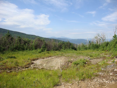
Looking down the logging road just prior to turning onto a cairn-marked herd path
Route: Logging road, bushwhack, (Elephant Mountain), bushwhack, logging road
After a long day with a lot of miles, I decided to go for more driving mileage and less walking mileage.
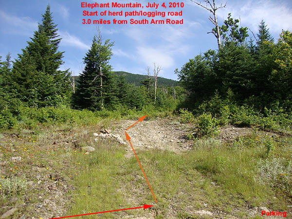
Starting on foot 3 miles from South Arm Road, I followed a grassy logging road uphill around a few turns to a landing and dead end. At the far left corner of this landing, I followed a cairn into a grown in logging road. While some surveyors tape suggested to go immediately right, it seemed out of the way. Instead, I followed a herd path up the maze of logging roads, losing it perhaps around 3,200 feet.
I then bushwhacked up to about 3,300 feet, where I came across flat, grown in logging road. I went straight across this and went up the fallline, skirting around a few thick spruce patches and fir waves. By the time I reached about 3,600 feet, I was able to follow another herd path on and off again up to the summit, direct to the canister.
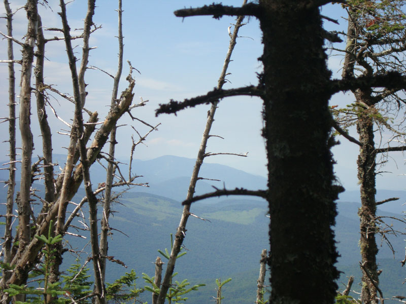
Since the canister was near a fir wave, I did some light bushwhacking to the west and found a few very spotty views (Old Speck, Mt. Cabot). Nothing great, yet better than nothing.
While finding the summit was fairly straight forward, the challenge would be making it back to the correct logging roads. Having purposely stepped in the mud on the 3,300 foot logging road, I was able to bushwhack back down to it and find my print (only about 50 feet away from where I hit the road). From there, I was able to piece together my previous route down the grown in logging roads and eventually back to the prominent one leading back to the informal parking area.
While I certainly looked at my map and compass a few times, I found my altimeter and a printed out satellite photo (which I had marked up with a few key points and elevations based upon the topographic map) to be the most helpful in navigating the maze of logging roads.
| Hike Ratings |
|
Getting To Trailhead: |
Moderate |
| Destination: |
Elephant Mountain |
|
Length: |
Moderate |
|
Steepness: |
Difficult |
|
Navigation: |
Difficult |
|
Views: |
Minimal |
|
Crowds: |
Minimal |
|
| Hike Stats |
|
Date Hiked: |
Sunday, July 4, 2010 |
| Hike Commenced: |
9:09 AM |
| Parking Elevation: |
2,690' |
| Destination: |
Elephant Mountain |
| Ascent Commenced: |
9:09 AM |
| Summit Reached: |
10:14 AM |
| Time Elapsed: |
01:05 |
| Trailhead Elevation: |
2,700' |
| Summit Elevation: |
3,772' |
| Vertical Gain: |
1,092' |
|
|
| Hike Ended: |
11:24 AM |
| Hike Time Elapsed: |
02:15 |
| Hike Vertical Gain: |
1,142' |
|
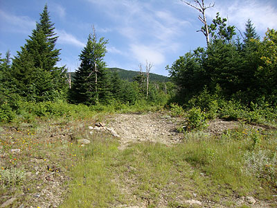
The beginning of the logging road walk
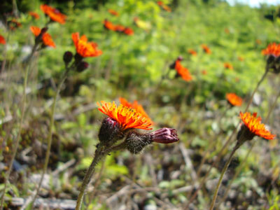
Hawkweed along the logging road
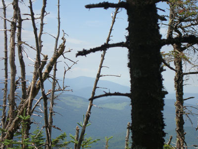
Slight views toward the Grafton Notch area from near the summit of Elephant Mountain
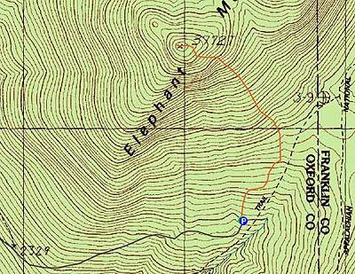

Directions to trailhead: Take Route 5 North from Bethel, Maine (will correspond for US 2 for awhile). At the end of Route 5 in Andover, take a right onto Route 120. After crossing a bridge, Route 120 will take a sharp right turn. Almost immediately after that turn, take a left onto South Arm Road (0.6 miles from Route 5).
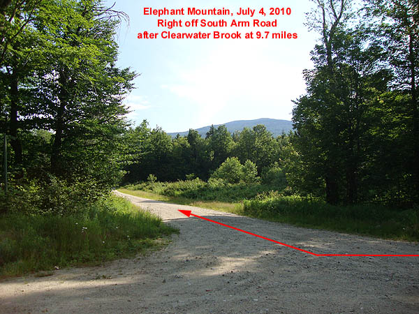
Starting at 0.0 miles on South Arm Road, the Appalachian Trail crossing will be passed between 7.4 and 7.5 miles. Just before 9.7 miles, Clearwater Brook will be crossed (sign). Just after this bridge, take a right onto an unmarked logging road (Old Country Road). If you cross Grindstone Road, you went too far on South Arm Road.
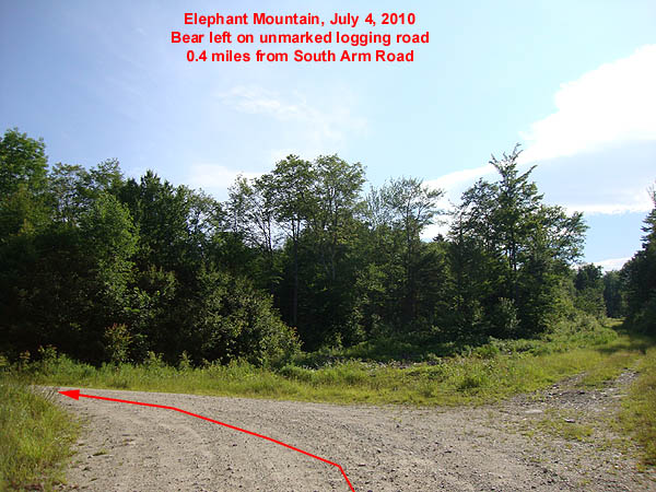
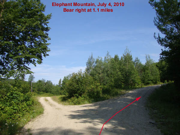
Starting at 0.0 miles, head up the logging road. Bear left at 0.4 miles onto the unmarked Elephant Mountain Road. Bear right at 1.1 miles to stay on Elephant Mountain Road. Just prior to 3 miles, the road will go downhill briefly, prior to climbing back uphill at 3.0 miles. There is limited room for parking here. The herd path starts on a grassy logging road on the left, marked with a cairn.
Back to Elephant Mountain Profile
|
