Home
States
Colorado
Connecticut
Maine
Massachusetts
New Hampshire
New York
Rhode Island
Utah
Vermont
View All
Lists
NE 4,000 Footers
NE 100 Highest
NH 4,000 Footers
NH 100 Highest
NH 52 With A View
NH Belknap Range
NH Ossipee 10
Links
Trail Conditions
Trip Log
Sunrises
Sunsets
About
|
Moxie Mountain
Caratunk, ME
Trailheads, measurements, times, distances, and maps are all approximate and relative to the hike(s) as shown below.
The trail to Moxie Mountain
Route: Logging road, unnamed trail
Parked near the start of the trail (large cairn marking a grassy logging road).
Followed this logging road for awhile (occasional cairns) with good looks at the mountain. Occasional blue blazes and flagging tape help with navigation.
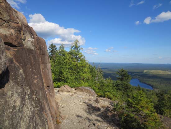
Trail enters the woods 1 mile from the large cairn at the start of the grassy logging road. Very nice trail! Decently maintained with lots of views and minor ledge scrambles. Did not have enough time to take a side trail over to the vast ledges on the west side of the ridge.
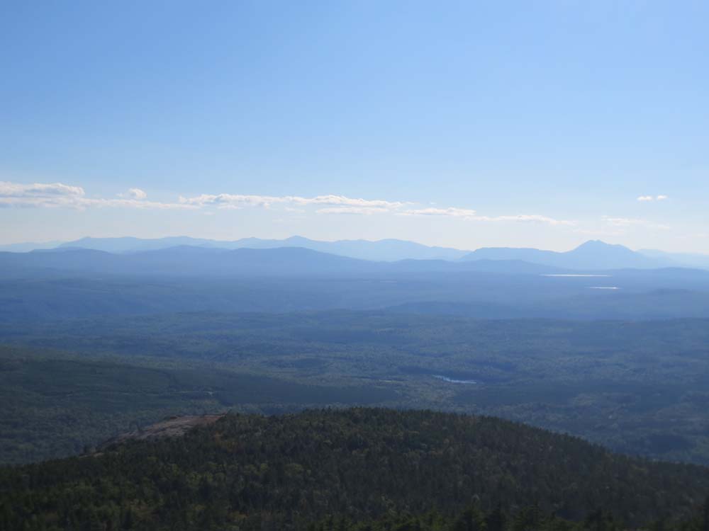
Excellent directional views from the near summit ledge, as well as from the helicopter pad (which I think is next to the highpoint...the benchmark seems lower).
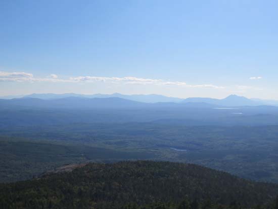
Very interesting to see the abandoned Moscow Air Force Station from the ledges...the series of roads we drove go right by it. Drove up to the southern most part of it on the way out...pretty random to see this out in the middle of nowhere!
| Hike Ratings |
|
Getting To Trailhead: |
Difficult |
| Destination: |
Moxie Mountain |
|
Length: |
Moderate |
|
Steepness: |
Difficult |
|
Navigation: |
Moderate |
|
Views: |
Excellent |
|
Crowds: |
Minimal |
|
| Hike Stats |
|
Date Hiked: |
Saturday, August 17, 2013 |
| Parking Elevation: |
1,540' |
| Destination: |
Moxie Mountain |
| Time Elapsed: |
00:55 |
| Trailhead Elevation: |
1,540' |
| Summit Elevation: |
2,930' |
| Vertical Gain: |
1,430' |
|
|
| Hike Time Elapsed: |
02:03 |
| Hike Vertical Gain: |
1,490' |
|
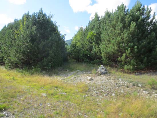
The grassy logging road marked with a cairn
The Carrabasset Valley area high peaks as seen from Moxie Mountain
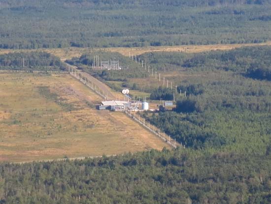
The abandoned Moscow Air Force Station as seen from Moxie Mountain

Directions to trailhead: From Bingham/Moscow, take Route 16 East. Take a left onto Townline Road (sign missing in summer 2013). Dead Water Road eventually joins from the left at the river. Soon thereafter, bear left to stay on Dead Water Road. Eventually, bear left onto Heald Pond Road, almost immediately passing under a high tension power line. At a fork with Chase Pond Road, bear right to remain on Heald Pond Road (in summer 2013, Heald Pond Road becomes rougher thereafter), soon crossing a small bridge. After climbing up a washed out section of road, there will be a somewhat grassy area on the right, followed by a grassy logging road marked with a cairn. Park near here, then continue on foot up the grassy logging road.
Back to Moxie Mountain Profile
|