Home
States
Colorado
Connecticut
Maine
Massachusetts
New Hampshire
New York
Rhode Island
Utah
Vermont
View All
Lists
NE 4,000 Footers
NE 100 Highest
NH 4,000 Footers
NH 100 Highest
NH 52 With A View
NH Belknap Range
NH Ossipee 10
Links
Trail Conditions
Trip Log
Sunrises
Sunsets
About
|
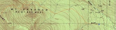
Mt. Abraham
Kingfield, ME, Mt. Abraham, ME
Trailheads, measurements, times, distances, and maps are all approximate and relative to the hike(s) as shown below.
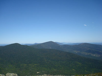
Looking up the Mt. Abraham Trail
Route: Mt. Abraham Trail
Though I had planned to hike Mt. Abraham for quite some time, the distance was quite a barrier. With a nice Labor Day forecast, I decided to sneak out of the busy White Mountains and give it a shot.
Finding the trailhead proved to be somewhat challenging, as Google Maps and the AMC Guide aren't too accurate. It's literally a maze of mostly unmarked dirt roads - bottom line, if you reach a large logging landing with a road curving steeply to the right from it, you went too far on Rapid Springs Road.
The first part of the Mt. Abraham Trail, also known as the Fire Warden's Trail, was fairly gradual and boring. Unfortunately there were a few blowdowns and muddy sections, so I wasn't able to make particularly great time on it.
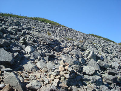
After crossing a dirt/logging road, the trail continued at a fairly gradual pace for awhile, until it reached the old fire warden's cabin. From there, the trail almost instantly became steep (though not nonstop steep, as there were a few traverses). After about half an hour, I emerged above the treeline and began the careful ascent up through the rocky upper slope of Mt. Abraham. Though the weather forecast called for reasonable wind speeds, I was constantly getting knocked around by frequent heavy gusts. Since there are very few wind breaks, it was pretty slow going.
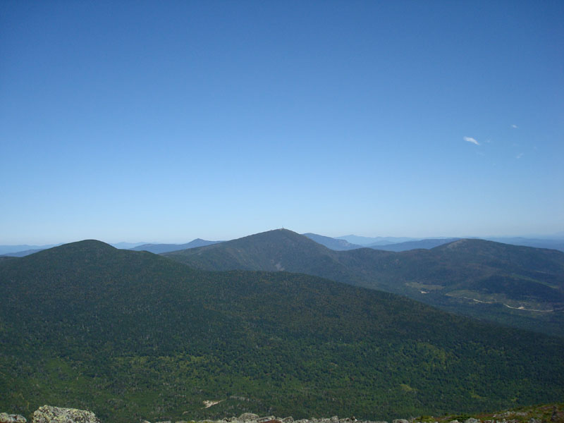
The views from the summit were tremendous. Fortunately there are some rock walls (and a shelter), so one can likely get out of wind from pretty much any direction. The wind on this day was coming from the northeast, which is rare in my observations.
After having a sandwich, I decided to make my way back through the exposed upper portion of the trail and then back to the parking lot. While I only saw two people the entire morning, the trail was a bit busier on the return trip (still nothing compared to what 4,000 footer trails would likely be like in the Whites on this day).
All in all, a nice hike. If I hike it from this approach again, I may look into starting from the logging road crossing so that I can cut off the somewhat muddy first section of trail.
| Hike Ratings |
|
Getting To Trailhead: |
Moderate |
| Destination: |
Mt. Abraham |
|
Length: |
Moderate |
|
Steepness: |
Difficult |
|
Navigation: |
Easy |
|
Views: |
Excellent |
|
Crowds: |
Minimal |
|
| Hike Stats |
|
Date Hiked: |
Monday, September 1, 2008 |
| Hike Commenced: |
9:37 AM |
| Parking Elevation: |
1,163' |
| Destination: |
Mt. Abraham |
| Ascent Commenced: |
9:37 AM |
| Summit Reached: |
11:40 AM |
| Time Elapsed: |
02:03 |
| Trailhead Elevation: |
1,163' |
| Summit Elevation: |
4,050' |
| Distance: |
4 miles |
| Vertical Gain: |
3,087' |
|
|
| Hike Ended: |
2:20 PM |
| Hike Time Elapsed: |
04:43 |
| Hike Distance: |
8 miles |
| Hike Vertical Gain: |
3,287' |
|

The Mt. Abraham Trail trailhead
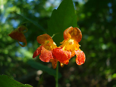
Spotted touch-me-nots
Looking north at Spaulding and Sugarloaf from the Mt. Abraham summit

Directions to trailhead: Take Route 27 North to Kingfield. After passing the Route 142 junction and crossing a bridge, take the second left onto West Kingfield Road. Continue on this road, going straight through junctions. It will soon become Rapid Springs Road, which is dirt. A few minutes up the road, there will be a four way intersection. Take a left, cross two wood bridges, then bear right at the next junction. Continue up this road, which will soon come to a crossroad, with the The Firewarden's Trail trailhead directly ahead. While there is no parking lot, there is room to park along the roads near the trailhead.
Back to Mt. Abraham Profile
|