Home
States
Colorado
Connecticut
Maine
Massachusetts
New Hampshire
New York
Rhode Island
Utah
Vermont
View All
Lists
NE 4,000 Footers
NE 100 Highest
NH 4,000 Footers
NH 100 Highest
NH 52 With A View
NH Belknap Range
NH Ossipee 10
Links
Trail Conditions
Trip Log
Sunrises
Sunsets
About
|
Mt. Abraham
Mt. Abraham, ME
Trailheads, measurements, times, distances, and maps are all approximate and relative to the hike(s) as shown below.
Looking down the Mt. Abraham Trail
Route: Rapid Stream Road, Mt. Abraham Trail, (Mt. Abraham), Mt. Abraham Trail, Rapid Stream Road
With minimal snow in the lower elevations and a nice forecast, we decided to head up and hike Mt. Abraham. While we had planned to hike the entire 3.5+ mile roadwalk to the summer trailhead, we were able to drive to perhaps within a mile of it, thanks to only 2" of snow being on the road.
After a brief roadwalk, we hopped onto the Mt. Abraham Firewarden's Trail. The first portion of this had minimal snowcover, which made navigating the rocky portions tricky with snowshoes. The trail was well blazed, though, and portions of it had new reroutes onto smoother terrain.
After crossing a logging road, we continued on the gradual second portion of the trail, stopping at the slowly collapsing cabin for a break. Thereafter, snow depths increased on the third portion of the trail, with unbroken trail snow depths closer to a foot.
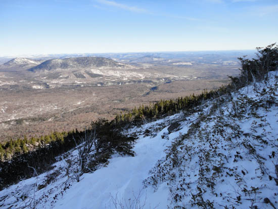
Eventually clearing treeline after the steep climb, we donned winter gear to deal with cold, brisk winds. This fourth portion of the trail had minimal snow in the rocky areas, however we kept our snowshoes on due to deep drifts in scrub patches. Extra care had to be taken in navigating this area, as many of the small cairns were already burried.
Reaching the summit, we had tremendous views, ranging from the Whites to Baxter State Park. After a quick lunch break in an area out of the wind, we snowshoed back to the cabin, then switched to Microspikes for the balance of the walk back to Rapid Stream Road.
While perhaps a much easier winter ascent of Mt. Abraham than compared to what it could be in January and February, it was still a longer, more strenuous hike than compared to the summer.
| Hike Ratings |
|
Getting To Trailhead: |
Difficult |
| Destination: |
Mt. Abraham |
|
Length: |
Difficult |
|
Steepness: |
Difficult |
|
Navigation: |
Moderate |
|
Views: |
Excellent |
|
Crowds: |
Minimal |
|
| Hike Stats |
|
Date Hiked: |
Friday, December 24, 2010 |
| Hike Commenced: |
8:30 AM |
| Parking Elevation: |
965' |
| Destination: |
Mt. Abraham |
| Ascent Commenced: |
8:53 AM |
| Summit Reached: |
12:16 PM |
| Time Elapsed: |
03:23 |
| Trailhead Elevation: |
1,163' |
| Summit Elevation: |
4,050' |
| Vertical Gain: |
3,107' |
|
|
| Hike Ended: |
3:28 PM |
| Hike Time Elapsed: |
06:58 |
| Hike Vertical Gain: |
3,345' |
|
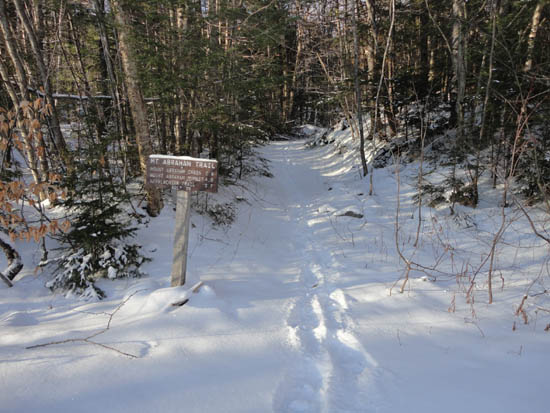
The Mt. Abraham Trail trailhead
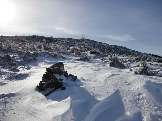
Looking up the Mt. Abraham Trail
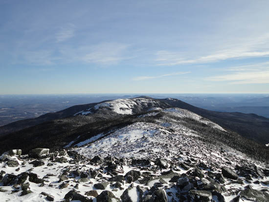
Looking southeast at the Mt. Abraham ridge from the summit
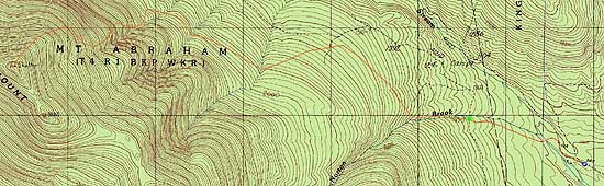

Directions to trailhead: Take Route 27 North to Kingfield. After passing the Route 142 junction and crossing a bridge, take the second left onto West Kingfield Road. Continue on this road, going straight through junctions. It will soon become Rapid Stream Road, which is dirt. In winter, this road may be plowed partway to the summer trailhead. A few miles up the road, there will be a four way intersection. Take a left, cross two wood bridges, then bear right at the next junction. Continue up this road, which will soon come to a crossroad, with the The Firewarden's Trail trailhead directly ahead.
Back to Mt. Abraham Profile
|