Home
States
Colorado
Connecticut
Maine
Massachusetts
New Hampshire
New York
Rhode Island
Utah
Vermont
View All
Lists
NE 4,000 Footers
NE 100 Highest
NH 4,000 Footers
NH 100 Highest
NH 52 With A View
NH Belknap Range
NH Ossipee 10
Links
Trail Conditions
Trip Log
Sunrises
Sunsets
About
|
Mt. Cutler
Hiram, ME
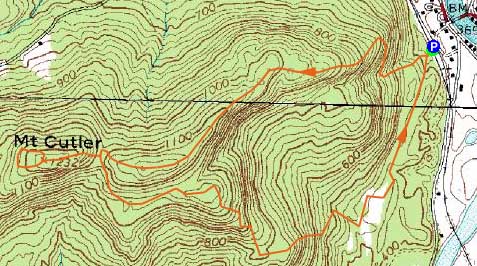
Trailheads, measurements, times, distances, and maps are all approximate and relative to the hike(s) as shown below.
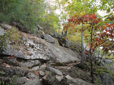
Looking up the Barnes Trail
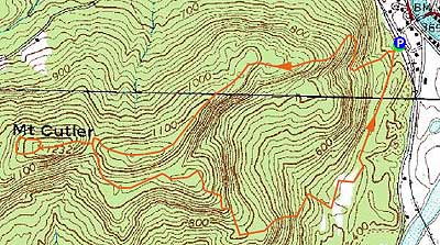
Route: Barnes Trail, herdpath, (Mt. Cutler summit), herd path, Saco Ridge Trail, snowmobile trail
With some rain passing through New Hampshire on a forecasted sunny afternoon, I attempted to avoid it by heading southeast into Maine. Unfortunately, the dark clouds followed me, resulting in dark skies.
Starting at the trailhead at the tracks (a nice wooden sign), I followed the steep Barnes Trail (formerly the Mt. Cutler Trail) over a boulder field and them some ledge scrambles, passing through many nice views thereafter.
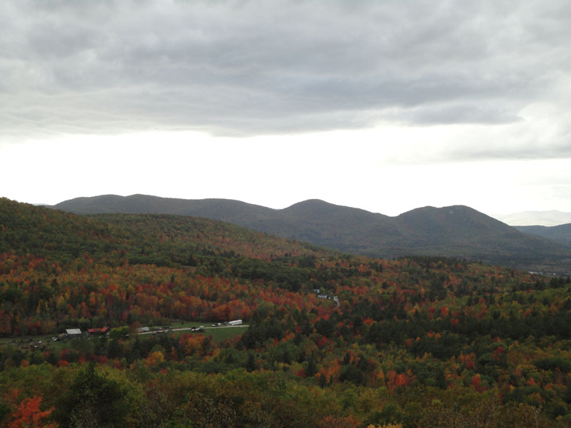
Reaching the notch where the red blazed trail took left hairpin turn, I followed a vague path lined with cairns up to the true summit of Mt. Cutler. While the dark clouds made for less than optimal viewing, there were nonetheless good views from three distinct vistas, including two nice blueberry field views beyond the summit cairn. While the Presidentials were in hiding, the Burnt Meadow Mountains were easily seen in the foreground.
For the descent, I returned to the notch, then continued on the red blazed trail, at this point called the Saco Ridge Trail. The trail worked its way down a few view ledges, then dropped steeply down to a snowmobile trail, which I jogged back to the trailhead.
It was great to see these trails signed and marked - a few years earlier, it was a fairly vague hike in places.
| Hike Ratings |
|
Getting To Trailhead: |
Easy |
| Destination: |
Mt. Cutler |
|
Length: |
Moderate |
|
Steepness: |
Difficult |
|
Navigation: |
Moderate |
|
Views: |
Excellent |
|
Crowds: |
Minimal |
|
| Hike Stats |
|
Date Hiked: |
Friday, October 8, 2010 |
| Hike Commenced: |
3:48 PM |
| Parking Elevation: |
390' |
| Destination: |
Mt. Cutler |
| Ascent Commenced: |
3:48 PM |
| Summit Reached: |
4:26 PM |
| Time Elapsed: |
00:38 |
| Trailhead Elevation: |
390' |
| Summit Elevation: |
1,232' |
| Vertical Gain: |
1,002' |
|
|
| Hike Ended: |
5:18 PM |
| Hike Time Elapsed: |
01:30 |
| Hike Vertical Gain: |
1,142' |
|
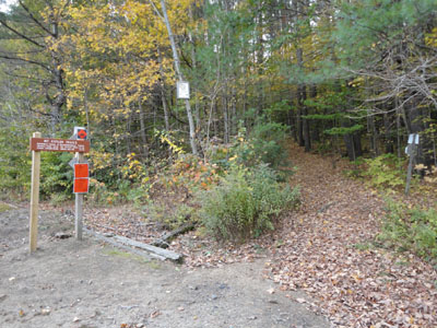
The Mt. Cutler Trail trailhead, just off Mt. View Avenue
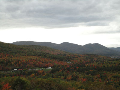
Looking northwest at the Burnt Meadow Mountains from near the Mt. Cutler summit

Directions to trailhead: From Route 25, take Route 5 North to Hiram. Just after 117 departs east from 5/113, cross the bridge (still on 5/113), then take an immediate left onto River Road. Very shortly after, take a right onto Mt. View Avenue. Just after Mt. View Avenue takes a sharp left turn, take a right into a small dirt parking lot next to the railroad tracks. The Mt. Cutler Trail trailhead is across the tracks, a few dozen feet to the south.
Back to Mt. Cutler Profile
|