Home
States
Colorado
Connecticut
Maine
Massachusetts
New Hampshire
New York
Rhode Island
Utah
Vermont
View All
Lists
NE 4,000 Footers
NE 100 Highest
NH 4,000 Footers
NH 100 Highest
NH 52 With A View
NH Belknap Range
NH Ossipee 10
Links
Trail Conditions
Trip Log
Sunrises
Sunsets
About
|
Mt. Katahdin (Baxter Peak), Mt. Katahdin (South Peak), Mt. Katahdin (Chimney Peak), Mt. Katahdin (Pamola)
T3 R10, ME, Mt. Katahdin, ME
Trailheads, measurements, times, distances, and maps are all approximate and relative to the hike(s) as shown below.
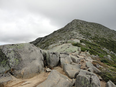
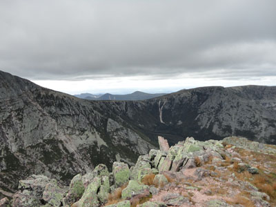
Looking up the Hunt Trail on the way to Baxter Peak
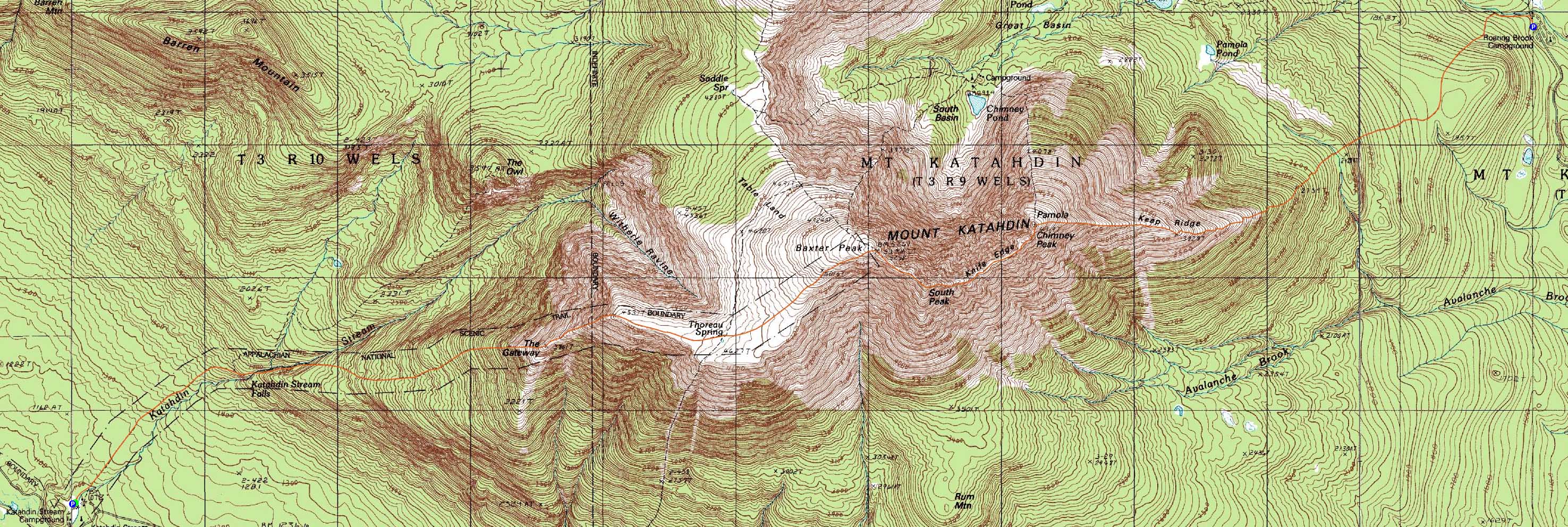
Route: Hunt Trail, (Baxter Peak), The Knife Edge, (South Peak), The Knife Edge, (Chimney Peak), The Knife Edge, (Pamola), Helon Taylor Trail, Chimney Pond Trail
After spotting a vehicle at Roaring Brook, we headed to Katahdin Spring, arriving just prior to the day use area closing.
While the Hunt Trail started gently, it started climbing after the bridged water crossing. After passing through a detoured area (due to rock stairway construction), we soon emerged from the scrub. While the views opened up, the winds also picked up. There were multiple tricky scrambles, including built in foot and hand holds.
As we climbed, the winds became more bitter and powerful, resulting in us putting on winter hats and gloves. Reaching the flats up high, we worked our way past Thoreau Spring and up to Baxter, amongst massive crowds.
Though cloudy overhead, we had excellent views in all directions. After an extended break out of the wind on the side of the cliffs, we continued onto South Peak on rocky trail with some minor scrambles.
Deciding the wind wasn't quite bad enough to turn back, we headed onto the Knife Edge. Occasional strong gusts of wind stopped us on occasion, however we kept moving, as rain showers appeared to be closing in. Sure enough, we had a few sprinkles along the way - fortunately, the winds helped to keep the rock dry.
I found the Knife's Edge to not be as challenging as the hype made it out to be. That said, I would not want to be out on it during higher winds or more slippery conditions. There were multiple areas in which the trail was extremely narrow (ie no passing room) with significant drop offs on one or both sides. In addition, the scramble down and back up the chimney was a bit challenging (requiring us to take our packs off to jump down one part without overshooting the landing and thus falling off a small cliff), I didn't find it as challenging as Huntington Ravine on Mt. Washington. Nonetheless, it wouldn't be a place for those who don't like heights.
After passing over Pamola, we were treated to an extended rainbow display on Keep Ridge. Keeping consistent with much of the rest of the park, we found this trail to be measured in "Maine Miles" and thus a much longer walk out than the 3.2 miles as suggested on the signs.
| Hike Ratings |
|
Getting To Trailhead: |
Easy |
| Destination: |
Mt. Katahdin (Baxter Peak) |
|
Length: |
Moderate |
|
Steepness: |
Very Difficult |
|
Navigation: |
Easy |
|
Views: |
Excellent |
|
Crowds: |
Heavy |
| Destination: |
Mt. Katahdin (South Peak) |
|
Length: |
Moderate |
|
Steepness: |
Difficult |
|
Navigation: |
Easy |
|
Views: |
Excellent |
|
Crowds: |
Heavy |
| Destination: |
Mt. Katahdin (Chimney Peak) |
|
Length: |
Difficult |
|
Steepness: |
Very Difficult |
|
Navigation: |
Moderate |
|
Views: |
Excellent |
|
Crowds: |
Heavy |
| Destination: |
Mt. Katahdin (Pamola) |
|
Length: |
Difficult |
|
Steepness: |
Very Difficult |
|
Navigation: |
Easy |
|
Views: |
Excellent |
|
Crowds: |
Minimal |
|
| Hike Stats |
|
Date Hiked: |
Sunday, September 5, 2010 |
| Hike Commenced: |
7:30 AM |
| Parking Elevation: |
1,480' |
| Destination: |
Mt. Katahdin (Baxter Peak) |
| Ascent Commenced: |
7:31 AM |
| Summit Reached: |
12:12 PM |
| Time Elapsed: |
04:41 |
| Trailhead Elevation: |
1,080' |
| Summit Elevation: |
5,267' |
| Distance: |
5.2 miles |
| Vertical Gain: |
4,237' |
| Destination: |
Mt. Katahdin (South Peak) |
| Ascent Commenced: |
1:14 PM |
| Summit Reached: |
1:33 PM |
| Time Elapsed: |
00:17 |
| Trailhead Elevation: |
5,267' |
| Summit Elevation: |
5,240' |
| Vertical Gain: |
90' |
| Destination: |
Mt. Katahdin (Chimney Peak) |
| Ascent Commenced: |
1:34 PM |
| Summit Reached: |
2:24 PM |
| Time Elapsed: |
00:50 |
| Trailhead Elevation: |
5,240' |
| Summit Elevation: |
4,910' |
| Vertical Gain: |
190' |
| Destination: |
Mt. Katahdin (Pamola) |
| Ascent Commenced: |
2:25 PM |
| Summit Reached: |
2:38 PM |
| Time Elapsed: |
00:13 |
| Trailhead Elevation: |
4,910' |
| Summit Elevation: |
4,919' |
| Vertical Gain: |
109' |
|
|
| Hike Ended: |
5:33 PM |
| Hike Time Elapsed: |
10:03 |
| Hike Distance: |
9.6 miles |
| Hike Vertical Gain: |
4,676' |
|
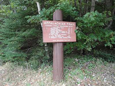
The Hunt Trail trailhead
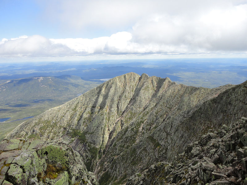
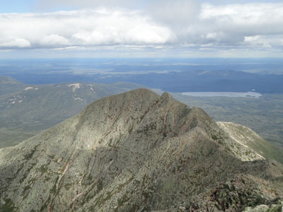
Looking at the Knife Edge from Baxter Peak
The back at Baxter Peak on The Knife Edge to South Peak
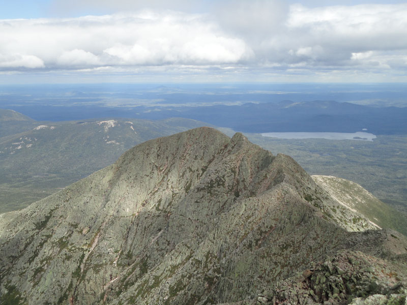
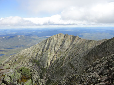
Pamola and Chimney Peak as seen from South Peak
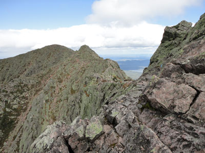
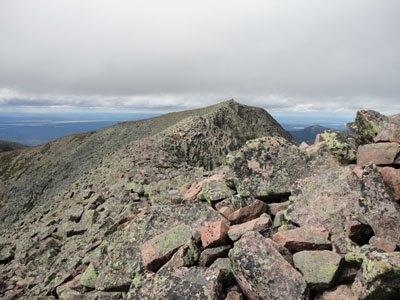
The Knife Edge between South Peak and Chimney Peak
The Knife Edge between South Peak and Chimney Peak

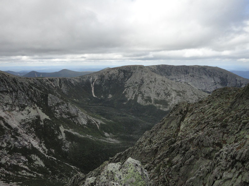
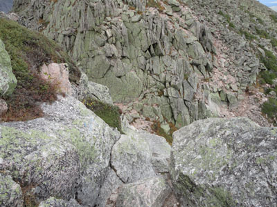
Looking toward Hamlin Peak from Chimney Peak
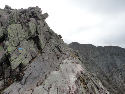
The chimney between Chimney Peak and Pamola
Looking toward the Saddle from Pamola
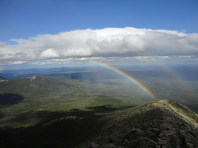
Rainbows rising from Keep Ridge along the Helon Taylor Trail
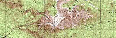

Directions to trailhead: From the Togue Pond Gate (Millinocket side), take Roaring Brook Road to its end. The Chimney Pond Trail trailhead is beyond the sign-in shack. Weather and crowd restrictions apply.
Back to Mt. Katahdin (Baxter Peak) Profile
Back to Mt. Katahdin (South Peak) Profile
Back to Mt. Katahdin (Chimney Peak) Profile
Back to Mt. Katahdin (Pamola) Profile
|