Home
States
Colorado
Connecticut
Maine
Massachusetts
New Hampshire
New York
Rhode Island
Utah
Vermont
View All
Lists
NE 4,000 Footers
NE 100 Highest
NH 4,000 Footers
NH 100 Highest
NH 52 With A View
NH Belknap Range
NH Ossipee 10
Links
Trail Conditions
Trip Log
Sunrises
Sunsets
About
|
Mt. Tire'm
Waterford, ME
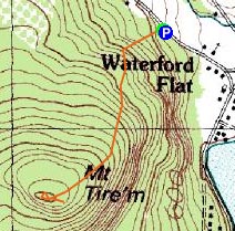
Trailheads, measurements, times, distances, and maps are all approximate and relative to the hike(s) as shown below.
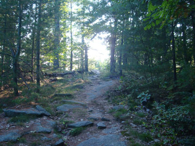
Lookig up the Daniel Brown Trail
Route: Daniel Brown Trail
Since the forecasted mostly sunny day wasn't quite ringing true in the White Mountains, I decided to go east and get away from some of the clouds and haze. My first stop was Mt. Tire'm.
While the trailhead is in theory marked, the plaque was obscured by weeds. Nonetheless, it was pretty obvious and I was soon on my way up the trail.
The Daniel Brown Trail starts off somewhat steeply, before becoming a bit more gradual as it ascends. Soon, there were some views through the trees and eventually, a ledge view of Bear Pond. While the trail itself wasn't marked, it was fairly obvious.
The high point to me looked to be a large, split boulder a bit off the trail. While there were some additional obstructed view points, I didn't find anything better than the near-summit ledge view. While good, I would find it to be nowhere near as nice as the one on nearby Hawk Mountain.
| Hike Ratings |
|
Getting To Trailhead: |
Easy |
| Destination: |
Mt. Tire'm |
|
Length: |
Easy |
|
Steepness: |
Moderate |
|
Navigation: |
Easy |
|
Views: |
Excellent |
|
Crowds: |
Moderate |
|
| Hike Stats |
|
Date Hiked: |
Wednesday, September 24, 2008 |
| Hike Commenced: |
4:31 PM |
| Parking Elevation: |
560' |
| Destination: |
Mt. Tire'm |
| Ascent Commenced: |
4:31 PM |
| Summit Reached: |
4:47 PM |
| Time Elapsed: |
00:16 |
| Trailhead Elevation: |
560' |
| Summit Elevation: |
1,104' |
| Vertical Gain: |
549' |
|
|
| Hike Ended: |
5:04 PM |
| Hike Time Elapsed: |
00:33 |
| Hike Vertical Gain: |
554' |
|
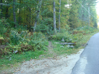
Daniel Brown Trail trailhead
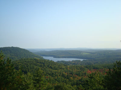
Looking southeast from the Mt. Tire'm vista

Directions to trailhead: Take Routes 35 and 37 north to Waterford, then take a left onto Plummer Hill Road. Just after passing a community center, the Daniel Brown Trail trailhead is on the left. There is room to park on the side of the road.
Back to Mt. Tire'm Profile
|

