Home
States
Colorado
Connecticut
Maine
Massachusetts
New Hampshire
New York
Rhode Island
Utah
Vermont
View All
Lists
NE 4,000 Footers
NE 100 Highest
NH 4,000 Footers
NH 100 Highest
NH 52 With A View
NH Belknap Range
NH Ossipee 10
Links
Trail Conditions
Trip Log
Sunrises
Sunsets
About
|
Mt. Waldo
Frankfort, ME
Trailheads, measurements, times, distances, and maps are all approximate and relative to the hike(s) as shown below.

Looking down the ledgy portion of the Mt. Waldo access road
Route: Access road
Access road was mostly dry. Initially a gentle gravel/grass road until it passes above the blueberry farm. Thereafter, it's a steeper climb on open ledge. Not well marked. Nice views on the approach, as well as near the summit. Appears to have more views from shoulders/subpeaks as well.
| Hike Ratings |
|
Getting To Trailhead: |
Easy |
| Destination: |
Mt. Waldo |
|
Length: |
Moderate |
|
Steepness: |
Moderate |
|
Navigation: |
Moderate |
|
Views: |
Excellent |
|
Crowds: |
Minimal |
|
| Hike Stats |
|
Date Hiked: |
Monday, August 27, 2018 |
| Parking Elevation: |
460' |
| Destination: |
Mt. Waldo |
| Time Elapsed: |
00:27 |
| Trailhead Elevation: |
460' |
| Summit Elevation: |
1,040' |
| Vertical Gain: |
580' |
|
|
| Hike Time Elapsed: |
01:00 |
| Hike Vertical Gain: |
580' |
|

The Mt. Waldo access road gate off Tyler Lane

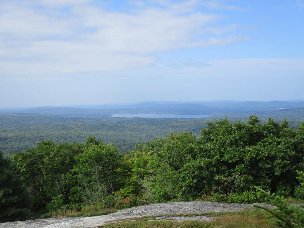
Looking southwest at Halfmoon Pond from Mt. Waldo
Directions to trailhead: Very limited room to park off Tyler Lane near Frankfort.
Back to Mt. Waldo Profile
|