Home
States
Colorado
Connecticut
Maine
Massachusetts
New Hampshire
New York
Rhode Island
Utah
Vermont
View All
Lists
NE 4,000 Footers
NE 100 Highest
NH 4,000 Footers
NH 100 Highest
NH 52 With A View
NH Belknap Range
NH Ossipee 10
Links
Trail Conditions
Trip Log
Sunrises
Sunsets
About
|
Mt. Will
Bethel, ME, Newry, ME
Trailheads, measurements, times, distances, and maps are all approximate and relative to the hike(s) as shown below.
Looking up the Mt. Will Trail near the south cliffs
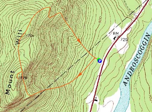
Route: Mt. Will Trail, bushwhack, (Mt. Will), bushwhack, Mt. Will Trail
After hiking nearby Old Speck, I decided to check out Mt. Will on my way home. Arriving at the trailhead, I took a quick look at the trailhead and decided that my snowshoes and crampons would not be going along for the walk.
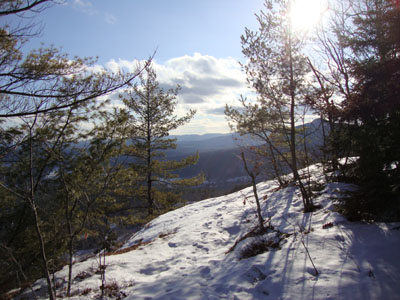
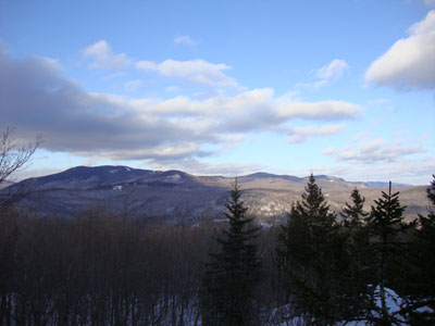
Taking the left loop (south cliffs), the trail sidled for awhile, crossing over numerous logging roads and small (frozen) brooks. Nearing a recent logging cut, the trail started to climb moderately, eventually reaching the south cliffs. The view from these was pretty good, stretching as far as Pleasant Mountain.
Above the cliffs, the trail climbed rather steeply up to the ridge. Sensing the summit would not be reached, I bushwhacked over a false summit and eventually to what I thought was the highpoint. Nearby, there was a ledge, but nothing in way of views.
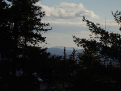
Back on the trail, it dropped into a col, along side a snowmobile trail, before climbing up to a viewless north peak. Descending a bit, I soon reached the upper north ledges, were there were descent views (though perhaps not as good as the south cliffs). Nonetheless, neither of these viewpoints (north ledges of south cliffs) were anyway near the top of the mountain. Being a fan of near-summit views, I wouldn't consider this to be a destination hike by any means.
The descent off the north ledges was a bit steep and icy, however my Microspikes were adequate enough to get me down safely.
| Hike Ratings |
|
Getting To Trailhead: |
Easy |
| Destination: |
Mt. Will |
|
Length: |
Moderate |
|
Steepness: |
Difficult |
|
Navigation: |
Moderate |
|
Views: |
Minimal |
|
Crowds: |
Minimal |
|
| Hike Stats |
|
Date Hiked: |
Sunday, January 31, 2010 |
| Hike Commenced: |
2:03 PM |
| Parking Elevation: |
1,496' |
| Destination: |
Mt. Will |
| Ascent Commenced: |
2:03 PM |
| Summit Reached: |
2:49 PM |
| Time Elapsed: |
00:46 |
| Trailhead Elevation: |
730' |
| Summit Elevation: |
1,726' |
| Vertical Gain: |
1,016' |
|
|
| Hike Ended: |
3:47 PM |
| Hike Time Elapsed: |
01:44 |
| Hike Vertical Gain: |
1,150' |
|
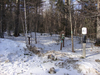
The Mt. Will Trail trailhead
Pleasant Mountain as seen from near the summit of Mt. Will
Views from the north ledges
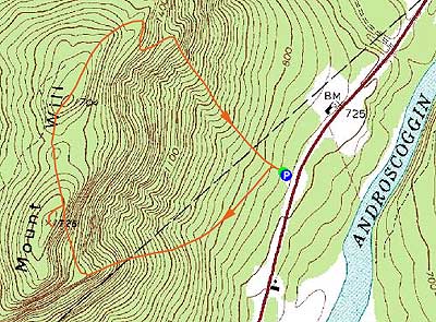

Directions to trailhead: Take US 2 East from Bethel. A few minutes after passing the Sunday River access road on the left, the town recycling center will be on the right. The Mt. Will Trail parking area and trailhead are on the left (across US 2 from the recycling center).
Back to Mt. Will Profile
|