Home
States
Colorado
Connecticut
Maine
Massachusetts
New Hampshire
New York
Rhode Island
Utah
Vermont
View All
Lists
NE 4,000 Footers
NE 100 Highest
NH 4,000 Footers
NH 100 Highest
NH 52 With A View
NH Belknap Range
NH Ossipee 10
Links
Trail Conditions
Trip Log
Sunrises
Sunsets
About
|
Peary Mountain
Brownfield, ME
Trailheads, measurements, times, distances, and maps are all approximate and relative to the hike(s) as shown below.
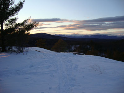
Looking down the trail to Peary Mountain
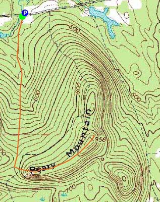
Route: Unknown trail, (Peary Mountain South Peak), herd path, (Peary Mountain), herd path, (Peary Mountain South Peak), Unknown trail
With the days starting to get longer, my sunset hike options are starting to increase. After hiking in state for a few weeks, I felt like skipping across the border and doing something in Maine.
After parking in a small, plowed lot across the street from the unmarked trailhead, I headed up the groomed snowmobile trail to the height of land. Not quite remembering where the proper entrance to the trail was at that point, I started to bushwhack toward the bald south peak, reaching the trail pretty quickly.
The sun was just about to set into the horizon as I reached the south peak. Wanting to hit the main peak as well, I continued along the ridge, following an approximate herd path, marked in places with cairns, breaking trail in about 6-12" of snow.
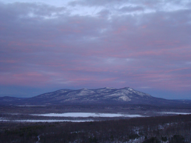
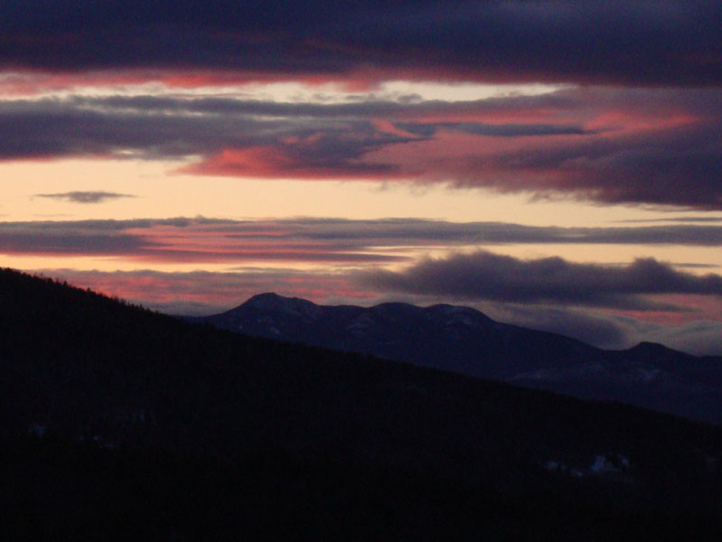
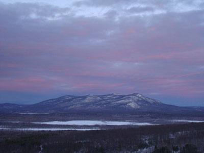
The views from the summit were strong - Pleasant Mountain with pink clouds above it. Quickly turning around, I worked my way back to the south peak for a very colorful display - unfortunately, some of the best colors occured whilst I was in transit. Nonetheless, it was a nice display from the south peak.
The walk back was non-eventful - I was able to make it back to the parking lot without needing a headlamp.
| Hike Ratings |
|
Getting To Trailhead: |
Easy |
| Destination: |
Peary Mountain (South Peak) |
|
Length: |
Easy |
|
Steepness: |
Moderate |
|
Navigation: |
Moderate |
|
Views: |
Excellent |
|
Crowds: |
Minimal |
| Destination: |
Peary Mountain |
|
Length: |
Moderate |
|
Steepness: |
Moderate |
|
Navigation: |
Moderate |
|
Views: |
Excellent |
|
Crowds: |
Minimal |
|
| Hike Stats |
|
Date Hiked: |
Wednesday, January 6, 2009 |
| Hike Commenced: |
3:49 PM |
| Parking Elevation: |
420' |
| Destination: |
Peary Mountain (South Peak) |
| Ascent Commenced: |
3:49 PM |
| Summit Reached: |
4:10 PM |
| Time Elapsed: |
00:21 |
| Trailhead Elevation: |
420' |
| Summit Elevation: |
910' |
| Vertical Gain: |
515' |
| Destination: |
Peary Mountain |
| Ascent Commenced: |
4:10 PM |
| Summit Reached: |
4:18 PM |
| Time Elapsed: |
00:08 |
| Trailhead Elevation: |
910' |
| Summit Elevation: |
958' |
| Vertical Gain: |
83' |
|
|
| Hike Ended: |
4:48 PM |
| Hike Time Elapsed: |
00:59 |
| Hike Vertical Gain: |
678' |
|
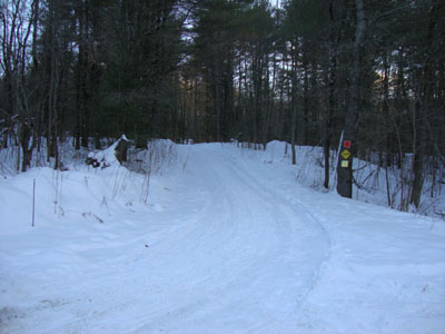
The trailhead for the trail to Peary Mountain on Farnsworth Road
Sunset colors as seen from the south peak of Peary Mountain


Directions to trailhead: Take Route 5 North from East Brownfield, then take a left onto Farnsworth Road. The trailhead and makeshift parking area will both be a few minutes down the road, just before a small bridge (no railings). The makeshift parking area is on the right, and the trailhead/logging road is on the left.
Back to Peary Mountain Profile
|