Home
States
Colorado
Connecticut
Maine
Massachusetts
New Hampshire
New York
Rhode Island
Utah
Vermont
View All
Lists
NE 4,000 Footers
NE 100 Highest
NH 4,000 Footers
NH 100 Highest
NH 52 With A View
NH Belknap Range
NH Ossipee 10
Links
Trail Conditions
Trip Log
Sunrises
Sunsets
About
|
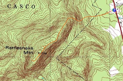
Rattlesnake Mountain
Casco, ME, Raymond, ME
Trailheads, measurements, times, distances, and maps are all approximate and relative to the hike(s) as shown below.
Looking up Bri-Mar Trail
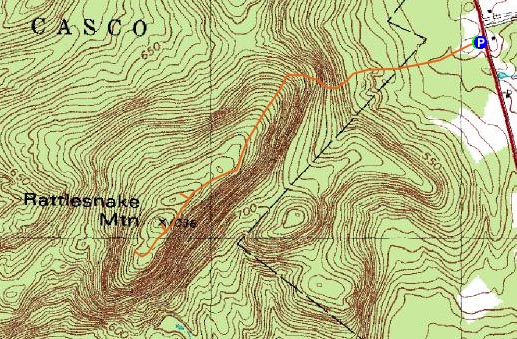
Route: Bri-Mar Trail, blue blazed trail, unknown trail, (Rattlesnake Mountain), unknown trail, blue blazed trail, Bri-Mar Trail
The second hike of the day was Rattlesnake Mountain. Arriving at the Bri-Mar Trail trailhead, I could see there were already some folks out on the trail.
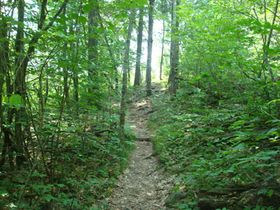
The first part of the trail goes through a meadow filled with wildflowers. From there, the trail was somewhat hard to follow - there are multiple junctions and only a few faded blazes. For future reference, left at the first fork, then merge left at the second junction, then right at the last fork, heading up hill.
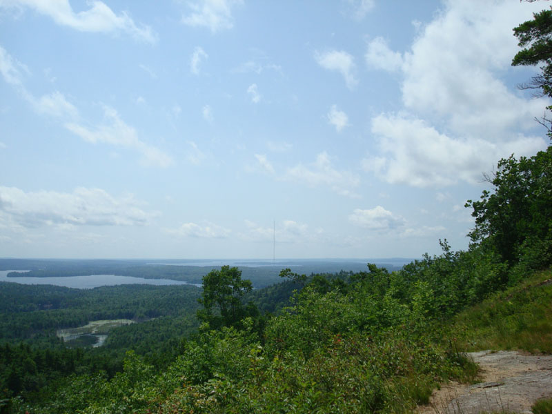
After a somewhat steep portion, the trail becomes increasingly scenic, arriving at a nice grassy viewpoint. This is still somewhat short of the summit.
I continued on from the viewpoint, soon ending up on a blue blazed trail. I followed this for a bit, before notcing it was losing elevation. Backtracking, I went to a junction I had reached earlier and followed a herd path up to what seemed to be the highpoint. With nothing to see here, I went back to the blue blazed trail, then took a left at another junction and followed a series of red spray painted rocks and ribboned trees to a grown in viewpoint with a log bench. All things considered, it was a pretty fruitless endeavor going beyond the original grassy viewpoint, so I went back to that and enjoyed the excellent vista.
Fortunately, bugs were not a problem at all.
| Hike Ratings |
|
Getting To Trailhead: |
Easy |
| Destination: |
Rattlesnake Mountain |
|
Length: |
Moderate |
|
Steepness: |
Moderate |
|
Navigation: |
Moderate |
|
Views: |
Excellent |
|
Crowds: |
Moderate |
|
| Hike Stats |
|
Date Hiked: |
Sunday, July 13, 2008 |
| Hike Commenced: |
11:03 AM |
| Parking Elevation: |
460' |
| Destination: |
Rattlesnake Mountain |
| Ascent Commenced: |
11:03 AM |
| Summit Reached: |
11:38 AM |
| Time Elapsed: |
00:35 |
| Trailhead Elevation: |
460' |
| Summit Elevation: |
1,035' |
| Vertical Gain: |
625' |
|
|
| Hike Ended: |
12:31 PM |
| Hike Time Elapsed: |
01:28 |
| Hike Vertical Gain: |
745' |
|
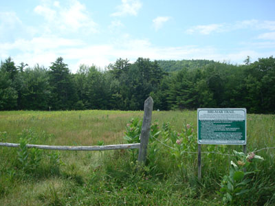
The Bri-Mar Trail trailhead
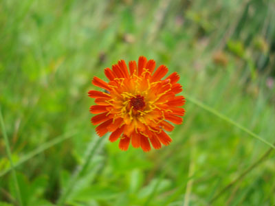
One of many wildflowers near the beginning of the Bri-Mar Trail

Looking toward Sebago Lake from the viewpoint below the Rattlesnake Mountain summit

Directions to trailhead: Take Route 302 East from Bridgton, then take a left onto 11 North. In Webb Mills, take a right onto Route 85 South. The Bri-Mar Trailhead and parking area are located on the side of a field on the right side of Route 85.
Back to Rattlesnake Mountain Profile
|