Home
States
Colorado
Connecticut
Maine
Massachusetts
New Hampshire
New York
Rhode Island
Utah
Vermont
View All
Lists
NE 4,000 Footers
NE 100 Highest
NH 4,000 Footers
NH 100 Highest
NH 52 With A View
NH Belknap Range
NH Ossipee 10
Links
Trail Conditions
Trip Log
Sunrises
Sunsets
About
|
The Roost
Batchelders Grant, ME
Trailheads, measurements, times, distances, and maps are all approximate and relative to the hike(s) as shown below.
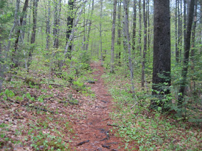
Looking up the north branch of the Roost Trail
Route: Roost Trail, (The Roost), spur trail, (The Roost), Roost Trail
Since the weather and my bum knee were preventing me from doing any sort of sizable hike, I decided to try a short Evans Notch hike whilst on my way to North Conway (a slight detour).
While there were some glimpses of blue sky on the drive up, there was a steady, light rain as I headed up Route 113. Reaching the Roost Trail trailhead, I quickly set foot up the trail. The steepest portion of it was the initial stairway climb from Route 113 - after that, it was pretty moderate going to the viewless summit.
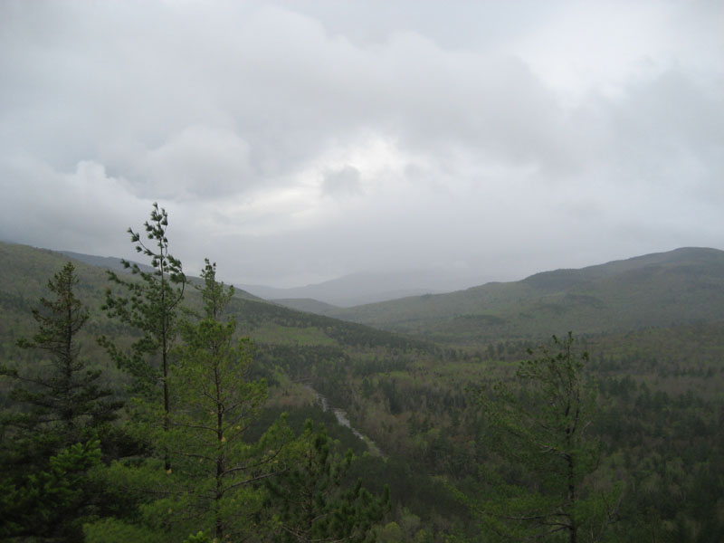
The spur path from the summit to the viewpoint was short, steep, and a bit slippery. Though obscured by the rain and fog, the views from the viewpoint were nonetheless quite good.
| Hike Ratings |
|
Getting To Trailhead: |
Easy |
| Destination: |
The Roost |
|
Length: |
Easy |
|
Steepness: |
Moderate |
|
Navigation: |
Minimal |
|
Views: |
Excellent |
|
Crowds: |
Minimal |
|
| Hike Stats |
|
Date Hiked: |
Sunday, May 10, 2009 |
| Hike Commenced: |
9:19 AM |
| Parking Elevation: |
820' |
| Destination: |
The Roost |
| Ascent Commenced: |
9:19 AM |
| Summit Reached: |
9:33 AM |
| Time Elapsed: |
00:14 |
| Trailhead Elevation: |
820' |
| Summit Elevation: |
1,374' |
| Distance: |
.5 mile |
| Vertical Gain: |
559' |
|
|
| Hike Ended: |
9:57 AM |
| Hike Time Elapsed: |
00:38 |
| Hike Vertical Gain: |
664' |
|
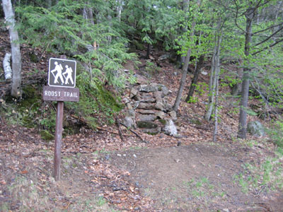
The Roost Trail trailhead on Route 113
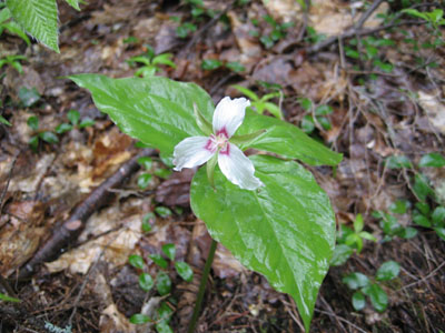
A painted trillium on the Roost Trail
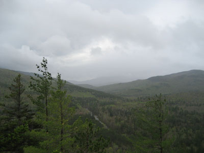
Looking up the Wild River valley from the viewpoint near the summit of The Roost
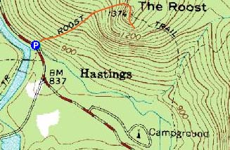

Directions to trailhead: From US 302, take Maine 113 North into Evans Notch. Shortly after passing the Wild River Road junction, the northern branch of the Roost Trail will be on the right. There is limited room for roadside parking.
Back to The Roost Profile
|