Home
States
Colorado
Connecticut
Maine
Massachusetts
New Hampshire
New York
Rhode Island
Utah
Vermont
View All
Lists
NE 4,000 Footers
NE 100 Highest
NH 4,000 Footers
NH 100 Highest
NH 52 With A View
NH Belknap Range
NH Ossipee 10
Links
Trail Conditions
Trip Log
Sunrises
Sunsets
About
|
Sabattus Mountain
Lovell, ME
Trailheads, measurements, times, distances, and maps are all approximate and relative to the hike(s) as shown below.
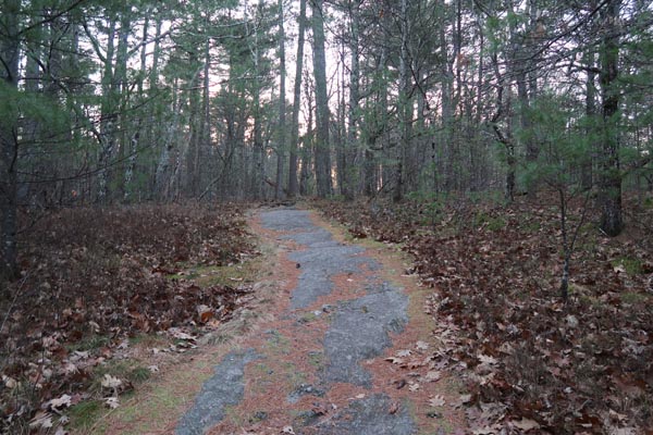
The western segment of the loop trail
Route: West loop of unknown trail, (Sabattus Mountain), west loop of unknown trail
Trail was snow free and (apart from mixed in with some mud) generally ice free. Some mud/ice down low. Nice sunrise from the ledges.
| Hike Ratings |
|
Getting To Trailhead: |
Easy |
| Destination: |
Sabattus Mountain |
|
Length: |
Moderate |
|
Steepness: |
Moderate |
|
Navigation: |
Easy |
|
Views: |
Excellent |
|
Crowds: |
Minimal |
|
| Hike Stats |
|
Date Hiked: |
Saturday, December 2, 2017 |
| Parking Elevation: |
755' |
| Destination: |
Sabattus Mountain |
| Time Elapsed: |
00:11 |
| Trailhead Elevation: |
760' |
| Summit Elevation: |
1,253' |
| Vertical Gain: |
505' |
|
|
| Hike Time Elapsed: |
00:41 |
| Hike Vertical Gain: |
565' |
|
The trailhead for the trails to the Sabattus Mountain summit
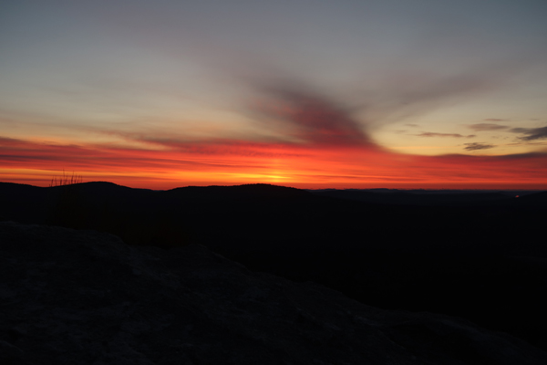
The sunrise from the Sabattus Mountain ledges

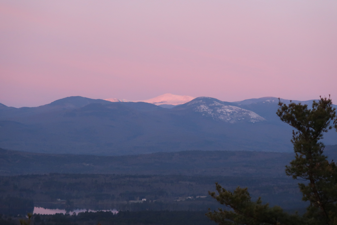
Mt. Washington as seen from the Sabattus Mountain ledges
Directions to trailhead: From US 302, take Route 5 North to Center Lovell. Take a right onto Sabattus Mountain Road. Head down this road a bit, then take a right onto a dirt Sabattus Trail road. The parking lot and trailhead will be down the road a bit on the right, marked with a big brown hiker sign.
Back to Sabattus Mountain Profile
|