Home
States
Colorado
Connecticut
Maine
Massachusetts
New Hampshire
New York
Rhode Island
Utah
Vermont
View All
Lists
NE 4,000 Footers
NE 100 Highest
NH 4,000 Footers
NH 100 Highest
NH 52 With A View
NH Belknap Range
NH Ossipee 10
Links
Trail Conditions
Trip Log
Sunrises
Sunsets
About
|
Sawyer Mountain
Limington, ME, Limerick, ME
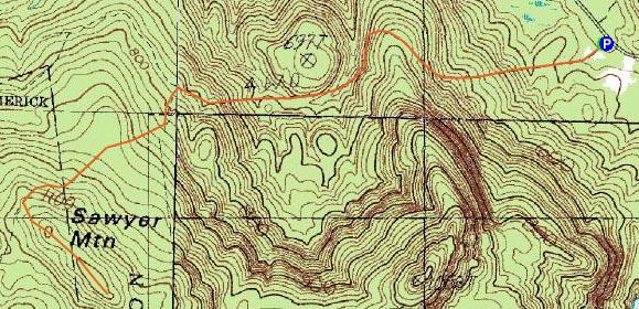
Trailheads, measurements, times, distances, and maps are all approximate and relative to the hike(s) as shown below.
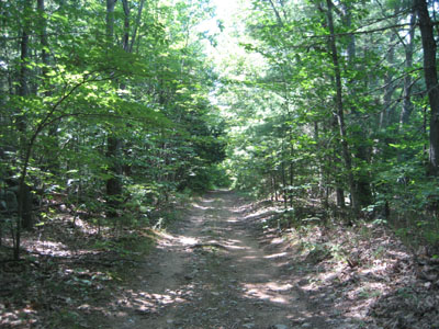
The old Sawyer Mountain Road
Route: Sawyer Mountain Road, unknown
Since I was going to Portland later in the day, I decided to do a small hike or two on the way. That small hike would end up being Sawyer Mountain.
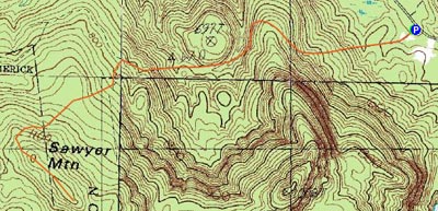
Arriving at the trailhead, I wasn't completely clear which way I should go - I followed my instinct and ended up being correct. The maps provided at the trailhead aren't overly helpful - what's a path and what's an old logging road isn't really defined.
The first portion of the hike is flat - the old road cuts through the woods, passes an old house, a beaver area, and a cemetary, before steepening up moderately. Since its been closed for awhile, Sawyer Mountain Road is somewhat eroded as it climbs up - a Jeep could still make it through, but alas the trails are closed off to everything but snowmobiles and hikers.
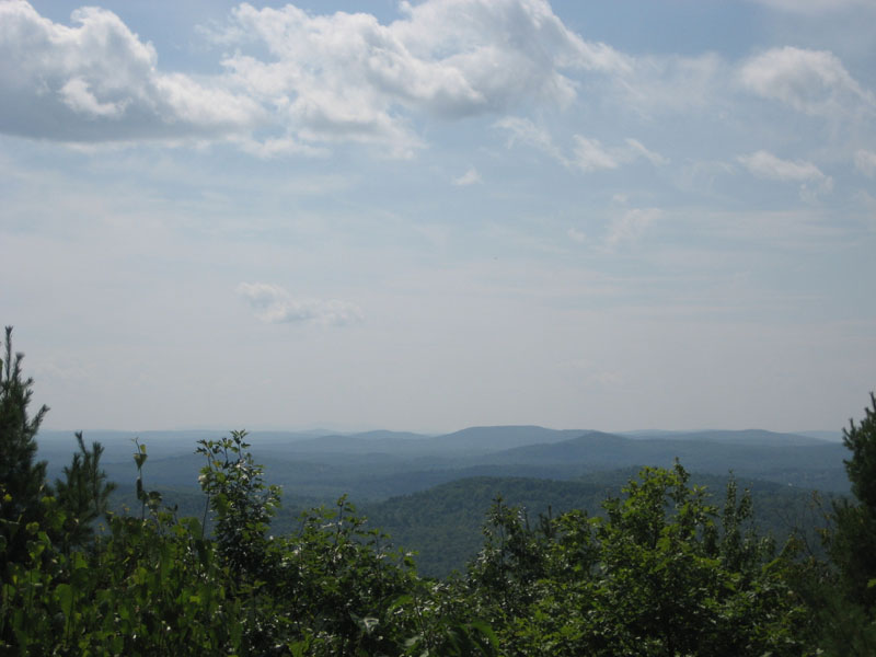
The spur to the summit wasn't really marked - if I wasn't consulting with the topo map provided, I probably would have scratched my head a lot more. Nonetheless, I followed the old road of sorts up to the summit and was greeted with somewhat hazy views to the southwest. Nothing really spectacular to see with the mediocre visibility, but on the whole a decent view. The view of interest to me was a bit obscured - Sebago Lake. There looks to be a better view point available lower on the mountain, however I didn't have much time to wander around.
The descent was rather dull - there's not too much to see on this trail/road other than the above listed 'attractions.' Still, not a bad hike by any means.
| Hike Ratings |
|
Getting To Trailhead: |
Easy |
| Destination: |
Sawyer Mountain |
|
Length: |
Moderate |
|
Steepness: |
Moderate |
|
Navigation: |
Moderate |
|
Views: |
Excellent |
|
Crowds: |
Minimal |
|
| Hike Stats |
|
Date Hiked: |
Sunday, August 12, 2007 |
| Hike Commenced: |
1:36 PM |
| Parking Elevation: |
490' |
| Destination: |
Sawyer Mountain |
| Ascent Commenced: |
1:37 PM |
| Summit Reached: |
2:13 PM |
| Time Elapsed: |
00:36 |
| Trailhead Elevation: |
490' |
| Summit Elevation: |
1,200' |
| Vertical Gain: |
790' |
|
|
| Hike Ended: |
3:00 PM |
| Hike Time Elapsed: |
01:24 |
| Hike Vertical Gain: |
875' |
|
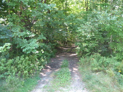
The old Sawyer Mountain Road entrance from Route 117
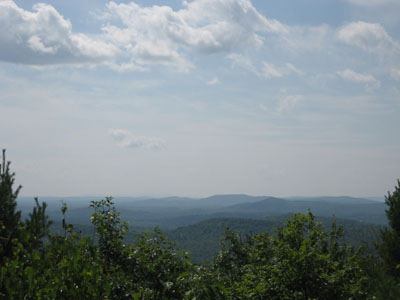
Looking southwest from the Sawyer Mountain summit

Directions to trailhead: Take Route 25 to Route 117. Take Route 117 southeast to a sharp turn - there's a dirt parking lot on the right side of the road with a few signs. Sawyer Mountain Road (closed to wheeled traffic) is to the right.
Back to Sawyer Mountain Profile
|