Home
States
Colorado
Connecticut
Maine
Massachusetts
New Hampshire
New York
Rhode Island
Utah
Vermont
View All
Lists
NE 4,000 Footers
NE 100 Highest
NH 4,000 Footers
NH 100 Highest
NH 52 With A View
NH Belknap Range
NH Ossipee 10
Links
Trail Conditions
Trip Log
Sunrises
Sunsets
About
|
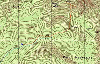
Snow Mountain
Upper Cupsuptic, ME
Trailheads, measurements, times, distances, and maps are all approximate and relative to the hike(s) as shown below.
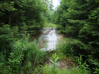
Looking up one of the wet slabs on the old logging road
Route: Logging road, bushwhack, (Snow Mountain), bushwhack, logging road
In Maine for the weekend, I decided to tackle Cupsuptic Snow after the drive up. After navigating the maze of logging roads, I parked at a turnoff and started downhill on a recently-recleared road. Soon going back uphill, the road eventually became a bit muddy.
After reaching the end of the recut area, I pushed through the brushy upper portion of the road, taking care on some slippery rock slabs. Reaching about 3,100 feet in elevation, I had had enough of the grown in road and instead opted to bushwhack direct to the summit.
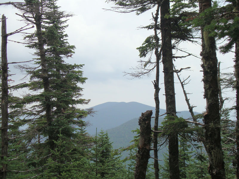
I had open woods for quite awhile, prior to reaching thicker and steeper stuff. I eventually popped onto the ridge at the knob just a bit east of the summit and was able to follow a herd path from there to the highpoint. While there wasn't a vista to be found, there were slight views through the trees near the cannister.
For the descent, I decided to try to skirt around the thick junk I had found and perhaps follow the herd path for awhile. Following it across the ridge, I soon dropped into nice open fern glades. Clouds had moved in overhead, taking away the ability of navigating by the sun. Nonetheless, I seemed to have good going and continued downhill. Unfortunately, I hadn't checked my compass in awhile and soon found myself looking through the trees into a valley with some clearcuts nearby - clearly not anywhere I had been. Checking my compass, I was facing northeast, rather than the southeastern direction I had been following on the falline at first.
Since I didn't have the area in the distance on my map or aerial imagery, I wasn't quite sure what I was looking at, so I turned around and headed back uphill. Soon thereafter, a thunderstorm erupted, making things that much trickier - a downpour, no visibility of the nearby valleys and ridges, etc. Reaching a height of land, I couldn't trust my altimeter any longer due to the weather change, so I took stock of where I could be and then set a new bearing.
Bumping into some old clearcuts, I modified my plans and dropped into a brook area, hoping to follow it back to the logging road. I ended up in a nasty marshy area with a tricky water crossing. Fortunately, the rain had passed through and I could now see my surroundings, which matched the valley on the map. Thusly, I climbed uphill and soon found myself on the recut logging road. Much time had been wasted due to not paying close enough attention during a quick weather change.
| Hike Ratings |
|
Getting To Trailhead: |
Difficult |
| Destination: |
Snow Mountain |
|
Length: |
Moderate |
|
Steepness: |
Difficult |
|
Navigation: |
Difficult |
|
Views: |
Minimal |
|
Crowds: |
Minimal |
|
| Hike Stats |
|
Date Hiked: |
Friday, July 16, 2010 |
| Hike Commenced: |
10:30 AM |
| Parking Elevation: |
2,710' |
| Destination: |
Snow Mountain |
| Ascent Commenced: |
10:30 AM |
| Summit Reached: |
11:47 AM |
| Time Elapsed: |
01:17 |
| Trailhead Elevation: |
2,710' |
| Summit Elevation: |
3,784' |
| Vertical Gain: |
1,124' |
|
|
| Hike Ended: |
2:39 PM |
| Hike Time Elapsed: |
04:09 |
| Hike Vertical Gain: |
1,474' |
|
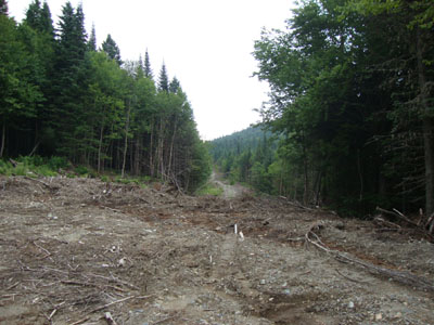
The beginning of the logging road walk
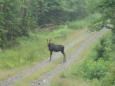
One of the locals out for a stroll

Slight views of West Kennebago Mountain from near the summit of Snow Mountain

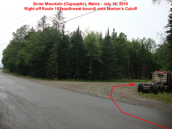
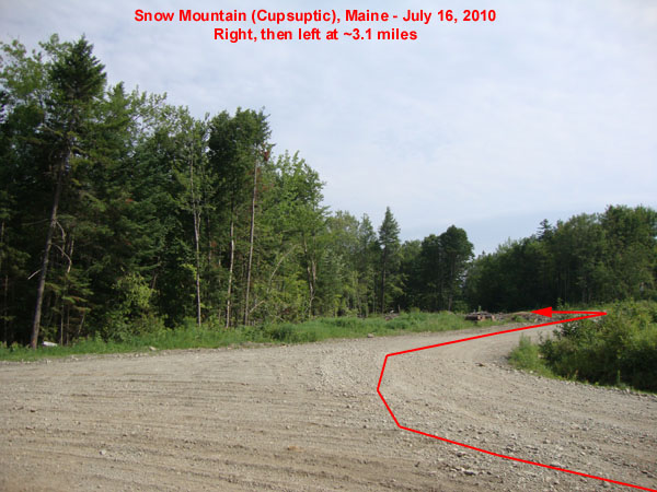
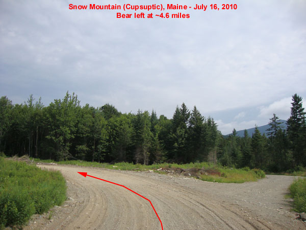
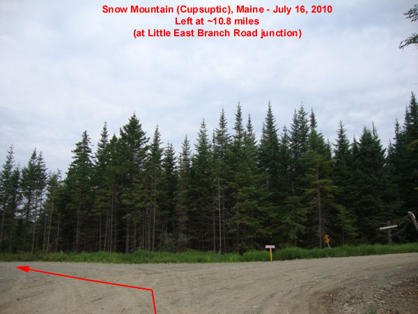
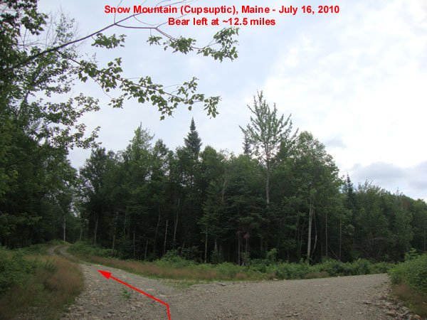
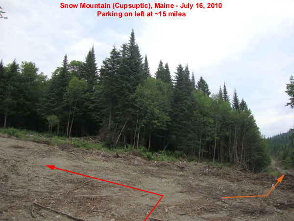
Directions to trailhead: Take Route 16 southwest (though technically northwest) from Oquossoc. Shortly after passing the Cupsuptic Campground, take a right onto Morton Cutoff (if you pass Pleasant Island Road on your left, you just missed it). At ~1.5 miles, a shooting range will be on the right. At a T-junction at ~3.1 miles, take a right, then take an immediate left. At ~4.6 miles, bear left. Take a left at a T-junction with Little East Branch Road at ~10.8 miles. At ~12.4 miles, take a right onto East Branch Road. At ~12.5 miles, bear left. At about 15 miles, there is room for parking on the left. The logging road continues straight, a bit more ruggedly.
Back to Snow Mountain Profile
|

