Home
States
Colorado
Connecticut
Maine
Massachusetts
New Hampshire
New York
Rhode Island
Utah
Vermont
View All
Lists
NE 4,000 Footers
NE 100 Highest
NH 4,000 Footers
NH 100 Highest
NH 52 With A View
NH Belknap Range
NH Ossipee 10
Links
Trail Conditions
Trip Log
Sunrises
Sunsets
About
|
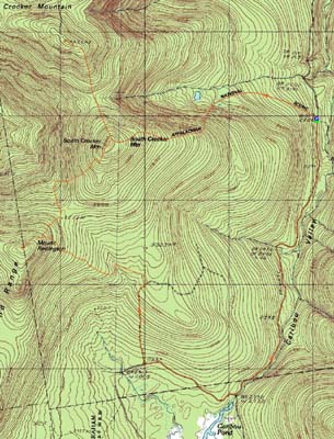
South Crocker Mountain, Crocker Mountain, Mt. Redington
Carrabasset Valley, ME, Redington, ME
Trailheads, measurements, times, distances, and maps are all approximate and relative to the hike(s) as shown below.
Looking down the Appalchian Trail on the way to South Crocker Mountain
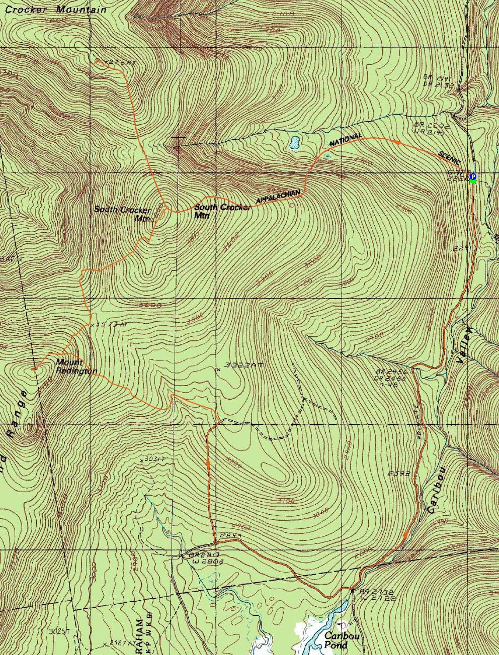
Route: Appalachian Trail, spur path, (South Crocker Mountain), spur path, Appalachian Trail, (Crocker Mountain), Appalachian Trail, spur path, (South Crocker Mountain), herd path, logging road, herd path, (Mt. Redington), herd path, various logging roads, Caribou Valley Road
With yet another mediocre (at best) forecast, I was planning on hiking Owl's Head. Ready to go in the morning, I suddenly came to a realization - I had no desire to hike Owl's Head. Thus, I took advantage of my last minute change of heart and gathered some maps for a trip to the Crockers and Redington.
The Caribou Valley Road - easy to miss due to a lack of signage - was quite rough. Prior to reaching the metal grate bridge, there were some exposed culverts, jutting rocks, and other obstacles. Immediately after passing the metal grate bridge, the road was eroded. Reaching the next sizable bridge, I took a leap of faith and drove over it. On either end, there are huge potholes - vehicles without decent clearance need not apply.
With my eye out for the Appalchian Trail crossing, I eventually saw a ribbon marking a trail on the right, then a few feet after, a trail to the left - the AT. Backing up, I parked in a small clearing on the right (careful parking - lots of large rocks hiding in the grass).
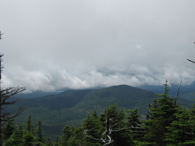
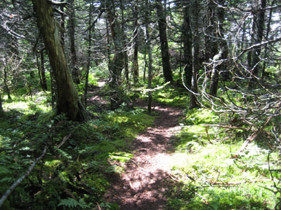
The Appalachian Trail to South Crocker started off fairly gradually - the footing wasn't ideal, though, so I wasn't able to go as fast as I would have liked. Shortly after passing the campsite spur junction at .9 mile, the trail steepened up significantly (though never becoming a scramble). Soon, I reached some talus slopes with great views, reminding me of nearby Mt. Abraham's Fire Warden's Trail.
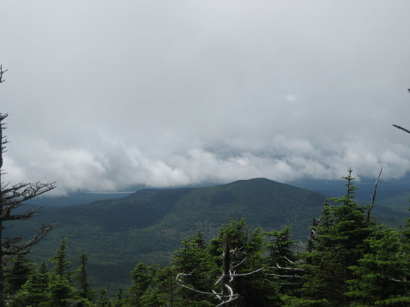
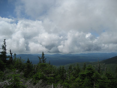
Awhile after crossing the open areas, the trail became a bit more gradual, soon reaching the sharp right turn near the summit of South Crocker. After taking the herd path to the summit (very little in way of views over the trees), I headed over to North Crocker. A steep descent and ascent later, I was at the summit, just as the fog lifted enough to provide some views from the boundary cut.
Back on South Crocker, I found the herd path to Redington directly behind the summit rocks. Though certainly not a trail, the herd path was nonetheless fairly easy to follow. Gradual at first, it soon dropped into a boundary cut. I took a right and followed the boundary cut around a corner, almost to a height of land, then took a left and followed the continuation of the herd path downhill.
After some steep terrain, I eventually arrived in an old clearcut. The herd path cut diagonally uphill to a logging road, then followed that a bit uphill. A cairn marked where the herd path took a right back into the woods. Eventually, another path entered from the left. Not long after that, I was at the summit area with the wreckage of a wind monitoring tower.
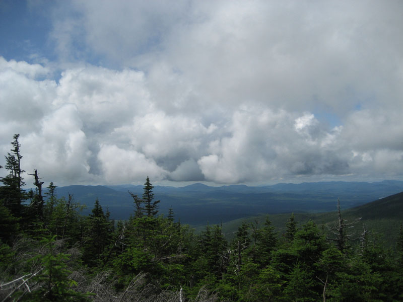
There were excellent directional views from the summit area, looking toward the Crockers and points northwest. Not too far from this view, on a herd path near part of the tower wreckage, I found the PVC summit cannister attached to a tree.
While I had originally planned to return to South Crocker, I decided to instead follow the alternate-popular-approach down to Caribou Valley Road. At the herd path junction below the summit, I beared right.
This herd path eventually reached an ATV road of sorts - I took a left when I reached this (some cairns helped with navigation). Right would not have been an option, as the ATV road almost immediately ends uphill.
This path eventually became more of a proper logging road. Reaching a junction marked with some sort of metallic wire anchor, I wanted to take a left and go uphill, however I saw a cairn downhill (south). Since the cairns had been right thus far, I took a right and headed downhill to the south.
Though this seemed to be way out of the way, I eventually reached a larger logging road. Taking a left onto this, I eventually made my way back to Caribou Valley Road, just prior to where the road crosses over a river (if one were to go southbound). Taking a left, I headed northbound and eventually made my way back to the Appalachian Trail crossing. While there was some nice scenery from some of the logging roads, I'm not sure how much of a time saver they were, as compared to returning to South Crocker.
| Hike Ratings |
|
Getting To Trailhead: |
Difficult |
| Destination: |
South Crocker Mountain |
|
Length: |
Moderate |
|
Steepness: |
Difficult |
|
Navigation: |
Easy |
|
Views: |
Minimal |
|
Crowds: |
Minimal |
| Destination: |
Crocker Mountain |
|
Length: |
Moderate |
|
Steepness: |
Difficult |
|
Navigation: |
Easy |
|
Views: |
Excellent |
|
Crowds: |
Minimal |
| Destination: |
South Crocker Mountain |
|
Length: |
Moderate |
|
Steepness: |
Difficult |
|
Navigation: |
Easy |
|
Views: |
Minimal |
|
Crowds: |
Minimal |
| Destination: |
Mt. Redington |
|
Length: |
Moderate |
|
Steepness: |
Moderate |
|
Navigation: |
Difficult |
|
Views: |
Excellent |
|
Crowds: |
Minimal |
|
| Hike Stats |
|
Date Hiked: |
Saturday, July 25, 2009 |
| Hike Commenced: |
11:16 AM |
| Parking Elevation: |
2,220' |
| Destination: |
South Crocker Mountain |
| Ascent Commenced: |
11:16 AM |
| Summit Reached: |
12:22 PM |
| Time Elapsed: |
01:06 |
| Trailhead Elevation: |
2,220' |
| Summit Elevation: |
4,050' |
| Distance: |
2.1 miles |
| Vertical Gain: |
1,840' |
| Destination: |
Crocker Mountain |
| Ascent Commenced: |
12:25 PM |
| Summit Reached: |
12:54 PM |
| Time Elapsed: |
00:29 |
| Trailhead Elevation: |
4,050' |
| Summit Elevation: |
4,228' |
| Distance: |
1 mile |
| Vertical Gain: |
558' |
| Destination: |
South Crocker Mountain |
| Ascent Commenced: |
1:07 PM |
| Summit Reached: |
1:34 PM |
| Time Elapsed: |
00:27 |
| Trailhead Elevation: |
4,228' |
| Summit Elevation: |
4,050' |
| Distance: |
1 mile |
| Vertical Gain: |
380' |
| Destination: |
Mt. Redington |
| Ascent Commenced: |
1:34 PM |
| Summit Reached: |
2:22 PM |
| Time Elapsed: |
00:48 |
| Trailhead Elevation: |
4,050' |
| Summit Elevation: |
4,010' |
| Vertical Gain: |
680' |
|
|
| Hike Ended: |
4:04 PM |
| Hike Time Elapsed: |
04:48 |
| Hike Vertical Gain: |
3,518' |
|
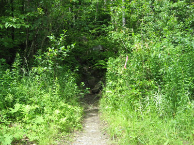
The Appalachian Trail crossing on Caribou Valley Road
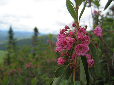
Bog laurel along the Appalachian Trail
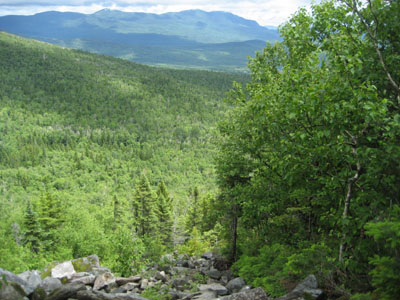
The Appalachian Trail between the Crockers
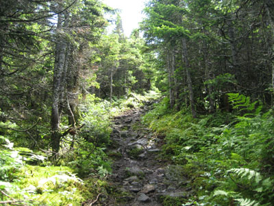
The Appalachian Trail between the Crockers
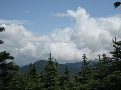
Looking at Black Nubble from near the summit of Crocker Mountain
The herd path to Mt. Redington
Looking northeast from the Mt. Redington viewpoint
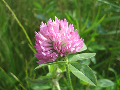
Red clover along the maze of logging roads from Mt. Redington

Directions to trailhead: Take Route 27 northwest from the entrance to Sugarloaf USA ski area. Just after passing a transfer station on the right (on an uphill), Caribou Valley Road will be on the left. As of summer 2009, vehicles with low clearance will not want to attempt this road. Non off-road-capable vehicles will want to park just before the metal grate bridge. The Appalachian Trail crossing is awhile beyond this bridge and a very dicey wood bridge. A small parking area will be on the right, just before the unsigned trail crossing.
Back to South Crocker Mountain Profile
Back to Crocker Mountain Profile
Back to Mt. Redington Profile
|