Home
States
Colorado
Connecticut
Maine
Massachusetts
New Hampshire
New York
Rhode Island
Utah
Vermont
View All
Lists
NE 4,000 Footers
NE 100 Highest
NH 4,000 Footers
NH 100 Highest
NH 52 With A View
NH Belknap Range
NH Ossipee 10
Links
Trail Conditions
Trip Log
Sunrises
Sunsets
About
|
Starks Mountain
Fryeburg, ME
Trailheads, measurements, times, distances, and maps are all approximate and relative to the hike(s) as shown below.
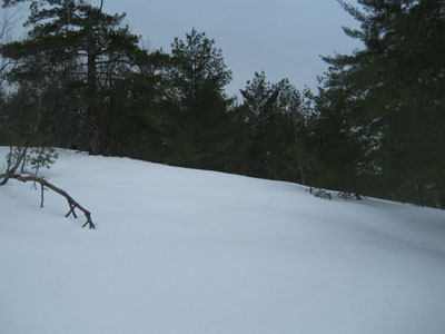
Looking up a clear section near the top of the old T-Bar line
Route: Bushwhack
After a very cold first half of the winter, I was somewhat glad to have warmer temperatures. While the day had started off in the 50s and sunny, clouds moved in as the end of my work day neared. Once in route to my destination, it started to sprinkle. Nonetheless, I wanted to get outside.
Arriving at the bottom of the old Stark's Hill ski area, I drove around the base area a bit, trying to find a good way to approach the hike (hoping to find a snowshoe track). Not finding anything obvious, I parked at the southernmost side of the plowed area and decided to go essentially straight up. This proved to work well, as I quickly found the bridge tower to the old T-Bar lift.
While there were lots of sapplings throughout, I was able to make a fairly easy line (in terms of vegetation) roughly following the old T-Bar. While the bottom and top were moderate in pitch, the middle portion of the ascent was somewhat steep. With the warm temperatures, I was sinking 1-2 feet, despite wearing snowshoes.
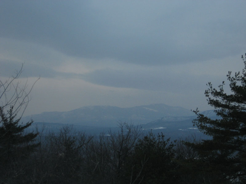
Though cloudy, the views from the summit were nonetheless decent- the Moats and Kearsarge North were on full display. After wandering around the summit tower area a bit, I decided to call it a day and backtrack down. While the weather wasn't perfect, the rain never picked up beyond a sprinkle.
| Hike Ratings |
|
Getting To Trailhead: |
Easy |
| Destination: |
Starks Mountain |
|
Length: |
Moderate |
|
Steepness: |
Difficult |
|
Navigation: |
Moderate |
|
Views: |
Excellent |
|
Crowds: |
Minimal |
|
| Hike Stats |
|
Date Hiked: |
Wednesday, February 11, 2009 |
| Hike Commenced: |
4:06 PM |
| Parking Elevation: |
470' |
| Destination: |
Starks Mountain |
| Ascent Commenced: |
4:06 PM |
| Summit Reached: |
4:36 PM |
| Time Elapsed: |
00:30 |
| Trailhead Elevation: |
470' |
| Summit Elevation: |
1,037' |
| Vertical Gain: |
567' |
|
|
| Hike Ended: |
5:03 PM |
| Hike Time Elapsed: |
00:57 |
| Hike Vertical Gain: |
567' |
|
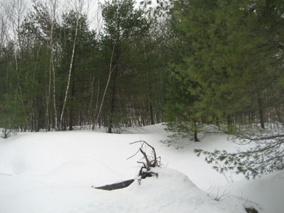
The bottom of the old T-Bar line up Starks Mountain

Looking at the Moats from Starks Mountain
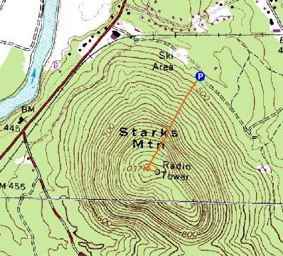

Directions to trailhead: Take 302 East from Center Conway. Just over the Maine border, take a right onto Haley Town. After crossing the railroad tracks, take an immediate left onto a dirt road. A few minutes down this road, it will split, then rejoin itself, at the site of the former Starks Hill ski area.
Back to Starks Mountain Profile
|