Home
States
Colorado
Connecticut
Maine
Massachusetts
New Hampshire
New York
Rhode Island
Utah
Vermont
View All
Lists
NE 4,000 Footers
NE 100 Highest
NH 4,000 Footers
NH 100 Highest
NH 52 With A View
NH Belknap Range
NH Ossipee 10
Links
Trail Conditions
Trip Log
Sunrises
Sunsets
About
|
Stone Mountain
Brownfield, ME
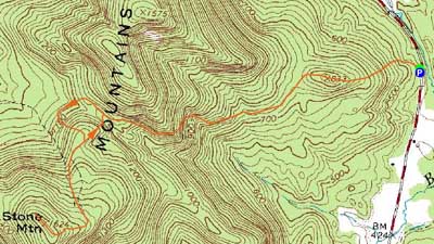
Trailheads, measurements, times, distances, and maps are all approximate and relative to the hike(s) as shown below.
The new Twin Brook Trail
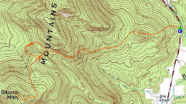
Route: Burnt Meadow Trail, Twin Brook Trail, bushwhack, unknown trail, (Stone Mountain), unknown trail, bushwhack, Twin Brook Trail, Burnt Meadow Trail
As has often been the case over the past three Junes, the weather forecast wasn't too accurate - the forecasted sunny afternoon was almost completely cloudy. Thus, along with expected biker weekend traffic, I opted to stay a bit local and head over to the Burnt Meadow Mountain area.
The small parking area had grown since my previous hike due to logging activity. Once the logging operation is done, there will be a few more spaces available.
I was pleasantly surprised to see a nice trailhead sign, as well as fresh blazing. Heading up the Burnt Meadow Trail, I went over the first crag (covered in a variety of wildflowers), and soon reached the Twin Brook Trail junction - also marked with a new sign.
The Twin Brook Trail, not complete when I hiked it in 2009, had been modified a bit and now featured better footing, good blazing, and a few less ups and downs. Nonetheless, there were still more than enough ups and downs to go around.
Having heard about a new trail being planned for Stone Mountain, I kept my eyes open for any signs of markings or clearing. I followed a lines of surveyors tape with no success - likely either old trail markings or else property boundaries. After passing over the height of land, I decided I'd go for Stone anyway. With that decision, I followed a likely property boundary line of tape into an open meadow, where I bumped into a cow moose.
On the other side of the meadow, I crossed a stone wall and worked my way up through a somewhat open softwood forest. Reaching a small subpeak, I took a bearing to make sure I was on course (since the subpeak didn't show up on the topo map), and pushed on to the south - and subsequently ran into a nice, new trail.
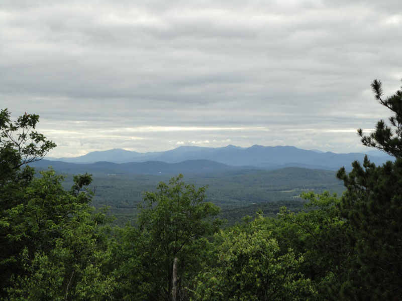
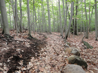
The trail to Stone Mountain was raked clean for part of the way, marked in surveyors tape, and generally very easy to follow. Reaching the blueberry field summit, I continued north and came to a nice Sandwich Range viewpoint. Though not as great a view peak as nearby Burnt Meadow Mountain (north peak), it was nonetheless quite nice. While I hadn't dealt with any mosquitoes, deer flies, or black flies, I did end up picking up a few ticks in the blueberry vines and grass on the summit.
Heading back down the new trail, I followed it all the way to its end - at the height of land in the col, about 100 feet away from the Twin Brook Trail. By the looks of it, the work crew was coming in through the meadow from the west, thus the non-connection to the Twin Brook Trail. With the exception of a few minor scrambles on the Burnt Meadow Trail, the ascent to Stone Mountain via these new trails appears to be fairly tame in pitch, which switchbacks up all of the steep portions.
While I was tempted to head up to Burnt Meadow Mountain, I decided to call it a day and retrace my steps back to the trailhead.
| Hike Ratings |
|
Getting To Trailhead: |
Easy |
| Destination: |
Stone Mountain |
|
Length: |
Moderate |
|
Steepness: |
Difficult |
|
Navigation: |
Difficult |
|
Views: |
Excellent |
|
Crowds: |
Minimal |
|
| Hike Stats |
|
Date Hiked: |
Friday, June 11, 2010 |
| Hike Commenced: |
3:50 PM |
| Parking Elevation: |
440' |
| Destination: |
Stone Mountain |
| Ascent Commenced: |
3:50 PM |
| Summit Reached: |
5:14 PM |
| Time Elapsed: |
01:24 |
| Trailhead Elevation: |
440' |
| Summit Elevation: |
1,624' |
| Vertical Gain: |
1,424' |
|
|
| Hike Ended: |
6:33 PM |
| Hike Time Elapsed: |
02:43 |
| Hike Vertical Gain: |
1,604' |
|
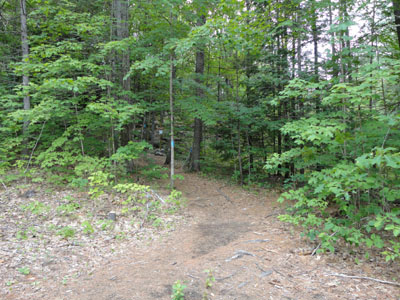
The trailhead to Burnt Meadow Mountain on Route 160
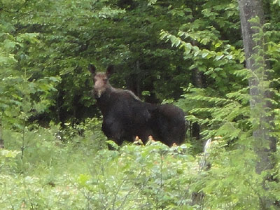
You never know who's watching
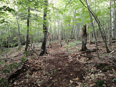
Looking up the future trail to Stone Mountain
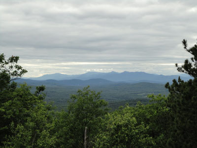
Looking at the Sandwich Range from near the summit of Stone Mountain

Directions to trailhead: Take 160 South from Brownfield. Shortly after passing the pond, just after a curve, there will be a small dirt parking lot on the right. The trailhead is to the right of this, marked with a light blue blaze, as well as a sign a few feet into the woods.
Back to Stone Mountain Profile
|