Home
States
Colorado
Connecticut
Maine
Massachusetts
New Hampshire
New York
Rhode Island
Utah
Vermont
View All
Lists
NE 4,000 Footers
NE 100 Highest
NH 4,000 Footers
NH 100 Highest
NH 52 With A View
NH Belknap Range
NH Ossipee 10
Links
Trail Conditions
Trip Log
Sunrises
Sunsets
About
|
The Owl
T3 R10, ME
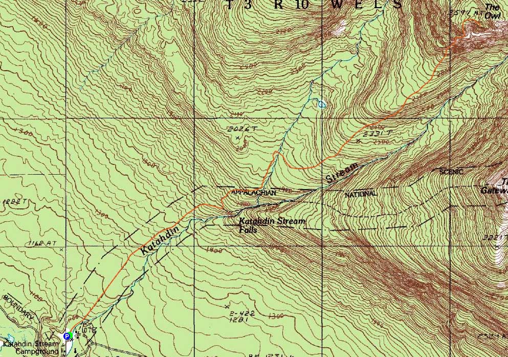
Trailheads, measurements, times, distances, and maps are all approximate and relative to the hike(s) as shown below.
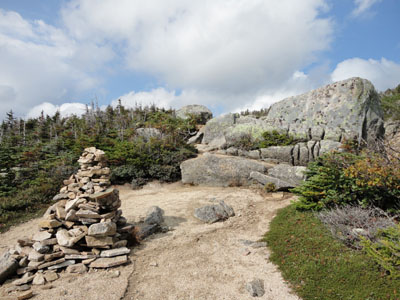
Looking down the Owl Trail
Route: Hunt Trail, The Owl Trail, (The Owl), The Owl Trail, Hunt Trail
After postponing my arrival to Baxter State Park due to the Duke Duke Duke Duke of Earl, the hurricane that never was, I finally headed up Saturday. Arriving around noon, I headed west to the Katahdin Stream trailhead.
Starting there, we made decent time along the Hunt Trail, soon reaching the Owl Trail junction. From there, the lingering warmer temperatures made things a bit of a challenge. Nonetheless, the pitch wasn't too bad (and, for Baxter standards, the footing was not too bad either) as we climbed, crossed a brook, climbed some more, then arrived at a plateau. Looking up, we saw that the bulk of the climb was ahead of us yet.
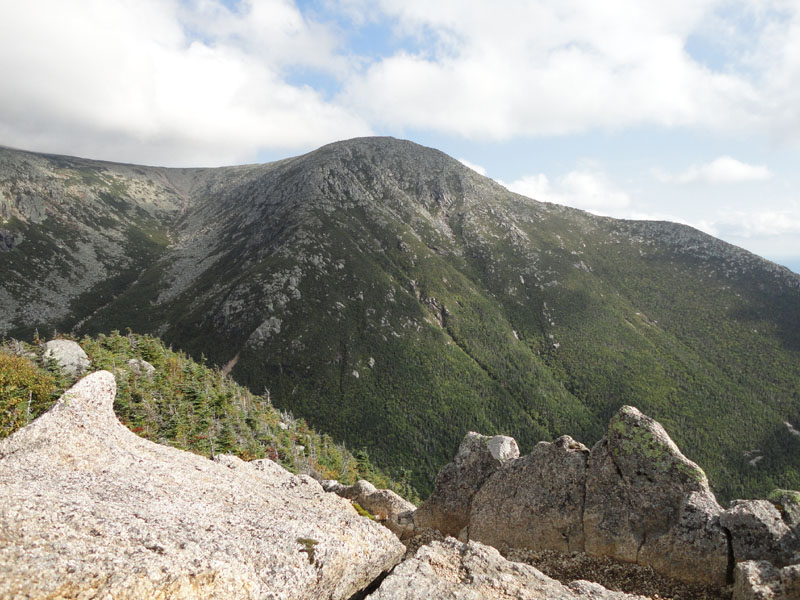
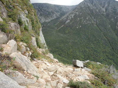
Sure enough, we reached the beginning of the real climb, which was steep and rough with multiple scramble ledges and a few tight squeezes. The views along the way were quite good. Reaching the summit ridge and subsequent walk to the open highpoint, the views in all directions were superb as the fog from the rain continued to lift.
The descent back down the scrambles required a bit of care, however thereafter it was fairly smooth sailing.
| Hike Ratings |
|
Getting To Trailhead: |
Easy |
| Destination: |
The Owl |
|
Length: |
Moderate |
|
Steepness: |
Very Difficult |
|
Navigation: |
Easy |
|
Views: |
Excellent |
|
Crowds: |
Minimal |
|
| Hike Stats |
|
Date Hiked: |
Saturday, September 4, 2010 |
| Hike Commenced: |
1:02 PM |
| Parking Elevation: |
1,080' |
| Destination: |
The Owl |
| Ascent Commenced: |
1:02 PM |
| Summit Reached: |
3:24 PM |
| Time Elapsed: |
02:22 |
| Trailhead Elevation: |
1,080' |
| Summit Elevation: |
3,736' |
| Distance |
3.6 miles |
| Vertical Gain: |
2,696' |
|
|
| Hike Ended: |
5:36 PM |
| Hike Time Elapsed: |
04:34 |
| Hike Vertical Gain: |
2,736' |
|
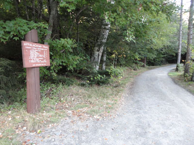
The Hunt Trail trailhead at Katahdin Stream Campground
Looking up the Owl Trail

Looking at the southwest spur of Mt. Katahdin from The Owl
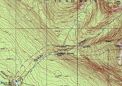

Directions to trailhead: From the Togue Pond Gate (Millinocket side), take the Tote Road west, then turn right onto the Katahdin Stream Campground entrance road. The limited-space day use parking lot will be located on the left. The Hunt Trail continues straight.
Back to The Owl Profile
|