Home
States
Colorado
Connecticut
Maine
Massachusetts
New Hampshire
New York
Rhode Island
Utah
Vermont
View All
Lists
NE 4,000 Footers
NE 100 Highest
NH 4,000 Footers
NH 100 Highest
NH 52 With A View
NH Belknap Range
NH Ossipee 10
Links
Trail Conditions
Trip Log
Sunrises
Sunsets
About
|
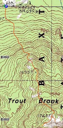
Trout Brook Mountain
T6R9, ME
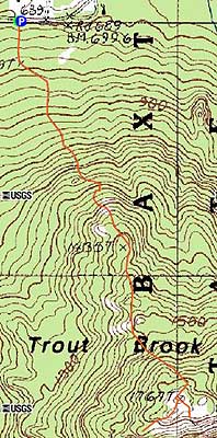
Trailheads, measurements, times, distances, and maps are all approximate and relative to the hike(s) as shown below.
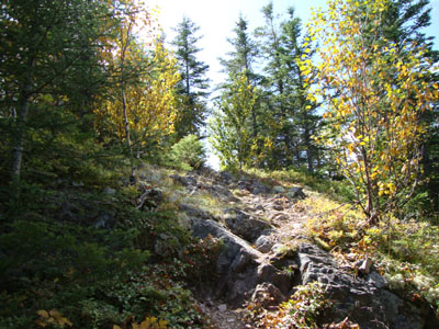
Looking up the Trout Brook Mountain Trail
Route: Trout Brook Mountain Trail
On a sore ankle and not satisfied with just hiking Burnt Mountain, I headed up the Tote Road to Trout Brook Mountain.
The Trout Brook Mountain Trail started off gently, prior to reaching some steep, ledgy stretches. Many of the ledgy areas provided excellent views to the north.
Reaching the summit, I was let down by the relative lack of views. Not satisfied, I looked around a bit. Spotting a dramatic cliff, I backtracked up to the summit sign, the followed a herd path (and then bushwhacked) over to it. From the ledge, I had amazing views of nearby ponds and peaks.
Back on the trail, I had to take my time descending, as the steep ledgy areas worked hard to challenge my ankle.
| Hike Ratings |
|
Getting To Trailhead: |
Easy |
| Destination: |
Trout Brook Mountain |
|
Length: |
Moderate |
|
Steepness: |
Difficult |
|
Navigation: |
Moderate |
|
Views: |
Excellent |
|
Crowds: |
Moderate |
|
| Hike Stats |
|
Date Hiked: |
Saturday, September 5, 2009 |
| Hike Commenced: |
11:31 AM |
| Parking Elevation: |
700' |
| Destination: |
Trout Brook Mountain |
| Ascent Commenced: |
11:31 AM |
| Summit Reached: |
12:09 PM |
| Time Elapsed: |
00:38 |
| Trailhead Elevation: |
700' |
| Summit Elevation: |
1,767' |
| Distance: |
1.3 miles |
| Vertical Gain: |
1,137' |
|
|
| Hike Ended: |
1:16 PM |
| Hike Time Elapsed: |
01:44 |
| Hike Vertical Gain: |
1,257' |
|
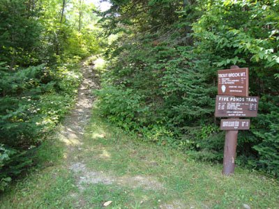
The Trout Brook Mountain Trail trailhead
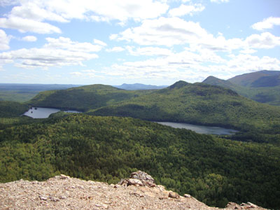
Looking at Billish Pond and Long Pond from the Trout Mountain ledges

Directions to trailhead: The Trout Brook Trail trailhead and parking area are located across the Tote Road from the Trout Brook Farm Campground.
Back to Trout Brook Mountain Profile
|