Home
States
Colorado
Connecticut
Maine
Massachusetts
New Hampshire
New York
Rhode Island
Utah
Vermont
View All
Lists
NE 4,000 Footers
NE 100 Highest
NH 4,000 Footers
NH 100 Highest
NH 52 With A View
NH Belknap Range
NH Ossipee 10
Links
Trail Conditions
Trip Log
Sunrises
Sunsets
About
|
Tunk Mountain
T10 SD, ME
Trailheads, measurements, times, distances, and maps are all approximate and relative to the hike(s) as shown below.
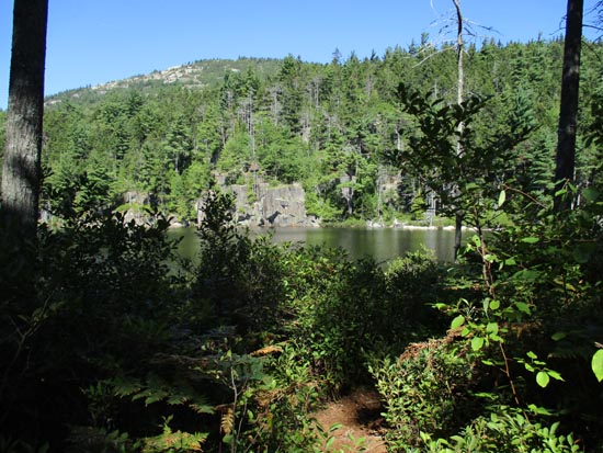
Approaching Mud Pond
Route: Tunk Mountain Trail, herd path
Trail was mostly dry. Lots of work has been done on it since the last Maine Mountain Guide, including eliminating the ropes (looks like by reroutes, rock steps, and iron rungs). Phone GPSed it at 1.63 miles to the ledges (where the trail suddenly turns north and goes to a large ledge) and then .18 miles via herd path to the highpoint.
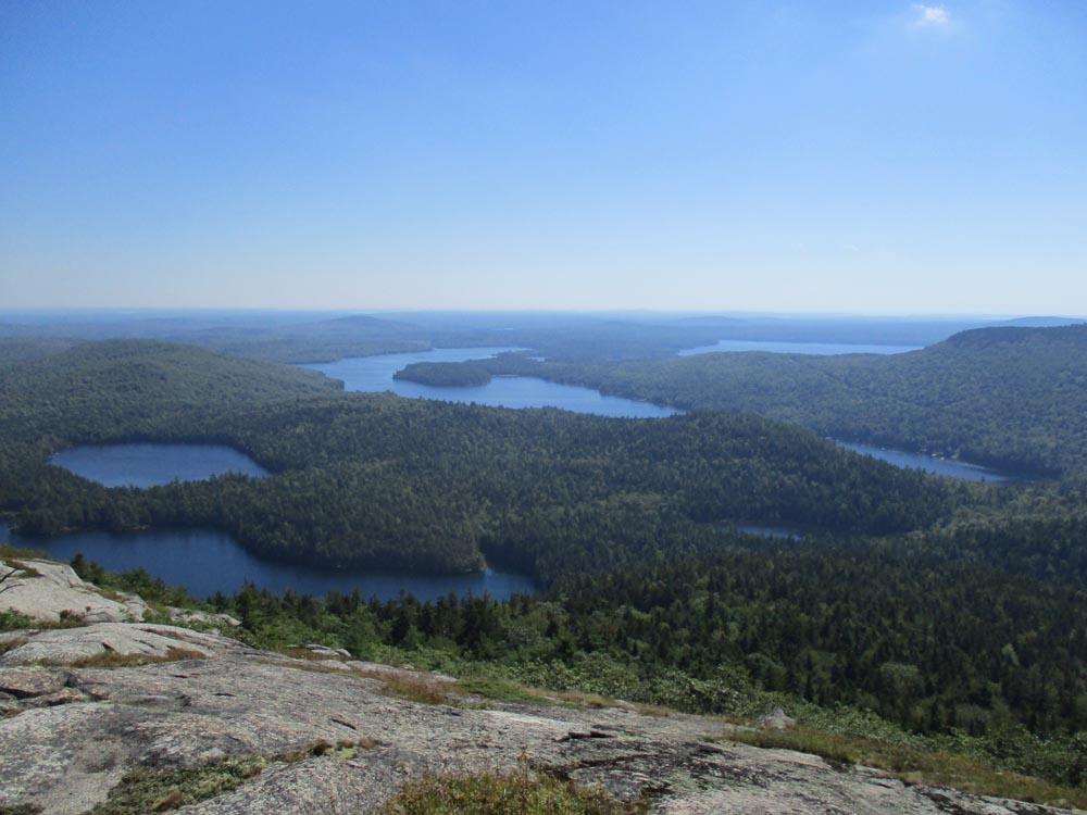
Nice gradual trail at first, passing by the shores of Salmon and Mud ponds. Apparently a 1 mile side trail goes out to another pond or two.
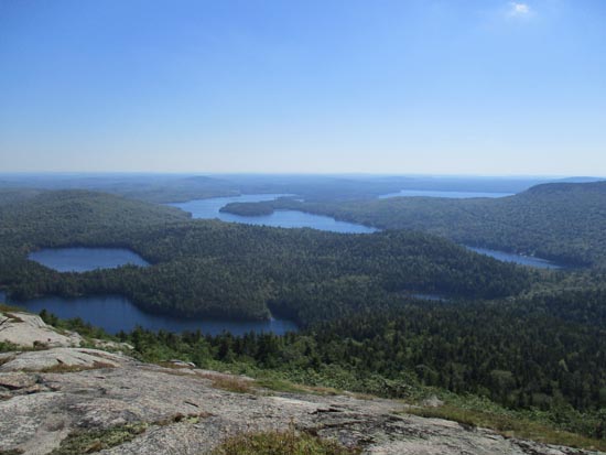
Some steeper ledges higher up that could pose an issue in wet or icy conditions. Perhaps the best views are where the blue trail take a sharp right turn (views open up if you descend slightly to the left; blue trail leads another tenth or so to a northern crag with dramatic views ruined by a wind farm).
The herd path to the summit is occasionally blazed in red (boundary markers perhaps?) and occasionally has flagging tape. Compared to the views just prior to its start, it's a bit anti climatic, but nonetheless has good views south. I suspect a short bushwhack to the south and/or west would result in really good views as well.
Overall, a neat trail and peak. The peaks in this vicinity warrant further exploration (have visited this and Schoodic thus far and both are great).
| Hike Ratings |
|
Getting To Trailhead: |
Easy |
| Destination: |
Tunk Mountain |
|
Length: |
Moderate |
|
Steepness: |
Difficult |
|
Navigation: |
Moderate |
|
Views: |
Excellent |
|
Crowds: |
Minimal |
|
| Hike Stats |
|
Date Hiked: |
Friday, September 18, 2015 |
| Parking Elevation: |
260' |
| Destination: |
Tunk Mountain |
| Time Elapsed: |
00:55 |
| Trailhead Elevation: |
260' |
| Summit Elevation: |
1,157' |
| Vertical Gain: |
1,057' |
|
|
| Hike Time Elapsed: |
01:01 |
| Hike Vertical Gain: |
1,217' |
|
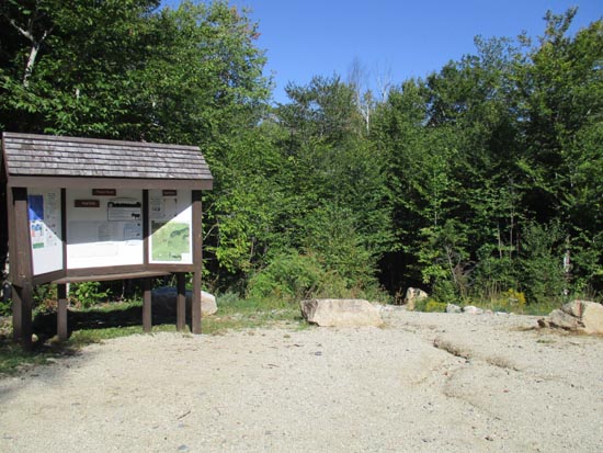
The Tunk Mountain Trail trailhead
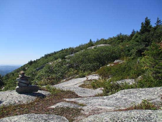
Looking up the Tunk Mountain Trail
Looking southeast at Spring River Lake from near the start of the summit herd path
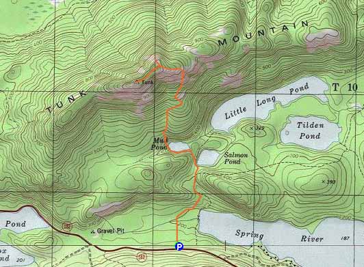

Directions to trailhead: Take Route 182 East from Franklin. The Tunk Mountain Trail parking lot and trailhead will be on the left, shortly after passing Fox Pond.
Back to Tunk Mountain Profile
|