Home
States
Colorado
Connecticut
Maine
Massachusetts
New Hampshire
New York
Rhode Island
Utah
Vermont
View All
Lists
NE 4,000 Footers
NE 100 Highest
NH 4,000 Footers
NH 100 Highest
NH 52 With A View
NH Belknap Range
NH Ossipee 10
Links
Trail Conditions
Trip Log
Sunrises
Sunsets
About
|
Pine Mountain, Tower Mountain, Berry Mountain
Pittsfield, MA, Hancock, MA
Trailheads, measurements, times, distances, and maps are all approximate and relative to the hike(s) as shown below. "Summit" photos may in fact not be at the actual summit - but instead at the best nearby vista.
Hawthorne Trail to Pine Mountain
I checked a handful of weather forecasts prior to this hike and they all concurred that it would be mostly cloudly in the morning, turning to a partly sunny day by lunch time. All three were wrong for this location!
I started out near the CCC Ski Lodge and took the Hawthorne Trail to the Pine Mountain Trail to Pine Mountain. Even without the fog and clouds, I doubt there's too much of a few from here except looking over the Tilden Swamp into New York State.
I continued to Tower Mountain and into the clouds - a great view of mist. I then took the Taconic Crest Trail over to Berry Pond and then navigated my way up the road to Berry Mountain. No view there, just a radio tower. I then decided to call it a day and took the Taconic Skyline trail back, stopping at Tower Mountain once again (with the fog lifting, a view was starting to appear to the south). I finished the hike by going down the Parker Brook Trail (which seemed like the nicest trail I had been on this whole hike) back down to the parking lot.
| Hike Ratings |
|
Getting To Trailhead: |
Easy |
| Destination: |
Pine Mountain |
|
Length: |
Easy |
|
Steepness: |
Moderate |
|
Navigation: |
Easy |
|
Views: |
Moderate |
|
Crowds: |
Minimal |
| Destination: |
Tower Mountain |
|
Length: |
Moderate |
|
Steepness: |
Moderate |
|
Navigation: |
Easy |
|
Views: |
Excellent |
|
Crowds: |
Minimal |
| Destination: |
Berry Mountain |
|
Length: |
Moderate |
|
Steepness: |
Moderate |
|
Navigation: |
Easy |
|
Views: |
Minimal |
|
Crowds: |
Minimal |
|
| Hike Stats |
|
Date Hiked: |
Thursday, November 9, 2006 |
| Hike Commenced: |
10:32 AM |
| Parking Elevation: |
1,180' |
| Destination: |
Pine Mountain |
| Ascent Commenced: |
10:33 AM |
| Summit Reached: |
11:14 AM |
| Trailhead Elevation: |
1,180' |
| Summit Elevation: |
2,220' |
| Vertical Gain: |
1,060' |
| Destination: |
Tower Mountain |
| Ascent Commenced: |
11:14 AM |
| Summit Reached: |
11:40 AM |
| Trailhead Elevation: |
2,220' |
| Summit Elevation: |
2,193' |
| Vertical Gain: |
203' |
| Destination: |
Berry Mountain |
| Ascent Commenced: |
11:40 AM |
| Summit Reached: |
12:12 PM |
| Trailhead Elevation: |
2,193' |
| Summit Elevation: |
2,203' |
| Vertical Gain: |
311' |
| Hike Ended: |
1:50 PM |
| Hike Vertical Gain: |
1,792' |
|
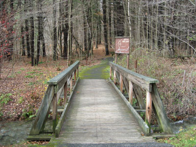
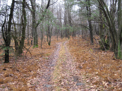
Hawthorne/Tranquility Trails trailhead
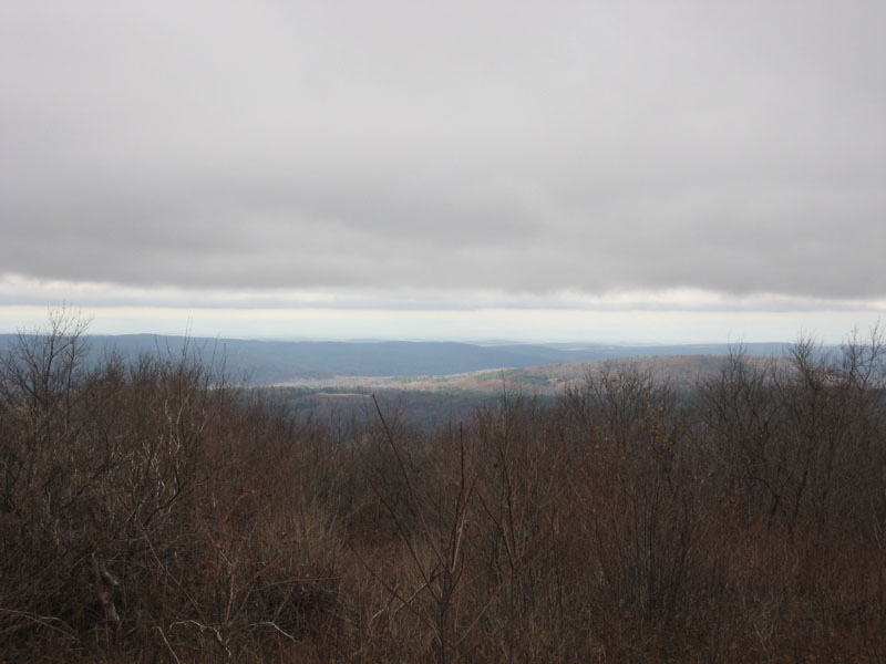
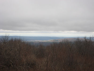
Pine Mountain summit, looking northwest over Tilden Swamp
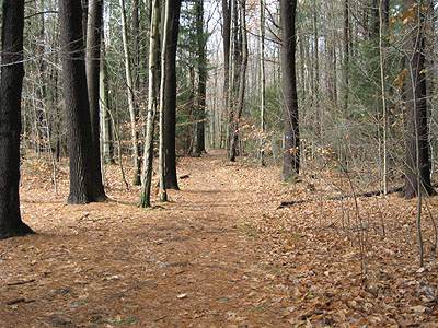
Pine Mountain trail to Tower Mountain
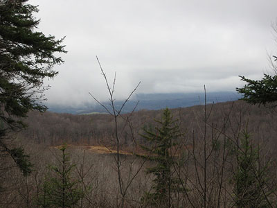
Tower Mountain summit, looking southwest
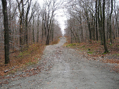
Road to Berry Mountain summit
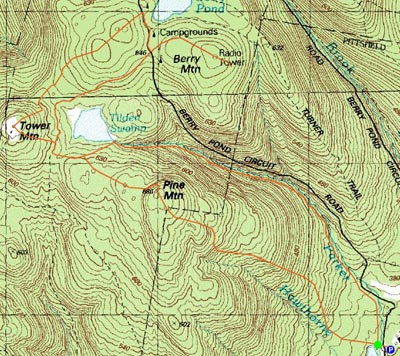

Directions to trailhead: From the Cascade Road entrance of the Pittsfield State Forest, take a left after the check-in station. There is a parking lot shortly after on the right. The trailhead is across the road at the footbridge.
Back to Pine Mountain Profile
Back to Tower Mountain Profile
Back to Berry Mountain Profile
|