Home
States
Colorado
Connecticut
Maine
Massachusetts
New Hampshire
New York
Rhode Island
Utah
Vermont
View All
Lists
NE 4,000 Footers
NE 100 Highest
NH 4,000 Footers
NH 100 Highest
NH 52 With A View
NH Belknap Range
NH Ossipee 10
Links
Trail Conditions
Trip Log
Sunrises
Sunsets
About
|
Blood Hill
Ashby, MA
Trailheads, measurements, times, distances, and maps are all approximate and relative to the hike(s) as shown below.

Looking up the Blood Hill Trail
Route: Blood Hill Trail
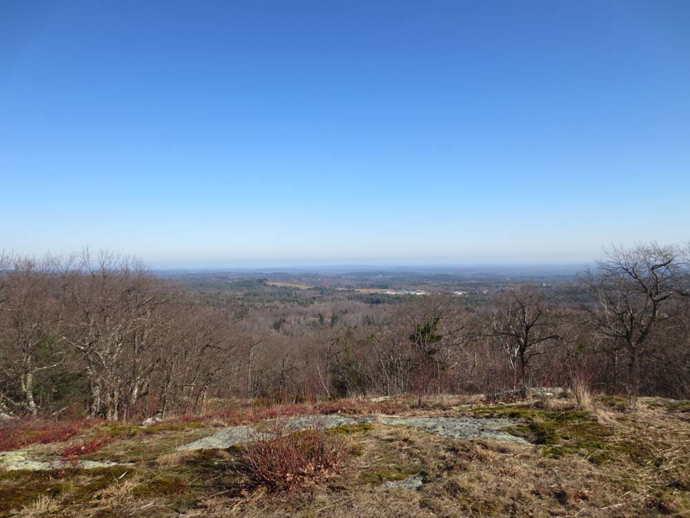
Trail was mostly dry and in good shape. One short area of mud in the middle section. Only one actual climb - the rest was a relatively flat walk. Nice directional views from the summit ledge, generally looking east and northeast.
| Hike Ratings |
|
Getting To Trailhead: |
Easy |
| Destination: |
Blood Hill |
|
Length: |
Moderate |
|
Steepness: |
Moderate |
|
Navigation: |
Easy |
|
Views: |
Excellent |
|
Crowds: |
Minimal |
|
| Hike Stats |
|
Date Hiked: |
Thursday, November 22, 2012 |
| Parking Elevation: |
1,000' |
| Destination: |
Blood Hill |
| Time Elapsed: |
00:17 |
| Trailhead Elevation: |
1,000' |
| Summit Elevation: |
1,515' |
| Vertical Gain: |
515' |
|
|
| Hike Time Elapsed: |
00:38 |
| Hike Vertical Gain: |
515' |
|

The Blood Hill Trail trailhead

Looking northeast from Blood Hill


Directions to trailhead: Take Route 119 northwest from Ashby, then take a left onto Erickson Road. At a second left hand turn in the road, take a right onto Luke Road. The Wiita Conservation Land parking lot will be at the end of the road, with the trail to Blood Hill starting at the fence.
Back to Blood Hill Profile
|