Home
States
Colorado
Connecticut
Maine
Massachusetts
New Hampshire
New York
Rhode Island
Utah
Vermont
View All
Lists
NE 4,000 Footers
NE 100 Highest
NH 4,000 Footers
NH 100 Highest
NH 52 With A View
NH Belknap Range
NH Ossipee 10
Links
Trail Conditions
Trip Log
Sunrises
Sunsets
About
|
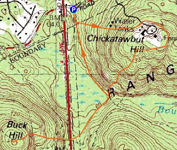
Chickatawbut Hill, Buck Hill
Milton, MA, Quincy, MA
Trailheads, measurements, times, distances, and maps are all approximate and relative to the hike(s) as shown below.
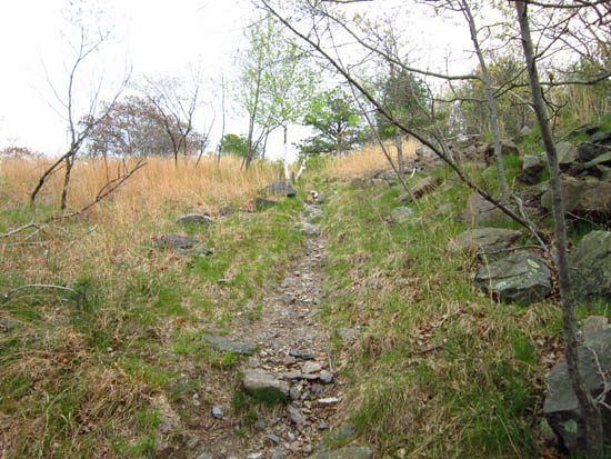
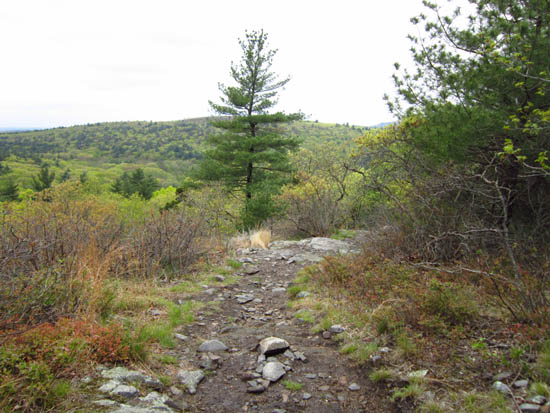
Heading up the trail to Chickatawbut Hill
Route: Braintree Pass Path, unnamed trail, (Chickatawbut Hill non-gated highpoint), Sky Line Trail, (Buck Hill), Sky Line Trail, Braintree Pass Path
Cloudy day, crowds not too bad. All sorts of state no trespassing signs around gates on Chickatawbut Hill, so didn't enter.
| Hike Ratings |
|
Getting To Trailhead: |
Easy |
| Destination: |
Chickatawbut Hill |
|
Length: |
Easy |
|
Steepness: |
Moderate |
|
Navigation: |
Difficult |
|
Views: |
Excellent |
|
Crowds: |
Minimal |
| Destination: |
Buck Hill |
|
Length: |
Moderate |
|
Steepness: |
Difficult |
|
Navigation: |
Easy |
|
Views: |
Excellent |
|
Crowds: |
Moderate |
|
| Hike Stats |
|
Date Hiked: |
Saturday, May 5, 2012 |
| Parking Elevation: |
190' |
| Destination: |
Chickatawbut Hill |
| Time Elapsed: |
00:14 |
| Trailhead Elevation: |
190' |
| Non Gated Highpoint Elevation: |
505' |
| Vertical Gain: |
325' |
| Destination: |
Buck Hill |
| Time Elapsed: |
00:20 |
| Trailhead Elevation: |
505' |
| Summit Elevation: |
496' |
| Vertical Gain: |
316' |
|
|
| Hike Time Elapsed: |
00:56 |
| Hike Vertical Gain: |
691' |
|
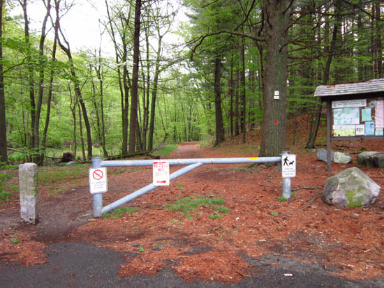
The Braintree Pass Path trailhead off Chickatawbut Road
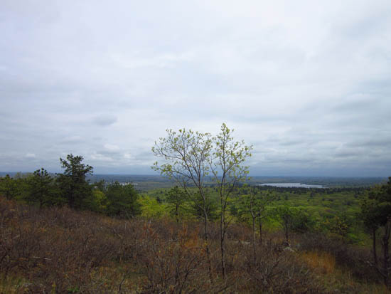
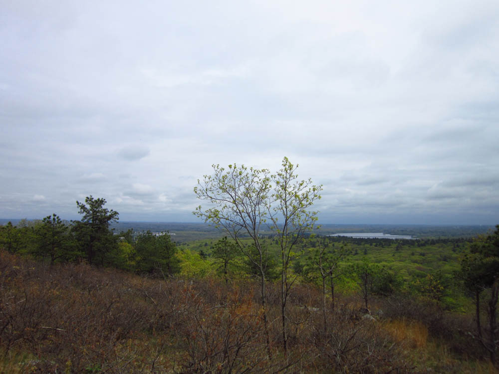
Looking southeast from ledges off Chickatawbut Hill
The Sky Line Trail between the peaks
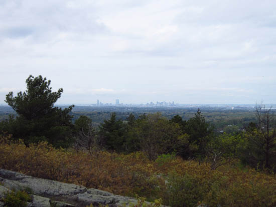
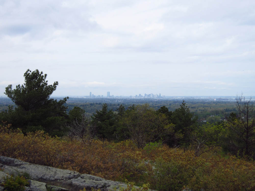
Boston as seen from Buck Hill

Directions to trailhead: From I-93 south of Boston, take Exit 5 to Route 28 North. Take a right at the lights onto Chickatawbut Road. There will be a small parking area immediately on the right, where the Braintree Pass Path starts.
Back to Chickatawbut Hill Profile
Back to Buck Hill Profile
|