Home
States
Colorado
Connecticut
Maine
Massachusetts
New Hampshire
New York
Rhode Island
Utah
Vermont
View All
Lists
NE 4,000 Footers
NE 100 Highest
NH 4,000 Footers
NH 100 Highest
NH 52 With A View
NH Belknap Range
NH Ossipee 10
Links
Trail Conditions
Trip Log
Sunrises
Sunsets
About
|
Goodnow Hill
Buckland, MA
Trailheads, measurements, times, distances, and maps are all approximate and relative to the hike(s) as shown below.
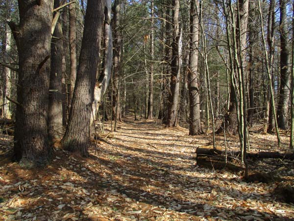
A trail to the Goodnow Hill viewpoint
With permission from a landowner (entrance is posted No Trepassing), I took a trail up from the south to the directional view near the summit (about 4/10 a mile, gentle). No snow to be found. I also followed a herd path north toward the true summit. Looks like there may be a herd path coming up from the west and from the north.
| Hike Ratings |
|
Getting To Trailhead: |
Difficult |
| Destination: |
Goodnow Hill |
|
Length: |
Easy |
|
Steepness: |
Easy |
|
Navigation: |
Difficult |
|
Views: |
Excellent |
|
Crowds: |
Minimal |
|
| Hike Stats |
|
Date Hiked: |
Sunday, April 16, 2017 |
| Parking Elevation: |
1,045' |
| Destination: |
Goodnow Hill |
| Time Elapsed: |
00:14 |
| Trailhead Elevation: |
1,045' |
| Summit Elevation: |
1,233' |
| Vertical Gain: |
218' |
|
|
| Hike Time Elapsed: |
00:24 |
| Hike Vertical Gain: |
248' |
|
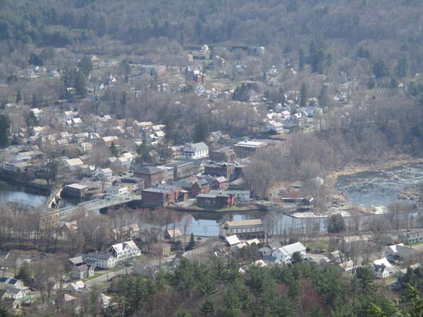
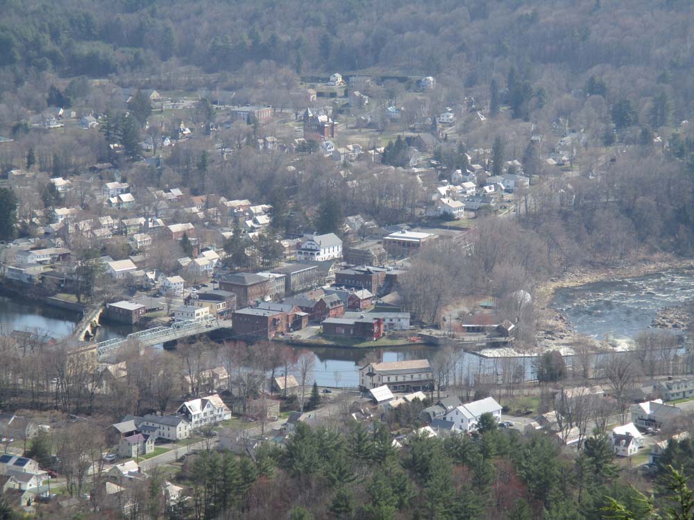
Shelburne Falls as seen from the Goodnow Hill viewpoint
Back to Goodnow Hill Profile
|