Home
States
Colorado
Connecticut
Maine
Massachusetts
New Hampshire
New York
Rhode Island
Utah
Vermont
View All
Lists
NE 4,000 Footers
NE 100 Highest
NH 4,000 Footers
NH 100 Highest
NH 52 With A View
NH Belknap Range
NH Ossipee 10
Links
Trail Conditions
Trip Log
Sunrises
Sunsets
About
|
Holt Hill
Andover, MA
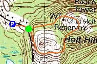
Trailheads, measurements, times, distances, and maps are all approximate and relative to the hike(s) as shown below.
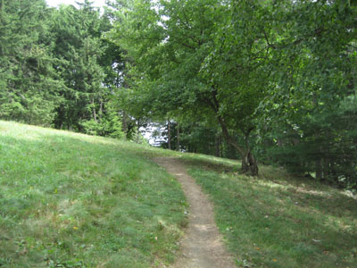
Rachel's Trail to the Holt Hill summit
Route: Rachel's Trail, other unknown trails, Holt Hill, access road
On my way to the Red Sox game, I stopped off at Holt Hill in Andover for a quick hike. Though there was a mostly sunny forecast, there were a lot of clouds. My original intent was to also hike over to Boston Hill, however due to tollbooth traffic, this wasn't in the cards.
The hike was a rather gentle one - looping around a hayfield, then through some woods, and up the hill to the summit.
The summit has a great view of the Boston skyline. There is a tower on top, also, however it's fenced off.
| Hike Ratings |
|
Getting To Trailhead: |
Easy |
| Destination: |
Holt Hill |
|
Length: |
Easy |
|
Steepness: |
Easy |
|
Navigation: |
Easy |
|
Views: |
Excellent |
|
Crowds: |
Moderate |
|
| Hike Stats |
|
Date Hiked: |
Saturday, August 18, 2007 |
| Hike Commenced: |
1:35 PM |
| Parking Elevation: |
285' |
| Destination: |
Holt Hill |
| Ascent Commenced: |
1:37 PM |
| Summit Reached: |
1:46 PM |
| Time Elapsed: |
00:09 |
| Trailhead Elevation: |
300' |
| Summit Elevation: |
420' |
| Vertical Gain: |
145' |
|
|
| Hike Ended: |
1:54 PM |
| Hike Time Elapsed: |
00:19 |
| Hike Vertical Gain: |
165' |
|
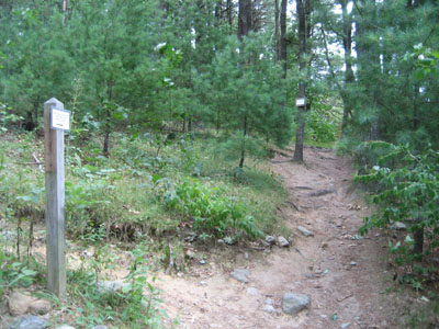
Rachel's Trail trailhead
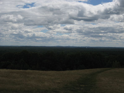
Looking southeast at Boston from Holt Hill

Directions to trailhead: Take 114 to Route 125 South. Prospect Road is shortly down 125 on the left. A small parking lot is located down this road on the right. Trailhead is just a bit further down the road on the left.
Back to Holt Hill Profile
|

