Home
States
Colorado
Connecticut
Maine
Massachusetts
New Hampshire
New York
Rhode Island
Utah
Vermont
View All
Lists
NE 4,000 Footers
NE 100 Highest
NH 4,000 Footers
NH 100 Highest
NH 52 With A View
NH Belknap Range
NH Ossipee 10
Links
Trail Conditions
Trip Log
Sunrises
Sunsets
About
|
Massaemett Mountain
Shelburne, MA
Trailheads, measurements, times, distances, and maps are all approximate and relative to the hike(s) as shown below.
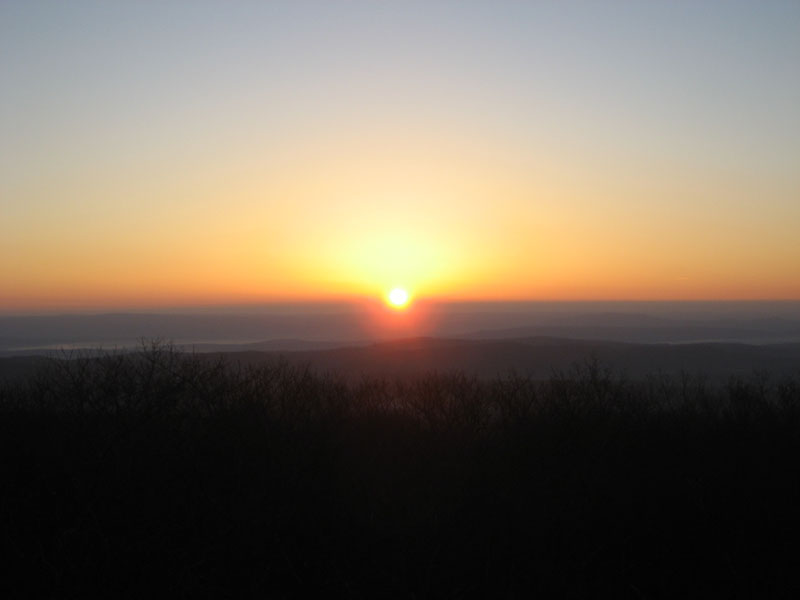
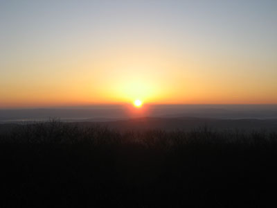
Sunrise on the trail
Having not had the time to hike due to an increased work schedule, I decided to get up early and hike in the dark with the intent of seeing the sunrise. Though not hitting it exactly as intended, I did make it within 5 minutes of the beginning of the rise. On the way up I also came across a deer, who quickly took off upon me clapping it out.
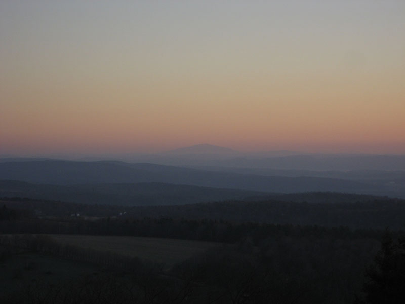
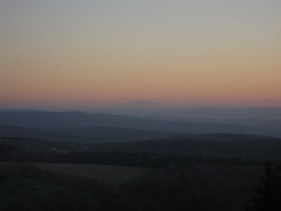
Mt. Monandock was visible, as well as (at one point) either Mt. Snow or Haystack - the sun reflected off a chairlift terminal for a split second - making the location of the mountains known (though their shape was not visible). Mt. Greylock was not yet visible to the west.
| Hike Ratings |
|
Getting To Trailhead: |
Easy |
| Destination: |
Massaemett Mountain |
|
Length: |
Moderate |
|
Steepness: |
Moderate |
|
Navigation: |
Easy |
|
Views: |
Excellent |
|
Crowds: |
Minimal |
|
| Hike Stats |
|
Date Hiked: |
Tuesday, December 12, 2006 |
| Hike Commenced: |
6:31 AM |
| Parking Elevation: |
425' |
| Destination: |
Massaemett Mountain |
| Ascent Commenced: |
6:42 AM |
| Summit Reached: |
7:12 AM |
| Trailhead Elevation: |
560' |
| Summit Elevation: |
1,588' |
| Vertical Gain: |
1,028' |
| Hike Ended: |
7:55 AM |
| Hike Vertical Gain: |
1,163' |
|
Looking northeast at Mt. Monadnock
Sunrise
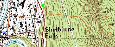

Directions to trailhead: From downtown Shelburne Falls parking, walk north on Main Street (not Bridge Street) then take a right onto Church Street. Bear left at the end of that street onto Highland Ave. Bear left onto a crushed rock road, cross Route 2, trailhead is at yellow gate.
Back to Massaemett Mountain Profile
|