Home
States
Colorado
Connecticut
Maine
Massachusetts
New Hampshire
New York
Rhode Island
Utah
Vermont
View All
Lists
NE 4,000 Footers
NE 100 Highest
NH 4,000 Footers
NH 100 Highest
NH 52 With A View
NH Belknap Range
NH Ossipee 10
Links
Trail Conditions
Trip Log
Sunrises
Sunsets
About
|
Massaemett Mountain
Shelburne, MA
Trailheads, measurements, times, distances, and maps are all approximate and relative to the hike(s) as shown below.
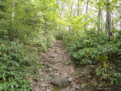
Heading up the trail to the Massaemett Mountain summit
With the mountain staring me down as I passed over Whitcomb Summit on the Mohawk Trail, I decided to hike it on my way through Shelburne.
After walking up the gated water tank access road, I continued up the trail proper as it climbed moderately to the summit through a variety of woods - some softwoods, some hardwoods, and some mountain laurel lined areas.
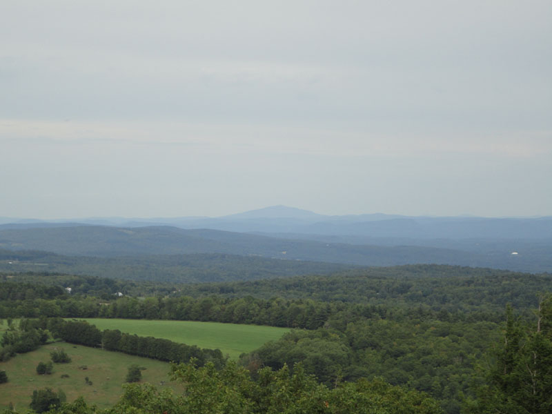
Reaching the viewless summit area (from the ground anyway), I climbed the fieldstone firetower and soon had cloudy, yet excellent views in all directions, ranging from Mt. Greylock to Mt. Tom to Mt. Monadnock to Mt. Snow.
| Hike Ratings |
|
Getting To Trailhead: |
Easy |
| Destination: |
Massaemett Mountain |
|
Length: |
Moderate |
|
Steepness: |
Moderate |
|
Navigation: |
Easy |
|
Views: |
Excellent |
|
Crowds: |
Minimal |
|
| Hike Stats |
|
Date Hiked: |
Saturday, August 21, 2010 |
| Hike Commenced: |
3:30 PM |
| Parking Elevation: |
560' |
| Destination: |
Massaemett Mountain |
| Ascent Commenced: |
3:30 PM |
| Summit Reached: |
4:00 PM |
| Time Elapsed: |
00:30 |
| Trailhead Elevation: |
560' |
| Summit Elevation: |
1,588' |
| Vertical Gain: |
1,028' |
|
|
| Hike Ended: |
4:39 PM |
| Hike Time Elapsed: |
01:09 |
| Hike Vertical Gain: |
1,028' |
|
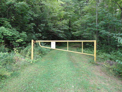
Road to the water tank
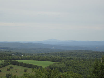
Monadnock as seen from the Massaemett fire tower
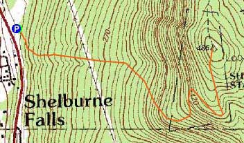

Directions to trailhead: Climbing a hill eastbound on Route 2 after passing the 112 North exit, look for a small paved driveway on the left as the road levels out. The trail starts at the yellow gate.
Back to Massaemett Mountain Profile
|