Home
States
Colorado
Connecticut
Maine
Massachusetts
New Hampshire
New York
Rhode Island
Utah
Vermont
View All
Lists
NE 4,000 Footers
NE 100 Highest
NH 4,000 Footers
NH 100 Highest
NH 52 With A View
NH Belknap Range
NH Ossipee 10
Links
Trail Conditions
Trip Log
Sunrises
Sunsets
About
|
Mt. Institute
Charlemont, MA, and Hawley, MA
Trailheads, measurements, times, distances, and maps are all approximate and relative to the hike(s) as shown below.
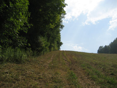
Looking up the Competition ski trail
In the area on a hot hazy day, I decided to do a quick hike up the Competition and Upper Competition trails on Mt. Institute. Due to recent mowing, the trails were easier to hike than most ski trails. Nonetheless, both have long sustained steep pitches - making hiking on a 90 degree day challenging.
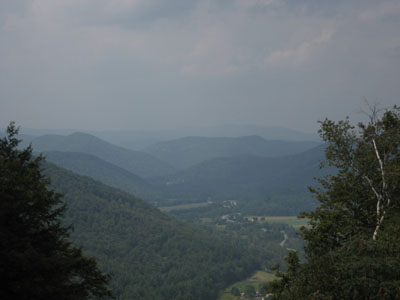
The views from the summit were hazy, but still good.
| Hike Ratings |
|
Getting To Trailhead: |
Easy |
| Destination: |
Mt. Institute |
|
Length: |
Moderate |
|
Steepness: |
Very Difficult |
|
Navigation: |
Easy |
|
Views: |
Excellent |
|
Crowds: |
Minimal |
|
| Hike Stats |
|
Date Hiked: |
Saturday, September 8, 2007 |
| Hike Commenced: |
12:58 PM |
| Parking Elevation: |
580' |
| Destination: |
Mt. Institute |
| Ascent Commenced: |
1:00 PM |
| Summit Reached: |
1:22 PM |
| Time Elapsed: |
00:22 |
| Trailhead Elevation: |
590' |
| Summit Elevation: |
1,538' |
| Vertical Gain: |
953' |
|
|
| Hike Ended: |
1:59 PM |
| Hike Time Elapsed: |
01:01 |
| Hike Vertical Gain: |
978' |
|
At the bottom of the Competition trail
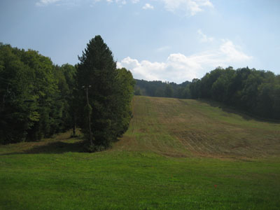
At the top of the UMass ski trail, looking up the Deerfield River Valley.
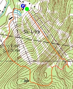

Directions to trailhead: Take South River Road east from Route 8A, then take a right onto Thunder Mountain Road. Park in the large parking lot.
Back to Mt. Institute Profile
|

