Home
States
Colorado
Connecticut
Maine
Massachusetts
New Hampshire
New York
Rhode Island
Utah
Vermont
View All
Lists
NE 4,000 Footers
NE 100 Highest
NH 4,000 Footers
NH 100 Highest
NH 52 With A View
NH Belknap Range
NH Ossipee 10
Links
Trail Conditions
Trip Log
Sunrises
Sunsets
About
|
Mt. Institute
Charlemont, MA, Hawley, MA
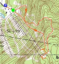
Trailheads, measurements, times, distances, and maps are all approximate and relative to the hike(s) as shown below.
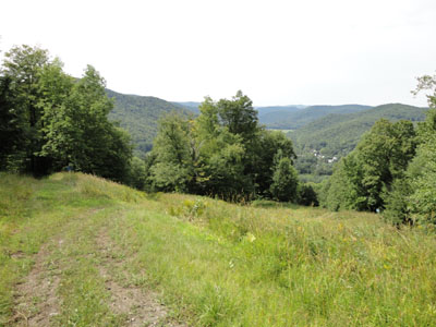
Looking down the Mohawk ski trail
Heading east on the Mohawk Trail, I stopped off at the Berkshire East ski area to check out the summer operations and recent ski area improvements.
After checking out the recently installed Mountain Top Triple Chair, I headed up the "easy" Mohawk ski trail. A steep climb with a few gradual spots, a single-wide mowed area made for decent hiking. A bit uphill from an area known as "Turkey Junction," I was surprised to see some major trail improvements had taken place, blasting a narrow ledgy area for better snow retention and skiing.
Arriving at the top of the triple chairlifts, I continued past the ski patrol shack to the highpoint, then checked out the top of the newer chairlift (as well as one of the top zip line platforms in use). After that, I headed down to where the former "Black Chair" ended - pretty much gone without a trace.
For the descent, I took the steep Big Chief trail down, noting the chute to the top of the trail had improved.
| Hike Ratings |
|
Getting To Trailhead: |
Easy |
| Destination: |
Mt. Institute |
|
Length: |
Moderate |
|
Steepness: |
Difficult |
|
Navigation: |
Easy |
|
Views: |
Excellent |
|
Crowds: |
Moderate |
|
| Hike Stats |
|
Date Hiked: |
Saturday, August 21, 2010 |
| Hike Commenced: |
2:21 PM |
| Parking Elevation: |
580' |
| Destination: |
Mt. Institute |
| Ascent Commenced: |
2:24 PM |
| Summit Reached: |
2:48 PM |
| Time Elapsed: |
00:24 |
| Trailhead Elevation: |
590' |
| Summit Elevation: |
1,538' |
| Vertical Gain: |
948' |
|
|
| Hike Ended: |
3:12 PM |
| Hike Time Elapsed: |
00:51 |
| Hike Vertical Gain: |
965' |
|
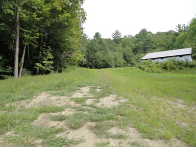
The bottom of the Mohawk ski trail
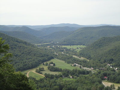
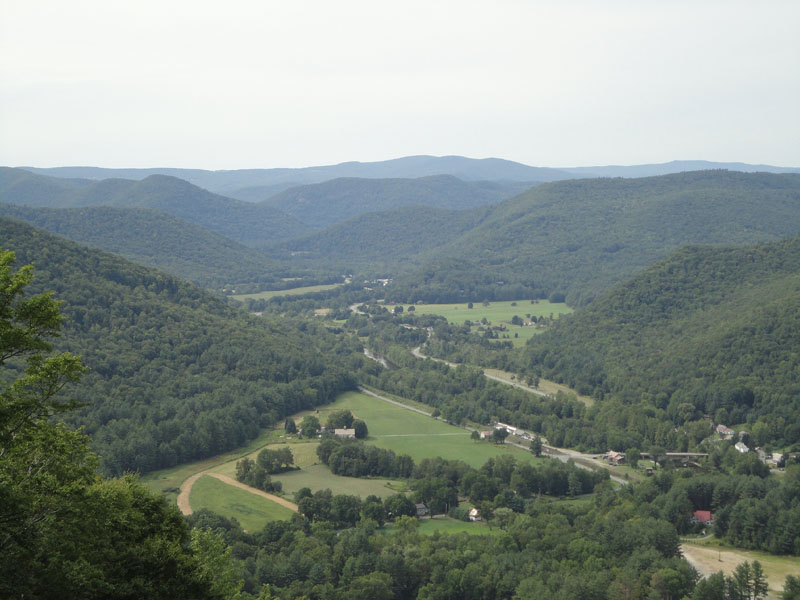
Looking up the Deerfield River valley from near the summit of Mt. Institute

Directions to trailhead: South River Road east from Route 8A, then take a right onto Thunder Mountain Road. Park in the large parking lot.
Back to Mt. Institute Profile
|