Home
States
Colorado
Connecticut
Maine
Massachusetts
New Hampshire
New York
Rhode Island
Utah
Vermont
View All
Lists
NE 4,000 Footers
NE 100 Highest
NH 4,000 Footers
NH 100 Highest
NH 52 With A View
NH Belknap Range
NH Ossipee 10
Links
Trail Conditions
Trip Log
Sunrises
Sunsets
About
|
Osgood Hill
North Andover, MA
Trailheads, measurements, times, distances, and maps are all approximate and relative to the hike(s) as shown below.
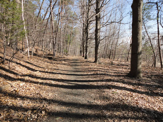
The old road at the Stevens Estate
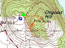
Route: Unknown trail, bushwhack, (Osgood Hill), unknown trail, bushwhack, unknown trail
For the second brief jog of the day, I headed just up the road from Weir Hill to the Stevens Estate. Starting on an old road, I jogged along some maple trees and soon found myself at a paved road. Backtracking to a faint old trail I saw uphill, I headed up a small rock stairway, but was unable to find a distinct footbed. Instead, I bushwhacked over a subpeak and then up to the summit of Osgood Hill, where I picked up an unmarked trail. Following that a bit south, I was soon at the top of an open field with excellent views of Lake Cochichewick.
Backtracking to the summit, I didn't see an obvious extension of the faint trail (which petered out near an air beacon). With not much time to look around, I instead bushwhacked back to the flat trail, then back to the parking lot.
| Hike Ratings |
|
Getting To Trailhead: |
Easy |
| Destination: |
Osgood Hill |
|
Length: |
Easy |
|
Steepness: |
Moderate |
|
Navigation: |
Difficult |
|
Views: |
Excellent |
|
Crowds: |
Minimal |
|
| Hike Stats |
|
Date Hiked: |
Wednesday, March 30, 2011 |
| Hike Commenced: |
4:03 PM |
| Parking Elevation: |
240' |
| Destination: |
Osgood Hill |
| Ascent Commenced: |
4:04 PM |
| Summit Reached: |
4:12 PM |
| Time Elapsed: |
00:08 |
| Trailhead Elevation: |
245' |
| Summit Elevation: |
343' |
| Vertical Gain: |
143' |
|
|
| Hike Ended: |
4:20 PM |
| Hike Time Elapsed: |
00:17 |
| Hike Vertical Gain: |
148' |
|
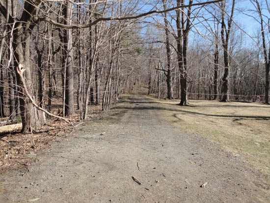
The start of old road at the Stevens Estate
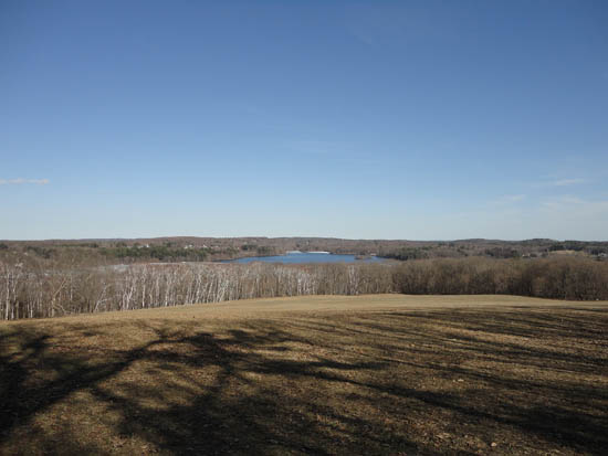
Looking southeast at Lake Cochichewick from the field near the summit of Osgood Hill

Directions to trailhead: From Exit 43-44 of I-495, take Sutton Street east, then take a right onto 125-133 south. Shortly thereafter, take a left onto Osgood Road. The Stevens Estate entrance will be on the left shortly thereafter, with parking near the buildings. A trail departs from the rear building.
Back to Osgood Hill Profile
|

