Home
States
Colorado
Connecticut
Maine
Massachusetts
New Hampshire
New York
Rhode Island
Utah
Vermont
View All
Lists
NE 4,000 Footers
NE 100 Highest
NH 4,000 Footers
NH 100 Highest
NH 52 With A View
NH Belknap Range
NH Ossipee 10
Links
Trail Conditions
Trip Log
Sunrises
Sunsets
About
|
Acorn Hill
Lyme, NH
Trailheads, measurements, times, distances, and maps are all approximate and relative to the hike(s) as shown below.
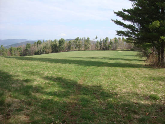
Looking down the path to Acorn Hill
Route: Cutting Hill Lane, unknown trail
For the first hike of the day, I headed over to Acorn Hill. The first part of the hike was on a woods road. Reaching a gate on the right, I followed a footpath into some fields, where there were excellent views. Eventually reaching the summit, there were also excellent views in multiple directions.
An easy but rewarding hike.
| Hike Ratings |
|
Getting To Trailhead: |
Easy |
| Destination: |
Acorn Hill |
|
Length: |
Easy |
|
Steepness: |
Easy |
|
Navigation: |
Moderate |
|
Views: |
Excellent |
|
Crowds: |
Minimal |
|
| Hike Stats |
|
Date Hiked: |
Sunday, May 8, 2011 |
| Parking Elevation: |
1,000' |
| Destination: |
Acorn Hill |
| Time Elapsed: |
00:21 |
| Trailhead Elevation: |
1,000' |
| Summit Elevation: |
1,377' |
| Vertical Gain: |
377' |
|
|
| Hike Time Elapsed: |
00:38 |
| Hike Vertical Gain: |
377' |
|
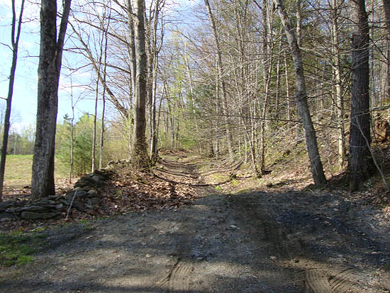
The beginning of the woods road portion of Cutting Hill Lane
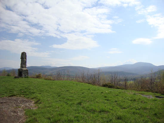
Looking at Smarts Mountain from Acorn Hill


Directions to trailhead: From Route 10 north of Lyme, take Pinnacle Road. Take a right onto Cutting Hill Lane. There is room to park at the turnaround at the top of the drivable portion of the road.
Back to Acorn Hill Profile
|

