Home
States
Colorado
Connecticut
Maine
Massachusetts
New Hampshire
New York
Rhode Island
Utah
Vermont
View All
Lists
NE 4,000 Footers
NE 100 Highest
NH 4,000 Footers
NH 100 Highest
NH 52 With A View
NH Belknap Range
NH Ossipee 10
Links
Trail Conditions
Trip Log
Sunrises
Sunsets
About
|
Bald Knob, Mt. Crosby
Groton, NH
Trailheads, measurements, times, distances, and maps are all approximate and relative to the hike(s) as shown below.
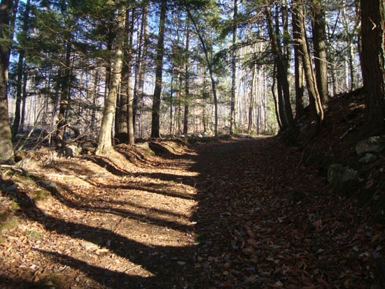
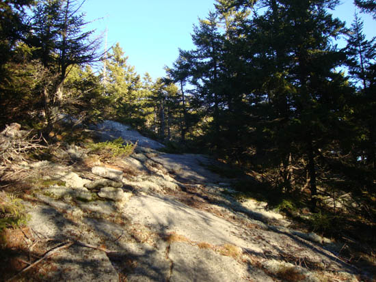
Looking up the Bald Knob Trail
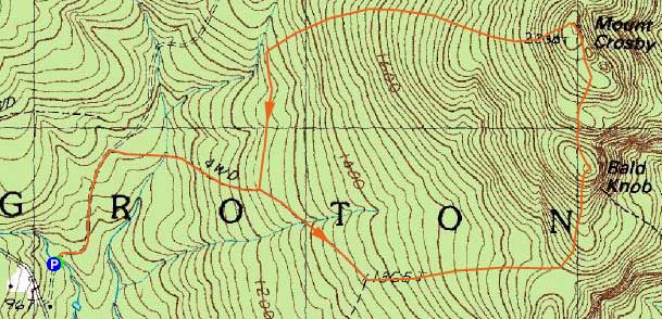
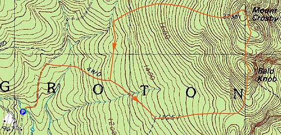
Route: John F. Woodhouse Trail, Bald Knob Trail, (Bald Knob), unknown trail, (Mt. Crosby), unknown trail, logging road, Bald Knob Trail, John F. Woodhouse Trail
With limited time but nice weather, I decided to check out Mt. Crosby and Bald Knob. Starting at the John F. Woodhouse Trail at Cockermouth Forest, the hike started out as a logging road jog. A few minutes later, I saw an older (not recently used by vehicles) logging road departing to the right, marked with yellow blazes. After descending shortly and crossing a brook on a footbridge, the logging road/Bald Knob Trail started to climb and a steady, but not overly steep pace, passing an unsigned junction marked with yellow arrow blazes. Continuing uphill with plenty of recent logging all around, the trail/road eventually took a left and continued to climb. Not too long thereafter, the trail headed into the woods on an older logging road. Reaching the col, I switched from jogging and followed the trail as it turned left and started to climb, a bit more steeply in short spurts, up to the ledgy summit of Bald Knob.
Since time wasn't on my side, I didn't explore the summit too long. Nonetheless, there were multiple vistas that provided views in almost every direction.
Following some cairns, I continued into the col, past an old trail junction sign (trail coming from the east), then up to Mt. Crosby proper - now marked with old camp trail signs.
After a few steeper ledgy climbs as well as some flats, I eventually reached the ledgy summit of Mt. Crosby, from where there were excellent views to the north, east, and south.
After poking around briefly, I saw yellow blazes heading downhill. Thusly, I followed them and was soon descending steeply. Not too long thereafter, I reached the logged area again and continued to carefully follow the yellow blazes, until they suddenly ended. From here, I followed some of the logging roads downhill until hitting an older logging road that paralleled the brook. Taking a left onto this, I eventually found myself at the yellow blazed junction I had seen earlier in the hike. From there, I jogged my way back to the trailhead.
While the logging has taken away from the lower portions of the hike (as well as the loop aspect of it), the summits are quite nice. My guess is that I'll hike this as an out and back in the future.
| Hike Ratings |
|
Getting To Trailhead: |
Easy |
| Destination: |
Bald Knob |
|
Length: |
Moderate |
|
Steepness: |
Difficult |
|
Navigation: |
Moderate |
|
Views: |
Excellent |
|
Crowds: |
Minimal |
| Destination: |
Mt. Crosby |
|
Length: |
Moderate |
|
Steepness: |
Difficult |
|
Navigation: |
Moderate |
|
Views: |
Excellent |
|
Crowds: |
Minimal |
|
| Hike Stats |
|
Date Hiked: |
Wednesday, November 24, 2010 |
| Hike Commenced: |
2:20 PM |
| Parking Elevation: |
970' |
| Destination: |
Bald Knob |
| Ascent Commenced: |
2:20 PM |
| Summit Reached: |
2:56 PM |
| Time Elapsed: |
00:26 |
| Trailhead Elevation: |
970' |
| Summit Elevation: |
2,050' |
| Vertical Gain: |
1,130' |
| Destination: |
Mt. Crosby |
| Ascent Commenced: |
2:59 PM |
| Summit Reached: |
3:13 PM |
| Time Elapsed: |
00:14 |
| Trailhead Elevation: |
2,050' |
| Summit Elevation: |
2,230' |
| Vertical Gain: |
280' |
|
|
| Hike Ended: |
3:54 PM |
| Hike Time Elapsed: |
01:34 |
| Hike Vertical Gain: |
1,490' |
|
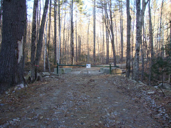
The John F. Woodhouse Trail trailhead off North Groton Road

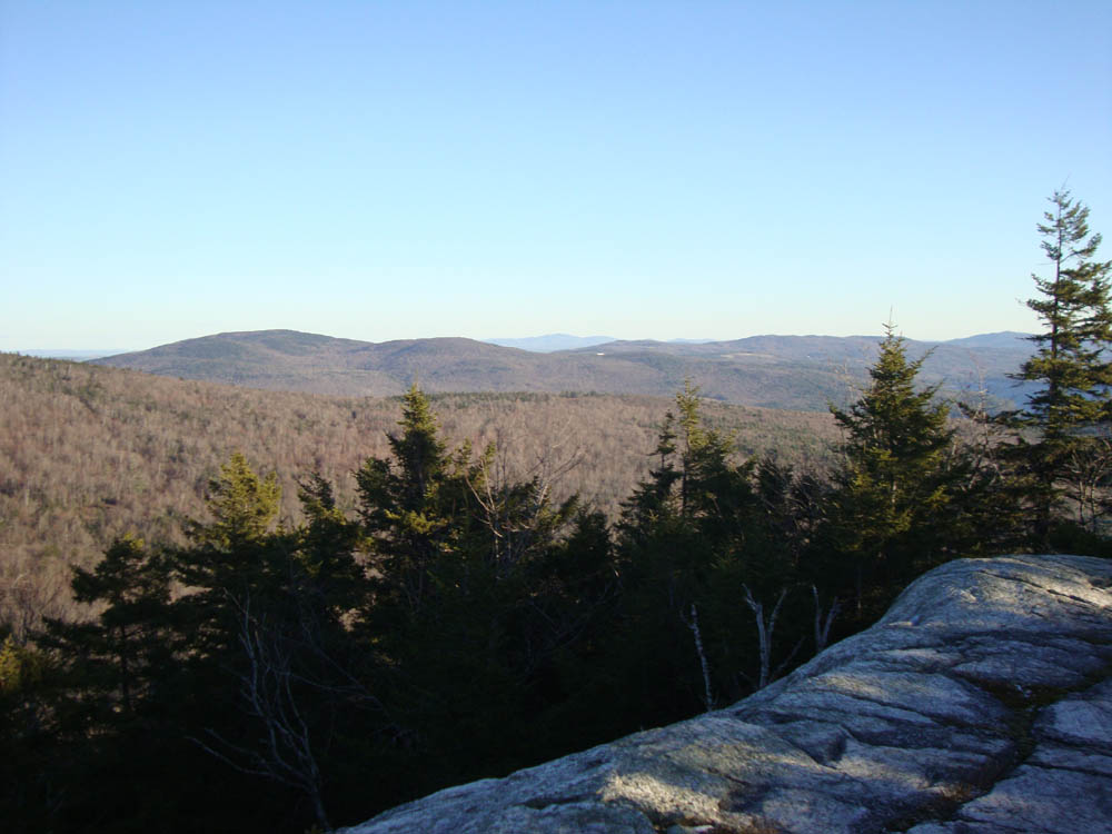
Looking at Plymouth Mountain and the Belknaps from Bald Knob
The spur trail from Bald Knob to Mt. Crosby
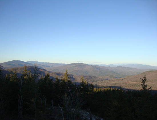
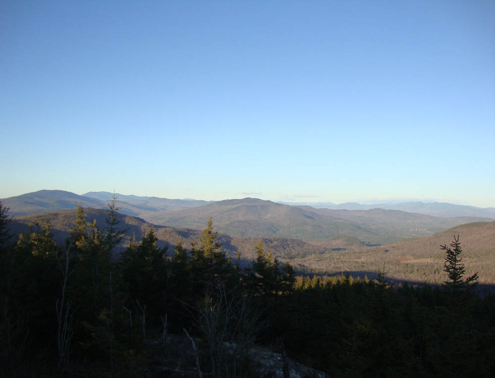
Stinson Mountain and points north as seen from Mt. Crosby

Directions to trailhead: Take Route 3A south from Plymouth. Just prior to reaching Newfound Lake, taken a right onto North Shore Road. Continue straight through Hebron onto Groton Road. Once in Groton, bear right onto North Groton Road. The Cockermouth Forest - John F. Woodhouse Trail sign will eventually be on the right. Follow that dirt road to the gate - there is minimal room for parking adjacent to the gate. The John F. Woodhouse Trail is the logging road behind the gate.
Back to Bald Knob Profile
Back to Mt. Crosby Profile
|