Home
States
Colorado
Connecticut
Maine
Massachusetts
New Hampshire
New York
Rhode Island
Utah
Vermont
View All
Lists
NE 4,000 Footers
NE 100 Highest
NH 4,000 Footers
NH 100 Highest
NH 52 With A View
NH Belknap Range
NH Ossipee 10
Links
Trail Conditions
Trip Log
Sunrises
Sunsets
About
|
Bald Mountain
Campton, NH
Trailheads, measurements, times, distances, and maps are all approximate and relative to the hike(s) as shown below.
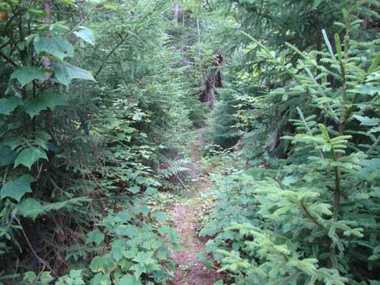
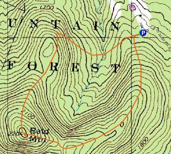
The eastern loop trail to Bald Mountain
Route: Forest Road 438, unknown trail, (Bald Mountain), unknown trail, Forest Road 438
From the gate on Forest Road 438, I followed the grassy road briefly, then took a diagonal left uphill onto a narrower trail (soon passing a no snowmobiles sign).
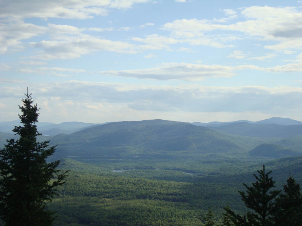
The trail was generally gradual as it climbed up a ridge, dropped off a subpeak, then ascended the summit. While the summit has a decent sized ledge, the slab does not feature any views. Just downhill from it, though, a herd path leads perhaps 100 feet to a ledge with directional view to the south.
Back on the summit ledge, I continued clockwise down the other side of the loop trail - the west side was a bit more open and crossed a few logging roads and pastures, as well as some old cellar holes.
| Hike Ratings |
|
Getting To Trailhead: |
Easy |
| Destination: |
Bald Mountain |
|
Length: |
Moderate |
|
Steepness: |
Moderate |
|
Navigation: |
Moderate |
|
Views: |
Excellent |
|
Crowds: |
Minimal |
|
| Hike Stats |
|
Date Hiked: |
Tuesday, August 2, 2011 |
| Parking Elevation: |
1,670' |
| Destination: |
Bald Mountain |
| Time Elapsed: |
00:26 |
| Trailhead Elevation: |
1,670' |
| Summit Elevation: |
2,204' |
| Vertical Gain: |
594' |
|
|
| Hike Time Elapsed: |
00:54 |
| Hike Vertical Gain: |
674' |
|
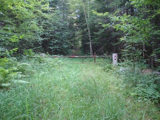
The Forest Road 438 gate at the end of Cook Hill Road
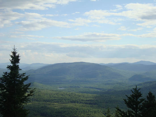
Looking southwest at Tenney Mountain from near the summit of Bald Mountain

Directions to trailhead: Take I-93 to Exit 28, then take Route 49 West. Take a left onto US 3 South. Almost immediately thereafter, take a right onto Old Daniel Webster Highway. Shortly thereafter, bear right onto Ellsworth Hill Road. Eventually, with a northern view on the right, take a left onto Mason Road. Eventually reaching a three way junction with Chandler Hill Road, take a right onto Cook Hill Road. Forest Road 438 starts at the end of this road. There is minimal room for parking adjacent to the gate.
Back to Bald Mountain Profile
|