Home
States
Colorado
Connecticut
Maine
Massachusetts
New Hampshire
New York
Rhode Island
Utah
Vermont
View All
Lists
NE 4,000 Footers
NE 100 Highest
NH 4,000 Footers
NH 100 Highest
NH 52 With A View
NH Belknap Range
NH Ossipee 10
Links
Trail Conditions
Trip Log
Sunrises
Sunsets
About
|
Bald Peak, Kinsman Mountain (North Peak), Kinsman Mountain (South Peak)
Easton, NH, Lincoln, NH
Trailheads, measurements, times, distances, and maps are all approximate and relative to the hike(s) as shown below.
Looking up the spur path to Bald Peak
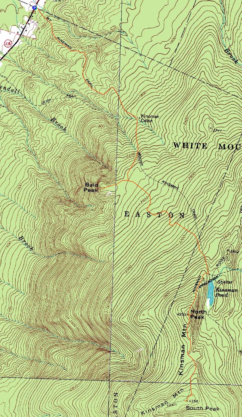
Route: Mt. Kinsman Trail, spur path, (Bald Peak), spur path, Mt. Kinsman Trail, Kinsman Ridge Trail, (Kinsman Mountain North Peak), Kinsman Ridge Trail, (Kinsman Mountain South Peak), Kinsman Ridge Trail, (Kinsman Mountain North Peak), Kinsman Ridge Trail, Mt. Kinsman Trail
The plan was to hike the Kinsmans from the west side. Unfortunately, I didn't do much research on how to find the trailhead - I knew there was no parking area, but that was about it. I ended up driving by it twice, thinking it would be more obvious (when I first saw it, I had a feeling it was it, but kept going).
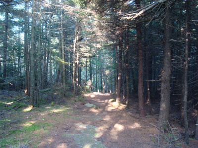
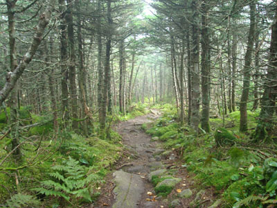
The trail was basically a logging road up to the Bald Peak spur path junction - good footing, easy to moderate grades, etc. While there were a few unmarked trails and logging roads that crossed the trail, there were occasional arrow signs and blazes to help with navigation.
The Bald Peak trek proved to be worth the .4 mile trip - there were excellent views in all directions from the mostly open summit.
Back on the trail, it soon picked up in steepness as it ascended, though never becoming as steep as the section of the Kinsman Ridge Trail leading to the summit of the north peak.
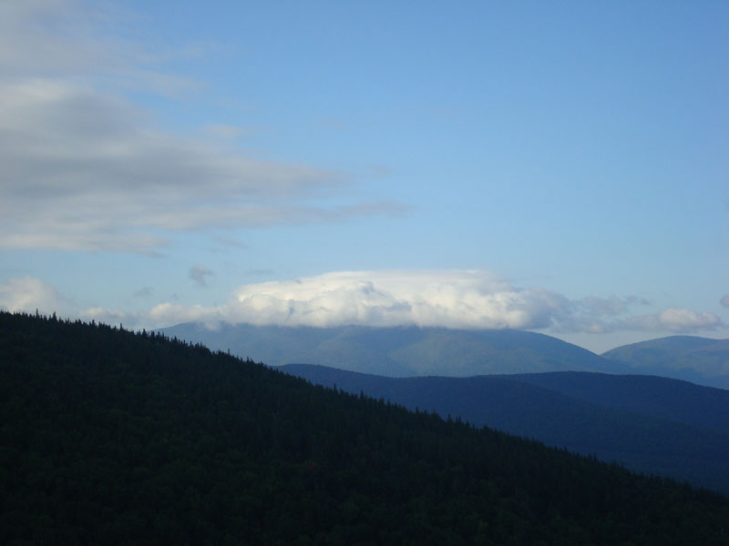
Since the summit was in a cloud, I kept going to the south peak. Like the Mt. Kinsman Trail, this section was fairly dry.
The summit of the south peak was also in a cloud when I reached it. Since it's higher and seemed to be in thicker fog, I decided to go back to the north peak to wait it out. Just as I neared the summit of the north peak, the fog lifted, giving great views from the ledges. The fog lifted from the south peak a short time later (but I had no intention of returning).
Soon after the fog lifted, the sky seemed to fill up with gliders and planes, taking advantage of the somewhat high winds.
After a good half hour or so of taking in the views from an increasingly crowded summit, I decided to call it a day and head back. I was amazed to see a bunch of cars lining Route 116 at the trailhead upon my return - mine was the third to arrive once I had found the trailhead in the morning.
| Hike Ratings |
|
Getting To Trailhead: |
Moderate |
| Destination: |
Bald Peak |
|
Length: |
Moderate |
|
Steepness: |
Moderate |
|
Navigation: |
Easy |
|
Views: |
Excellent |
|
Crowds: |
Minimal |
| Destination: |
Kinsman Mountain (North Peak) |
|
Length: |
Moderate |
|
Steepness: |
Difficult |
|
Navigation: |
Easy |
|
Views: |
Excellent |
|
Crowds: |
Minimal |
| Destination: |
Kinsman Mountain (South Peak) |
|
Length: |
Moderate |
|
Steepness: |
Difficult |
|
Navigation: |
Easy |
|
Views: |
Minimal (due to weather) |
|
Crowds: |
Minimal |
|
| Hike Stats |
|
Date Hiked: |
Sunday, August 31, 2008 |
| Hike Commenced: |
7:38 AM |
| Parking Elevation: |
1,030' |
| Destination: |
Bald Peak |
| Ascent Commenced: |
7:38 AM |
| Summit Reached: |
8:31 AM |
| Time Elapsed: |
00:53 |
| Trailhead Elevation: |
1,030' |
| Summit Elevation: |
2,470' |
| Distance: |
2.3 miles |
| Vertical Gain: |
1,495' |
| Destination: |
Kinsman Mountain (North Peak) |
| Ascent Commenced: |
8:33 AM |
| Summit Reached: |
9:40 AM |
| Time Elapsed: |
01:07 |
| Trailhead Elevation: |
2,470' |
| Summit Elevation: |
4,293'' |
| Distance: |
2.2 miles |
| Vertical Gain: |
1,873' |
| Destination: |
Kinsman Mountain (South Peak) |
| Ascent Commenced: |
9:40 AM |
| Summit Reached: |
10:10 AM |
| Time Elapsed: |
00:30 |
| Trailhead Elevation: |
4,293' |
| Summit Elevation: |
4,358' |
| Distance: |
.9 mile |
| Vertical Gain: |
373' |
|
|
| Hike Ended: |
1:36 PM |
| Hike Time Elapsed: |
05:58 |
| Hike Distance: |
10.4 miles |
| Hike Vertical Gain: |
4,099' |
|
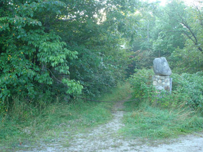
The Mt. Kinsman Trail trailhead on Route 116
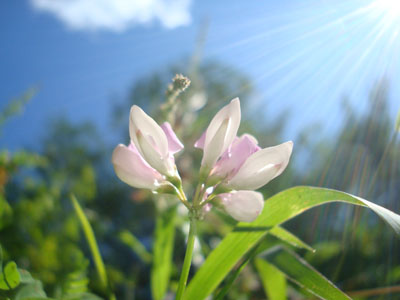
A wildflower near the bottom of the Mt. Kinsman Trail
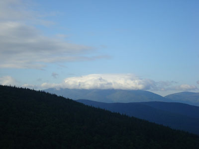
Looking southwest at Mt. Moosilauke from the summit of Bald Peak
Looking up the Mt. Kinsman Trail on the way to the north peak of Mt. Kinsman
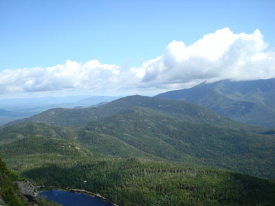
Looking northeast at Cannon Mountain from the ledge near the summit of Kinsman Mountain's North Peak
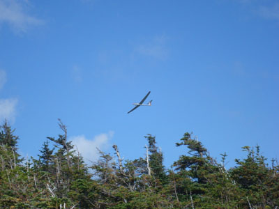
A glider flying over North Kinsman
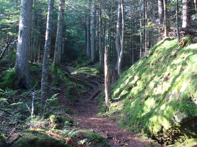
The Kinsman Ridge Trail near South Kinsman
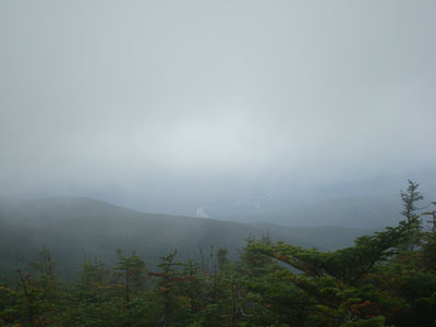
Looking through the fog at I-93 from near the summit of Kinsman Mountain's South Peak
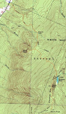

Directions to trailhead: Take Route 112 West from Lincoln to Route 116 North. The old Mt. Kinsman Trail trailhead is on the right, between two rock pillars, literally just before the Easton-Franconia border sign. Parking is only available on the side of Route 116. NOTE - As of spring 2009, the new trailhead and parking area are located just south of Tamarack Camp.
Back to Bald Peak Profile
Back to Kinsman Mountain (North Peak) Profile
Back to Kinsman Mountain (South Peak) Profile
|