Home
States
Colorado
Connecticut
Maine
Massachusetts
New Hampshire
New York
Rhode Island
Utah
Vermont
View All
Lists
NE 4,000 Footers
NE 100 Highest
NH 4,000 Footers
NH 100 Highest
NH 52 With A View
NH Belknap Range
NH Ossipee 10
Links
Trail Conditions
Trip Log
Sunrises
Sunsets
About
|
Bald Peak
Easton, NH
Trailheads, measurements, times, distances, and maps are all approximate and relative to the hike(s) as shown below.
The Mt. Kinsman Trail
Route: Mt. Kinsman Trail, Bald Knob Spur
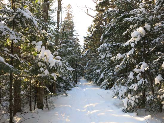
Half an inch to an inch of powder on top of a well packed snowshoe base. Very little snow along the first portion (ie the re-route) of the trail - maybe 2-4 inches. A little boney. Depths increased to about half a foot when rejoining the original trail (ie near the sugar house). Some low angle blue ice in the vicinity of the second water crossing.
If only going to Bald Peak, light traction would probably suffice for now. I wore snowshoes roundtrip and was happy with that choice, aside from a few boney areas near the trailhead.
| Hike Ratings |
|
Getting To Trailhead: |
Easy |
| Destination: |
Bald Peak |
|
Length: |
Moderate |
|
Steepness: |
Moderate |
|
Navigation: |
Easy |
|
Views: |
Excellent |
|
Crowds: |
Minimal |
|
| Hike Stats |
|
Date Hiked: |
Tuesday, February 11, 2014 |
| Parking Elevation: |
1,060' |
| Destination: |
Bald Peak |
| Time Elapsed: |
01:04 |
| Trailhead Elevation: |
1,060' |
| Summit Elevation: |
2,470' |
| Distance: |
2.3 miles |
| Vertical Gain: |
1,495' |
|
|
| Hike Time Elapsed: |
02:22 |
| Hike Distance: |
4.6 miles |
| Hike Vertical Gain: |
1,580' |
|
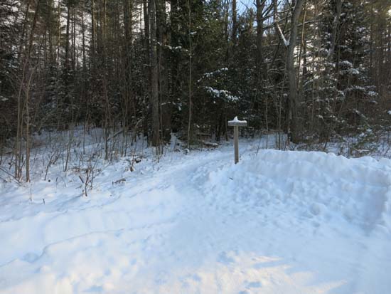
The Mt. Kinsman Trail trailhead

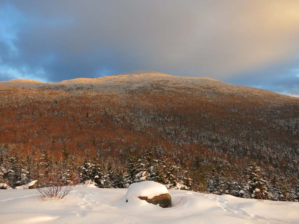
North Kinsman as seen from Bald Peak
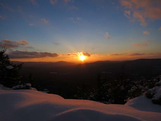
The sunset as seen from Bald Peak
Directions to trailhead: Take Route 112 West from Lincoln to Route 116 North. The short road to the Mt. Kinsman Trail trailhead and parking area will eventually be on the right, just before Tamarack Camp. In winter 2013-14, the parking lot was plowed.
Back to Bald Peak Profile
|