Home
States
Colorado
Connecticut
Maine
Massachusetts
New Hampshire
New York
Rhode Island
Utah
Vermont
View All
Lists
NE 4,000 Footers
NE 100 Highest
NH 4,000 Footers
NH 100 Highest
NH 52 With A View
NH Belknap Range
NH Ossipee 10
Links
Trail Conditions
Trip Log
Sunrises
Sunsets
About
|
Bayle Mountain
Ossipee, NH
Trailheads, measurements, times, distances, and maps are all approximate and relative to the hike(s) as shown below.
Looking up the trail to Bayle Mountain
Route: Unknown snowmobile trail, red blazed trail, (Bayle Mountain), red blazed trail, unknown snowmobile trail
With a short window of good weather, I decided to take a long lunch and head over to Bayle Mountain.
I at first found the access road hard to find - I ended up driving by it. Upon finding it, I followed it to the orange gate, parked, and took off in hopes of ditching the black flies and mosquitoes.
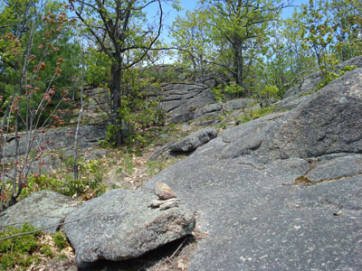
At the orange gate, I took a left and followed the snowmobile trail to the trailhead, conveniently marked with cairns. From here, the trail was decently marked with red blazes. Starting of gradually, the trail picked up in pitch as it navigated around some large boulders and over some neat ledges.
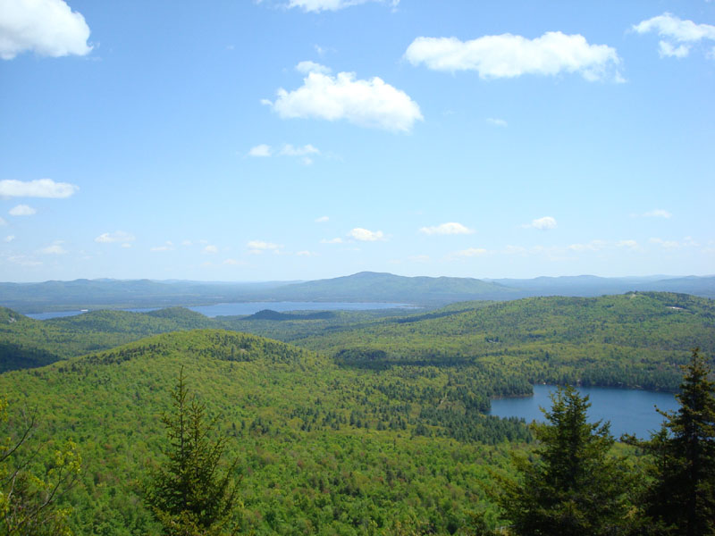
Soon enough, I arrived at the summit - it's truly one of the nicest summits I've ever been to. Open ledges, views in all directions, it was a tremendous place. I was surprised to find a log book in a container near a tree - and even more surprised to see someone had visited only three days earlier.
After walking around the ledges and enjoying the views, I had to call it a day and head back to work. I intend to visit this summit again someday soon!
| Hike Ratings |
|
Getting To Trailhead: |
Moderate |
| Destination: |
Bayle Mountain |
|
Length: |
Moderate |
|
Steepness: |
Difficult |
|
Navigation: |
Easy |
|
Views: |
Excellent |
|
Crowds: |
Minimal |
|
| Hike Stats |
|
Date Hiked: |
Tuesday, May 20, 2008 |
| Hike Commenced: |
11:27 AM |
| Parking Elevation: |
1,040' |
| Destination: |
Bayle Mountain |
| Ascent Commenced: |
11:33 AM |
| Summit Reached: |
11:52 AM |
| Time Elapsed: |
00:19 |
| Trailhead Elevation: |
1,100' |
| Summit Elevation: |
1,853' |
| Vertical Gain: |
763' |
|
|
| Hike Ended: |
12:34 PM |
| Hike Time Elapsed: |
01:07 |
| Hike Vertical Gain: |
873' |
|
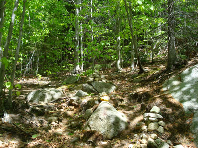
The trailhead to the trail to the Bayle Mountain summit
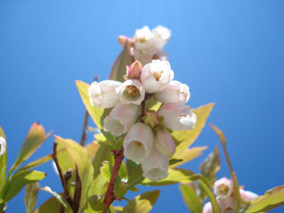
A wild low bush blueberry plant flowering near the summit of Bayle Mountain
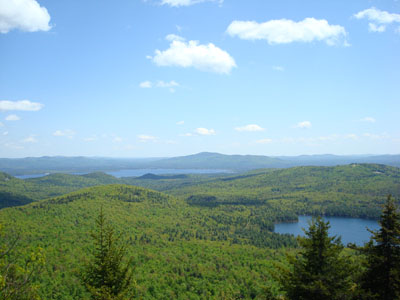
Looking southeast at Green Mountain from the Bayle Mountain summit
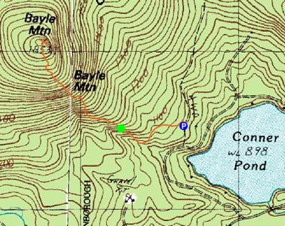

Directions to trailhead: From Route 16 South in West Ossipee, take a right onto Pine Hill Road. At the end of Pine Hill Road, take a right onto Ossipee Mountain Road. 2015 update: There is now a parking area off Marble Road, past Connor Pond.
Back to Bayle Mountain Profile
|