Home
States
Colorado
Connecticut
Maine
Massachusetts
New Hampshire
New York
Rhode Island
Utah
Vermont
View All
Lists
NE 4,000 Footers
NE 100 Highest
NH 4,000 Footers
NH 100 Highest
NH 52 With A View
NH Belknap Range
NH Ossipee 10
Links
Trail Conditions
Trip Log
Sunrises
Sunsets
About
|
Bayle Mountain
Ossipee, NH
Trailheads, measurements, times, distances, and maps are all approximate and relative to the hike(s) as shown below.
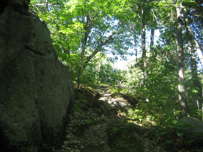
Looking up the trail to Bayle Mountain
Route: Unknown snowmobile trail, red blazed trail, (Bayle Mountain), red blazed trail, unknown snowmobile trail
Since it was such a nice day, I decided to do a smaller, local hike after having done a few larger hikes in the last week.
The snowmobile trail was in good shape - recently widened, regraded, and hayed. The Bayle Mountain Trail was also in good shape - dry and freshly reblazed.
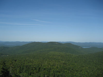
The views from the top were excellent as usual - it's easy to spend a lot of time there. While July had been a decent month in terms of log book entries, no one had signed it in the past ten days. Nonetheless, since I knew from my last visit that the book was filling up quickly, I brought up a new log book and pen, so that it will make it through the fall.
While there were a few mosquitoes out, they weren't an issue if you kept moving.
Another great day on Bayle Mountain!
| Hike Ratings |
|
Getting To Trailhead: |
Moderate |
| Destination: |
Bayle Mountain |
|
Length: |
Moderate |
|
Steepness: |
Difficult |
|
Navigation: |
Easy |
|
Views: |
Excellent |
|
Crowds: |
Minimal |
|
| Hike Stats |
|
Date Hiked: |
Wednesday, August 27, 2008 |
| Hike Commenced: |
3:55 PM |
| Parking Elevation: |
1,040' |
| Destination: |
Bayle Mountain |
| Ascent Commenced: |
4:00 PM |
| Summit Reached: |
4:20 PM |
| Time Elapsed: |
00:20 |
| Trailhead Elevation: |
1,100' |
| Summit Elevation: |
1,853' |
| Vertical Gain: |
763' |
|
|
| Hike Vertical Gain: |
873' |
|
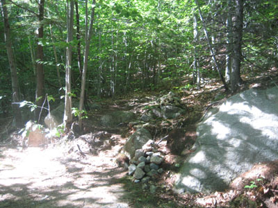
The trailhead to the trail to the Bayle Mountain summit
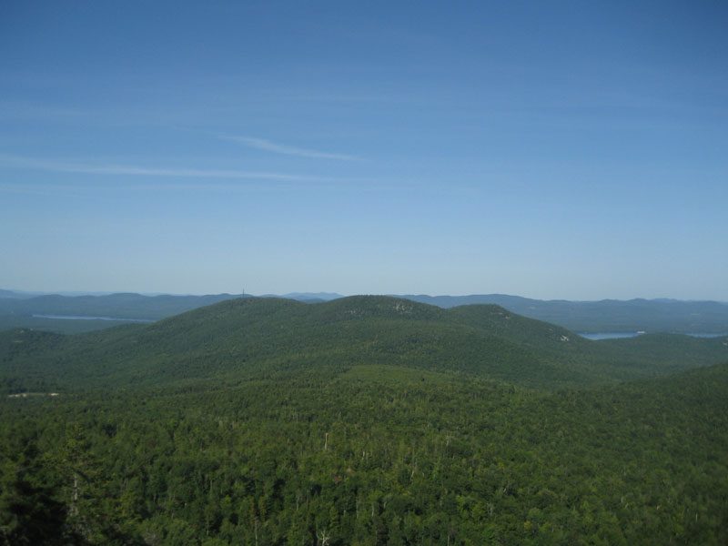
Looking at the Nickerson Mountains from the Bayle Mountain summit
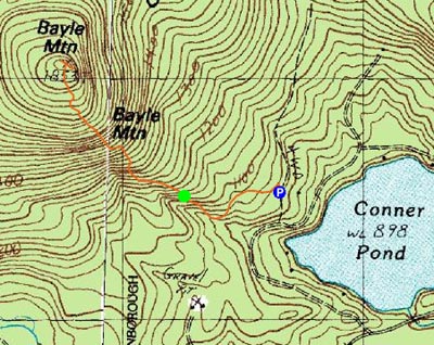

Directions to trailhead: From Route 16 South in West Ossipee, take a right onto Pine Hill Road. At the end of Pine Hill Road, take a right onto Ossipee Mountain Road. 2015 update: There is now a parking area off Marble Road, past Connor Pond.
Back to Bayle Mountain Profile
|