Home
States
Colorado
Connecticut
Maine
Massachusetts
New Hampshire
New York
Rhode Island
Utah
Vermont
View All
Lists
NE 4,000 Footers
NE 100 Highest
NH 4,000 Footers
NH 100 Highest
NH 52 With A View
NH Belknap Range
NH Ossipee 10
Links
Trail Conditions
Trip Log
Sunrises
Sunsets
About
|
Bayle Mountain
Ossipee, NH
Trailheads, measurements, times, distances, and maps are all approximate and relative to the hike(s) as shown below.
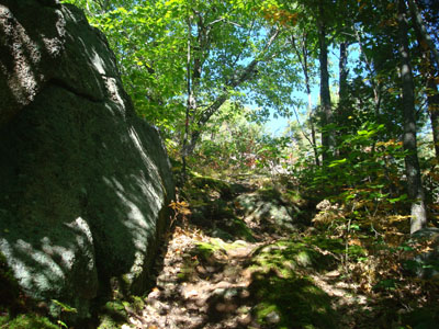
Looking up the trail to Bayle Mountain
Route: Unknown snowmobile trail, red blazed trail, (Bayle Mountain), red blazed trail, unknown snowmobile trail
While my plan had been to hike something in the western part of the state, the discovery of a nail in my tire postponed that grand scheme. Once I had that situation straightened out, I started to head west on Route 25 - only to see some thick layers of clouds in the distance. Since it was virtually all blue sky back in the northeastern Lakes Region, I decided to turn around, grab a book, and head up to Bayle.
The trail up Bayle Mountain had been recently blazed a nice bright red, making things easier to follow. A few sections were a little bit wet from the hurricane that had passed a night earlier, but on the whole the trail was in good shape considering. The early fall leaf colors were particularly nice.
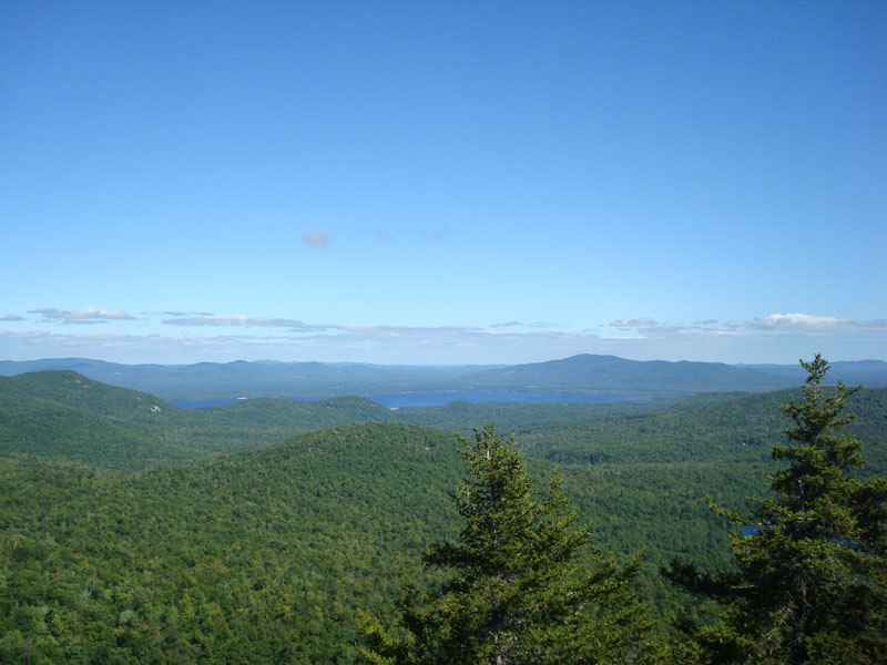
The summit was great as usual - a nice breeze, excellent views...perfect for doing some leisurely Sunday afternoon reading.
| Hike Ratings |
|
Getting To Trailhead: |
Moderate |
| Destination: |
Bayle Mountain |
|
Length: |
Moderate |
|
Steepness: |
Difficult |
|
Navigation: |
Easy |
|
Views: |
Excellent |
|
Crowds: |
Minimal |
|
| Hike Stats |
|
Date Hiked: |
Sunday, September 7, 2008 |
| Hike Commenced: |
2:01 PM |
| Parking Elevation: |
1,040' |
| Destination: |
Bayle Mountain |
| Ascent Commenced: |
2:06 PM |
| Summit Reached: |
2:28 PM |
| Time Elapsed: |
00:22 |
| Trailhead Elevation: |
1,100' |
| Summit Elevation: |
1,853' |
| Vertical Gain: |
763' |
|
|
| Hike Ended: |
4:01 PM |
| Hike Time Elapsed: |
02:00 |
| Hike Vertical Gain: |
873' |
|
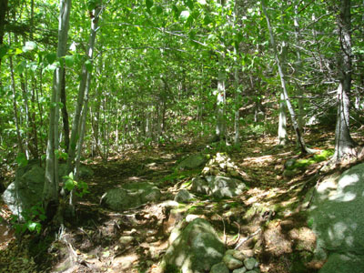
The trailhead to the trail to the Bayle Mountain summit
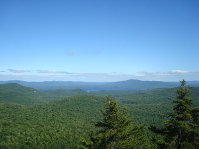
Looking at Green Mountain from the Bayle Mountain summit
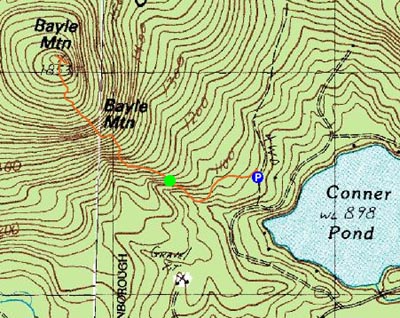

Directions to trailhead: From Route 16 South in West Ossipee, take a right onto Pine Hill Road. At the end of Pine Hill Road, take a right onto Ossipee Mountain Road. 2015 update: There is now a parking area off Marble Road, past Connor Pond.
Back to Bayle Mountain Profile
|