Home
States
Colorado
Connecticut
Maine
Massachusetts
New Hampshire
New York
Rhode Island
Utah
Vermont
View All
Lists
NE 4,000 Footers
NE 100 Highest
NH 4,000 Footers
NH 100 Highest
NH 52 With A View
NH Belknap Range
NH Ossipee 10
Links
Trail Conditions
Trip Log
Sunrises
Sunsets
About
|
Bayle Mountain
Ossipee, NH
Trailheads, measurements, times, distances, and maps are all approximate and relative to the hike(s) as shown below.
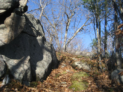
Looking up the trail to Bayle Mountain
Route: Unknown snowmobile trail, red blazed trail, (Bayle Mountain), red blazed trail, unknown snowmobile trail
With some more time off coming to me, I was thinking about going up north once again. Not wanting to deal with the clouds and cold temperatures, I decided to stay local and hike Bayle Mountain.
Opting for the scenic route, I parked at the western end of the snowmobile trail. With the leaves down, I was surprised how open the beginning of the trail was - instead of being dark and shady, it was basking in the sun.
While the leaves were a bit slippery (as well as a short patch of ice), the trail was nonetheless barebootable.
As usual, the views from the summit were tremendous. Though cold and windy, I, for the first time, why don't I add another comma based phrase into this poorly worded sentence, carried a thermos with some hot chocolate. A nice way to stay warm!
I took my time descending, doing some light bushwacking and finding some additional excellent views. What a neat mountain!
| Hike Ratings |
|
Getting To Trailhead: |
Moderate |
| Destination: |
Bayle Mountain |
|
Length: |
Moderate |
|
Steepness: |
Difficult |
|
Navigation: |
Easy |
|
Views: |
Excellent |
|
Crowds: |
Minimal |
|
| Hike Stats |
|
Date Hiked: |
Friday, November 21, 2008 |
| Hike Commenced: |
12:56 PM |
| Parking Elevation: |
1,005' |
| Destination: |
Bayle Mountain |
| Ascent Commenced: |
1:10 PM |
| Summit Reached: |
1:34 PM |
| Time Elapsed: |
00:24 |
| Trailhead Elevation: |
1,100' |
| Summit Elevation: |
1,853' |
| Vertical Gain: |
763' |
|
|
| Hike Vertical Gain: |
1,028' |
|
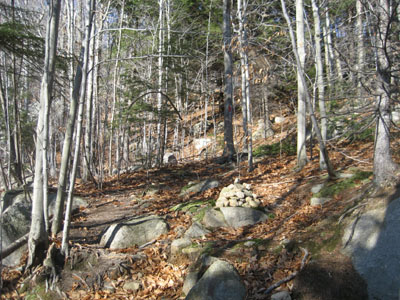
The trailhead to the trail to the Bayle Mountain summit
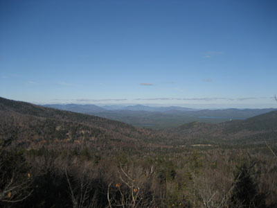
Looking at Kearsarge North Mountain from the Bayle Mountain summit
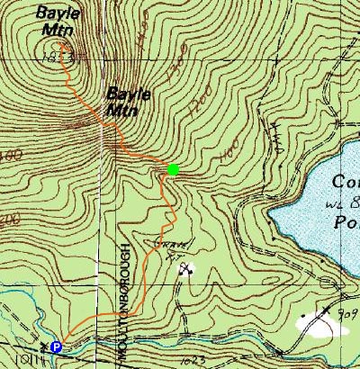

Directions to trailhead: From Route 16 South in West Ossipee, take a right onto Pine Hill Road. At the end of Pine Hill Road, take a right onto Ossipee Mountain Road. Shortly after passing Connor Pond, bear right onto Marble Road. Just before a narrow wooden bridge, the snowmobile trail enters on the right (and then leaves on the left after the bridge), marked slightly off the road with an orange gate. Park here without blocking the roads or trails, and head up the snowmobile trail on the right. The trailhead will be about 10-20 minutes up this snowmobile trail, to the left at a height of land on a curve in the road, marked with a cairn.
Back to Bayle Mountain Profile
|

