Home
States
Colorado
Connecticut
Maine
Massachusetts
New Hampshire
New York
Rhode Island
Utah
Vermont
View All
Lists
NE 4,000 Footers
NE 100 Highest
NH 4,000 Footers
NH 100 Highest
NH 52 With A View
NH Belknap Range
NH Ossipee 10
Links
Trail Conditions
Trip Log
Sunrises
Sunsets
About
|
Bayle Mountain
Ossipee, NH
Trailheads, measurements, times, distances, and maps are all approximate and relative to the hike(s) as shown below.
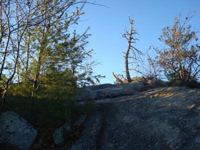
Looking up the trail to Bayle Mountain
Route: Unknown snowmobile trail, red blazed trail, (Bayle Mountain), red blazed trail, unknown snowmobile trail
After getting chased by high winds off the Algonquin Trail a bit below the Sandwich Dome, we decided to head over to the Ossipees and get a little more hiking in on a nice sunny day.
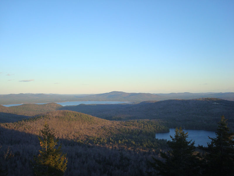
Though the leaves made things a bit slippery, the ascent was much easier than the previous hike, as there was very little in way of winds or ice with which to deal. The summit, on the other hand was a bit cold and windy. The views made up for this, however, as peaks in all directions were very easily seen.
Since there are much larger peaks to the west, there wasn't much to see in terms of a sunset as we descended. Nonetheless, there was enough light to get back to the trailhead without headlamps.
Another nice hike to Bayle Mountain!
| Hike Ratings |
|
Getting To Trailhead: |
Moderate |
| Destination: |
Bayle Mountain |
|
Length: |
Moderate |
|
Steepness: |
Difficult |
|
Navigation: |
Easy |
|
Views: |
Excellent |
|
Crowds: |
Minimal |
|
| Hike Stats |
|
Date Hiked: |
Sunday, November 23, 2008 |
| Hike Commenced: |
3:04 PM |
| Parking Elevation: |
1,005' |
| Destination: |
Bayle Mountain |
| Ascent Commenced: |
3:18 PM |
| Summit Reached: |
3:42 PM |
| Time Elapsed: |
00:24 |
| Trailhead Elevation: |
1,100' |
| Summit Elevation: |
1,853' |
| Vertical Gain: |
763' |
|
|
| Hike Ended: |
4:35 PM |
| Hike Time Elapsed: |
01:31 |
| Hike Vertical Gain: |
1,028' |
|
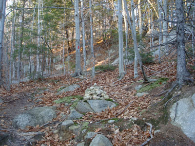
The trailhead to the trail to the Bayle Mountain summit
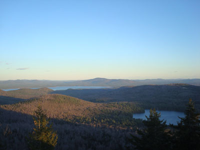
Looking at Green Mountain from the Bayle Mountain summit
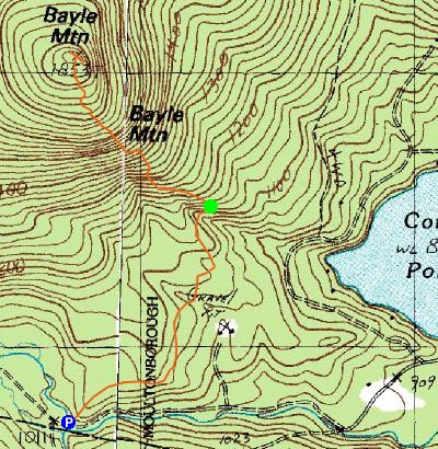

Directions to trailhead: From Route 16 South in West Ossipee, take a right onto Pine Hill Road. At the end of Pine Hill Road, take a right onto Ossipee Mountain Road. Shortly after passing Connor Pond, bear right onto Marble Road. Just before a narrow wooden bridge, the snowmobile trail enters on the right (and then leaves on the left after the bridge), marked slightly off the road with an orange gate. Park here without blocking the roads or trails, and head up the snowmobile trail on the right. The trailhead will be about 10-20 minutes up this snowmobile trail, to the left at a height of land on a curve in the road, marked with a cairn.
Back to Bayle Mountain Profile
|