Home
States
Colorado
Connecticut
Maine
Massachusetts
New Hampshire
New York
Rhode Island
Utah
Vermont
View All
Lists
NE 4,000 Footers
NE 100 Highest
NH 4,000 Footers
NH 100 Highest
NH 52 With A View
NH Belknap Range
NH Ossipee 10
Links
Trail Conditions
Trip Log
Sunrises
Sunsets
About
|
Bayle Mountain
Ossipee, NH
Trailheads, measurements, times, distances, and maps are all approximate and relative to the hike(s) as shown below.
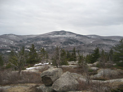
Looking down the trail to Bayle Mountain near the summit
Route: Unknown snowmobile trail, red blazed trail, (Bayle Mountain), red blazed trail, unknown snowmobile trail
Another day of bland weather. Thus, I wanted to do something shorter without any water crossings and minimal snow. Bayle Mountain!
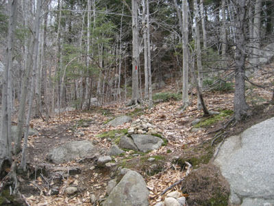
After parking on the side of the road just past the bridge, I quickly set foot down the snowmobile trail. Alternating between dry, muddy, snowy, and icy, it was nonetheless barebootable.
The Bayle Mountain Trail, on the other hand, was virtually snow free. Arriving at the summit, the views were decent, despite the clouds.
After staying away for a few months due to lack of room to park, it was nice to return to Bayle!
| Hike Ratings |
|
Getting To Trailhead: |
Moderate |
| Destination: |
Bayle Mountain |
|
Length: |
Moderate |
|
Steepness: |
Difficult |
|
Navigation: |
Easy |
|
Views: |
Excellent |
|
Crowds: |
Minimal |
|
| Hike Stats |
|
Date Hiked: |
Wednesday, April 8, 2009 |
| Hike Commenced: |
3:44 PM |
| Parking Elevation: |
1,005' |
| Destination: |
Bayle Mountain |
| Ascent Commenced: |
4:00 PM |
| Summit Reached: |
4:26 PM |
| Time Elapsed: |
00:26 |
| Trailhead Elevation: |
1,100' |
| Summit Elevation: |
1,853' |
| Vertical Gain: |
763' |
|
|
| Hike Ended: |
5:37 PM |
| Hike Time Elapsed: |
01:53 |
| Hike Vertical Gain: |
1,028' |
|
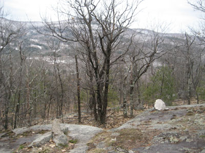
The trailhead to the trail to the Bayle Mountain summit
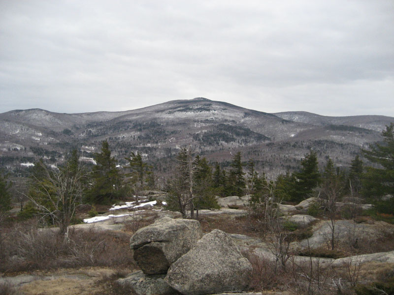
Looking Mt. Shaw from the Bayle Mountain summit
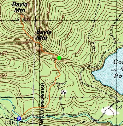

Directions to trailhead: From Route 16 South in West Ossipee, take a right onto Pine Hill Road. At the end of Pine Hill Road, take a right onto Ossipee Mountain Road. Shortly after passing Connor Pond, bear right onto Marble Road. Just before a narrow wooden bridge, the snowmobile trail enters on the right (and then leaves on the left after the bridge), marked slightly off the road with an orange gate. Park here without blocking the roads or trails, and head up the snowmobile trail on the right. The trailhead will be about 10-20 minutes up this snowmobile trail, to the left at a height of land on a curve in the road, marked with a cairn.
Back to Bayle Mountain Profile
|