Home
States
Colorado
Connecticut
Maine
Massachusetts
New Hampshire
New York
Rhode Island
Utah
Vermont
View All
Lists
NE 4,000 Footers
NE 100 Highest
NH 4,000 Footers
NH 100 Highest
NH 52 With A View
NH Belknap Range
NH Ossipee 10
Links
Trail Conditions
Trip Log
Sunrises
Sunsets
About
|
Bayle Mountain
Ossipee, NH
Trailheads, measurements, times, distances, and maps are all approximate and relative to the hike(s) as shown below.
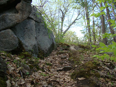
Looking up the Bayle Mountain Trail near the summit
Route: Unknown snowmobile trail, Bayle Mountain Trail, (Bayle Mountain), Bayle Mountain Trail, unknown snowmobile trail
After a long day at work, I had time to get a short hike in. Having not been to Bayle since the previous summer due to a state-sponsored closing of a Federally funded easement, it was nice to be able to enjoy the unique summit views.
Unfortunately, there were 11 blowdowns on the trail, along with signs saying the public were prohibited from doing anything about it (despite being a Federally "protected" trail). Who is John Galt?
| Hike Ratings |
|
Getting To Trailhead: |
Moderate |
| Destination: |
Bayle Mountain |
|
Length: |
Moderate |
|
Steepness: |
Difficult |
|
Navigation: |
Easy |
|
Views: |
Excellent |
|
Crowds: |
Minimal |
|
| Hike Stats |
|
Date Hiked: |
Thursday, May 6, 2010 |
| Hike Commenced: |
5:36 PM |
| Parking Elevation: |
1,005' |
| Destination: |
Bayle Mountain |
| Ascent Commenced: |
5:45 PM |
| Summit Reached: |
6:00 PM |
| Time Elapsed: |
00:15 |
| Trailhead Elevation: |
1,100' |
| Summit Elevation: |
1,853' |
| Vertical Gain: |
763' |
|
|
| Hike Ended: |
6:36 PM |
| Hike Time Elapsed: |
01:00 |
| Hike Vertical Gain: |
1,028' |
|
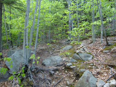
The Bayle Mountain Trail trailhead on the snowmobile trail
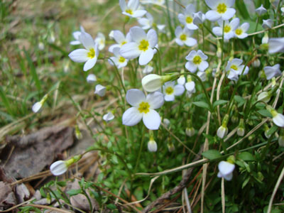
Bluets on the snowmobile trail
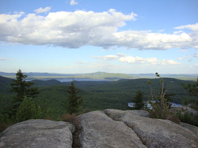
Green Mountain and Ossipee Lake as seen from Bayle Mountain
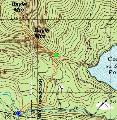

Directions to trailhead: From Route 16 South in West Ossipee, take a right onto Pine Hill Road. At the end of Pine Hill Road, take a right onto Ossipee Mountain Road. Shortly after passing Connor Pond, bear right onto Marble Road. Just before a narrow wooden bridge, the snowmobile trail enters on the right (and then leaves on the left after the bridge), marked slightly off the road with an orange gate. Park here without blocking the roads or trails, and head up the snowmobile trail on the right. The trailhead will be about 10-20 minutes up this snowmobile trail, to the left at a height of land on a curve in the road, marked with a cairn.
Back to Bayle Mountain Profile
|

