Home
States
Colorado
Connecticut
Maine
Massachusetts
New Hampshire
New York
Rhode Island
Utah
Vermont
View All
Lists
NE 4,000 Footers
NE 100 Highest
NH 4,000 Footers
NH 100 Highest
NH 52 With A View
NH Belknap Range
NH Ossipee 10
Links
Trail Conditions
Trip Log
Sunrises
Sunsets
About
|
Bayle Mountain
Ossipee, NH
Trailheads, measurements, times, distances, and maps are all approximate and relative to the hike(s) as shown below.
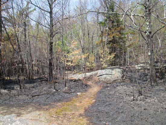
Looking up the charred Bayle Mountain Trail
Route: Unknown snowmobile trail, Bayle Mountain Trail, (Bayle Mountain), Bayle Mountain Trail, unknown snowmobile trail
With the Bayle Mountain forest fire recently extinguished, I decided to check out the trail.
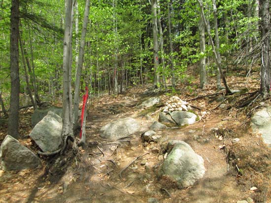
The snowmobile trails/logging roads were a little more difficult to navigate than I remembered, as some new roads had been added since my previous visit. The Bayle Mountain Trail trailhead was well marked, most likely for firefighters who had been using it to access the blaze.
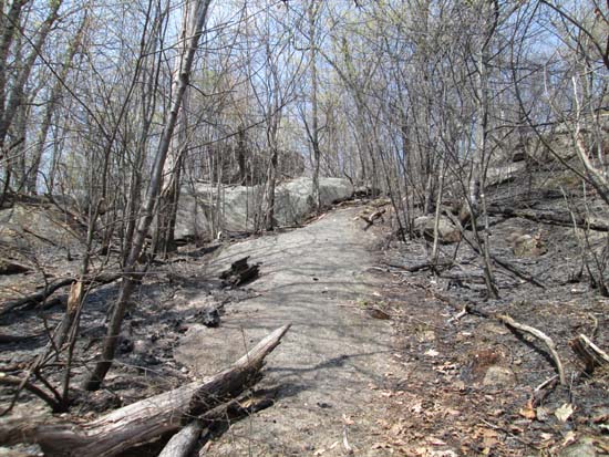
While the first tenth of a mile of the trail was green, it soon transitioned into charred undergrowth, with saplings and grown trees surviving. Though there was a carpet of burned leaves as far as the eye could see, the actual trail footbed still retained its leaves and grass.
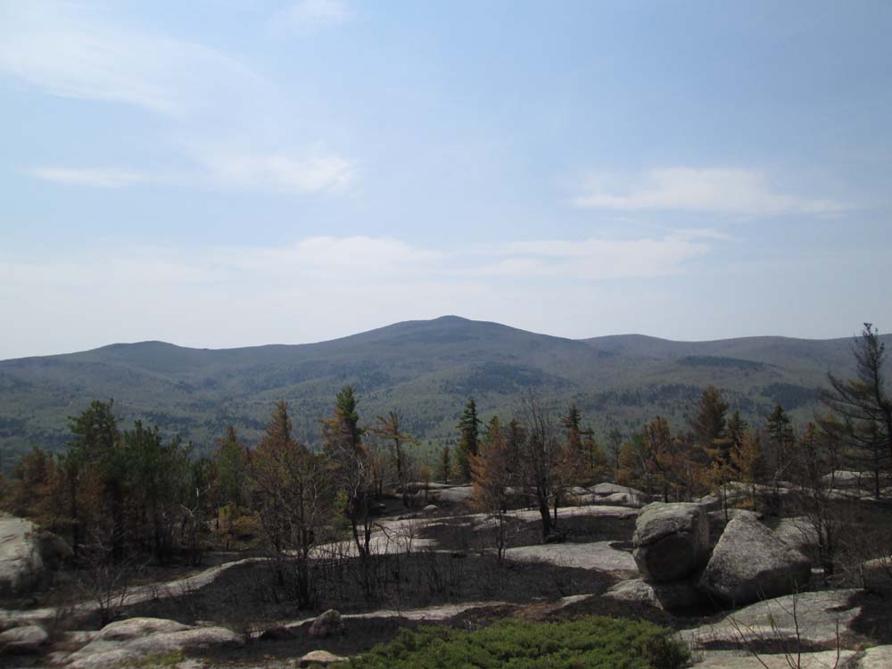
Arriving at the summit, perhaps half of the blueberry patches had been burned (suggesting a good crop next year). In addition, it appeared the fire had climbed up the peak on all sides. Interestingly, it appeared as if the flames may have originated from the controversial logging recently conducted within the Federally funded easement.
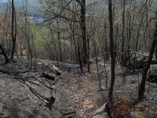
On the way down, I noticed smoke rising behind the split boulder. Sure enough, a large birch blowdown had flames emerging from it. I fortunately had enough Gatorade with me to douse the flames, though a good portion of the log appeared to be hot enough to catch again. Thusly, I called in the fire to dispatch when I regained cellphone reception, and soon a local firefighter (who was nearby monitoring the situation) was on his way to make sure it remained under control.
| Hike Ratings |
|
Getting To Trailhead: |
Moderate |
| Destination: |
Bayle Mountain |
|
Length: |
Moderate |
|
Steepness: |
Difficult |
|
Navigation: |
Moderate |
|
Views: |
Excellent |
|
Crowds: |
Minimal |
|
| Hike Stats |
|
Date Hiked: |
Sunday, May 10, 2015 |
| Parking Elevation: |
1,005' |
| Time to Trailhead: |
00:26 |
| Distance to Trailhead: |
0.7 mile |
| Destination: |
Bayle Mountain |
| Time Elapsed: |
00:23 |
| Trailhead Elevation: |
1,100' |
| Summit Elevation: |
1,853' |
| Distance: |
0.65 mile |
| Vertical Gain: |
763' |
|
|
| Hike Time Elapsed: |
01:48 |
| Hike Vertical Gain: |
1,028' |
|
The Bayle Mountain Trail trailhead on the snowmobile trail
Looking down the charred Bayle Mountain Trail
Looking up the charred Bayle Mountain Trail
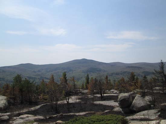
Mt. Shaw as seen from Bayle Mountain
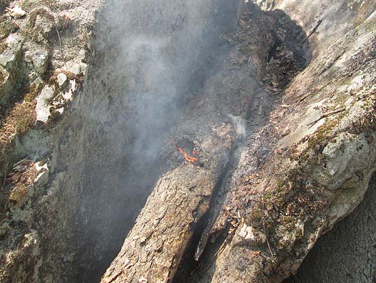
A birch blowdown catches fire in the mid day sun
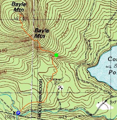

Directions to trailhead: From Route 16 South in West Ossipee, take a right onto Pine Hill Road. At the end of Pine Hill Road, take a right onto Ossipee Mountain Road. Shortly after passing Connor Pond, bear right onto Marble Road. In 2015, a roadside parking area had been added, just before a narrow wooden bridge. A snowmobile trail departs to the right, immediately before the bridge, marked slightly off the road with an orange gate. Proceed on foot, continuing straight at a junction about a third of a mile later. Soon thereafter, bear right at a junction. The trailhead will be about 0.3 miles further up this snowmobile trail, to the left at a height of land on a curve in the road, marked with a cairn.
Back to Bayle Mountain Profile
|