Home
States
Colorado
Connecticut
Maine
Massachusetts
New Hampshire
New York
Rhode Island
Utah
Vermont
View All
Lists
NE 4,000 Footers
NE 100 Highest
NH 4,000 Footers
NH 100 Highest
NH 52 With A View
NH Belknap Range
NH Ossipee 10
Links
Trail Conditions
Trip Log
Sunrises
Sunsets
About
|
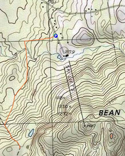
Bean Hill
Northfield, NH
Trailheads, measurements, times, distances, and maps are all approximate and relative to the hike(s) as shown below.
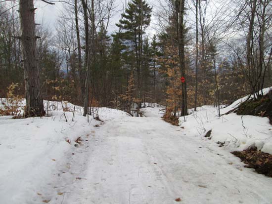
Ascending a snowmobile trail
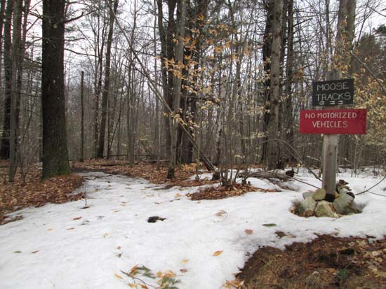
Route: Moose Tracks, snowmobile trail, bushwhack, (Bean Hill)
The bottom of the former ski area (ie the mountain bike park) is posted, as is a backdoor approach from the adjacent condo complex, and a logging landing east of there. So, the seemingly obvious points of access were out.
A small network of trails recently opened just before the entrance of the ski area. We took the Moose Tracks trail to the snowmobile trail, the took that up to the height of land. While there were occasional bare spots, there was generally enough coverage to allow snowshoeing.
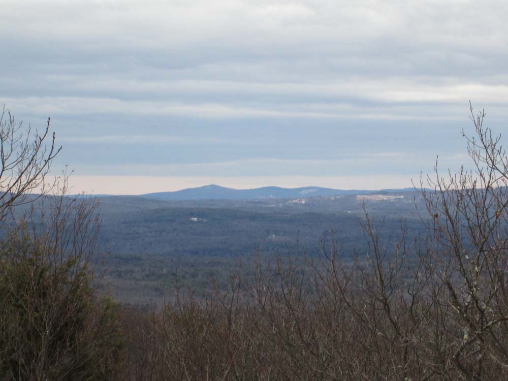
At the height of land, we bushwhacked up to Bean Hill in generally open woods, avoiding the subpeak with the mountain bike facility. Snowpack was generally 6-10" with some bare spots on southern facing areas. The summit ledge had decent views with the leaves down (Belknaps, Prospect), but would have narrow views with foliage. By the looks of it, this may have been a more popular peak once upon a time (memorial plaque from the 1950s, some old view enhancing cuts). It also appears there could be an informal trail heading off the northeast side of the peak, but I don't know where this would come out.
| Hike Ratings |
|
Getting To Trailhead: |
Easy |
| Destination: |
Bean Hill |
|
Length: |
Moderate |
|
Steepness: |
Difficult |
|
Navigation: |
Difficult |
|
Views: |
Excellent |
|
Crowds: |
Minimal |
|
| Hike Stats |
|
Date Hiked: |
Saturday, April 5, 2014 |
| Parking Elevation: |
840' |
| Destination: |
Bean Hill |
| Time Elapsed: |
01:10 |
| Trailhead Elevation: |
840' |
| Summit Elevation: |
1,510' |
| Vertical Gain: |
870' |
|
|
| Hike Time Elapsed: |
02:59 |
| Hike Vertical Gain: |
1,070' |
|
The start of the Moose Tracks trail off Ski Hill Drive
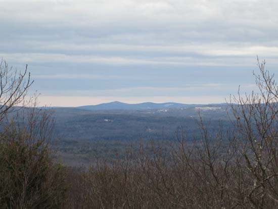
Looking at east at Prospect Mountain from Bean Hill

Directions to trailhead: From I-93 northbound, take exit 19, then bear right onto Route 132 south. Take a left onto Bean Hill Road. Ski Hill Road (Highland Mountain access road) will eventually be on the right. The Moose Tracks trail is on the right prior to reaching the mountain bike parking lot.
Back to Bean Hill Profile
|