Home
States
Colorado
Connecticut
Maine
Massachusetts
New Hampshire
New York
Rhode Island
Utah
Vermont
View All
Lists
NE 4,000 Footers
NE 100 Highest
NH 4,000 Footers
NH 100 Highest
NH 52 With A View
NH Belknap Range
NH Ossipee 10
Links
Trail Conditions
Trip Log
Sunrises
Sunsets
About
|
Big Ball Mountain, Black Snoot
Tuftonboro, NH, Moultonboro, NH
Trailheads, measurements, times, distances, and maps are all approximate and relative to the hike(s) as shown below.
Looking up the Banana Trail
Route: Mt. Shaw Trail, Tate Mountain Trail, Banana Trail, (Big Ball Mountain), Banana Trail, Black Snout Spur Trail, (Black Snoot), bushwack, Black Snout Spur Trail, Banana Trail, (Big Ball Mountain), Banana Trail, Tate Mountain Trail, Mt. Shaw Trail
After waiting out the morning rain, we headed up to Big Ball Mountain. With the exception of the small col prior to the summit, the trail is snow free. With skies clearing, we decided to continue up to Black Snoot.
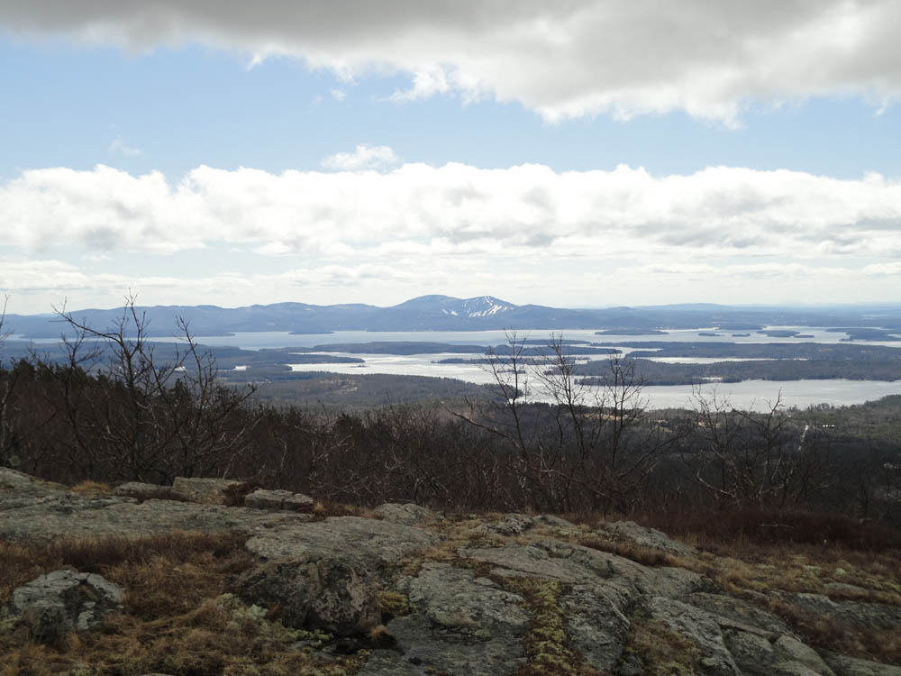
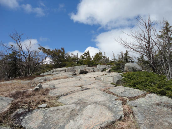
The Banana Trail between the peaks was generally snow free, though there were some patches of snow and blue ice. Reaching the summit, we had decent views of the Belknaps, points to the southeast, and Mt. Moosilauke.
With only Microspikes, we decided to press our luck and continue to Mt. Shaw. This idea quickly fizzled, as we encountered deep snow on the carriage road, making for excessive postholing without snowshoes. Instead, we decided to turn back and return from whence we came.
| Hike Ratings |
|
Getting To Trailhead: |
Easy |
| Destination: |
Big Ball Mountain |
|
Length: |
Moderate |
|
Steepness: |
Difficult |
|
Navigation: |
Easy |
|
Views: |
Excellent |
|
Crowds: |
Minimal |
| Destination: |
Black Snoot |
|
Length: |
Moderate |
|
Steepness: |
Difficult |
|
Navigation: |
Easy |
|
Views: |
Excellent |
|
Crowds: |
Minimal |
|
| Hike Stats |
|
Date Hiked: |
Sunday, April 17, 2011 |
| Parking Elevation: |
675' |
| Destination: |
Big Ball Mountain |
| Time Elapsed: |
01:14 |
| Trailhead Elevation: |
675' |
| Summit Elevation: |
2,060' |
| Vertical Gain: |
1,455' |
| Destination: |
Black Snoot |
| Time Elapsed: |
00:52 |
| Trailhead Elevation: |
2,060' |
| Summit Elevation: |
2,803' |
| Vertical Gain: |
903' |
|
|
| Hike Time Elapsed: |
05:23 |
| Hike Vertical Gain: |
2,618' |
|
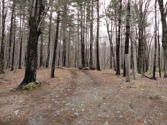
The Mt. Shaw Trail trailhead
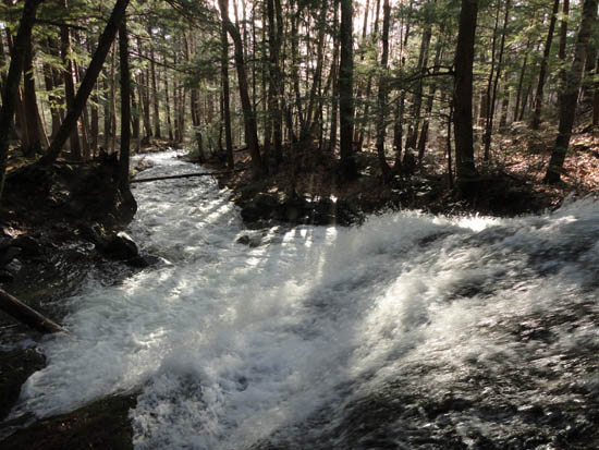
Roaring water along the Mt. Shaw Trail
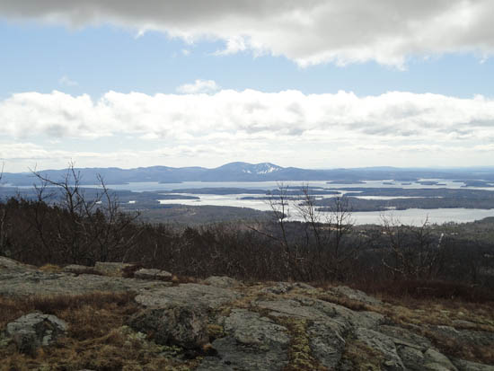
Looking at the Belknaps from the Big Ball Mountain summit
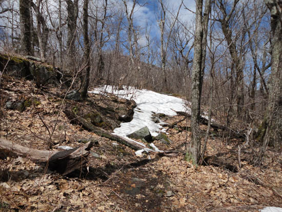
The Banana Trail on the way to Black Snoot
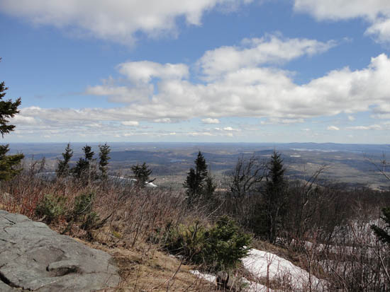
Looking southeast from Black Snoot
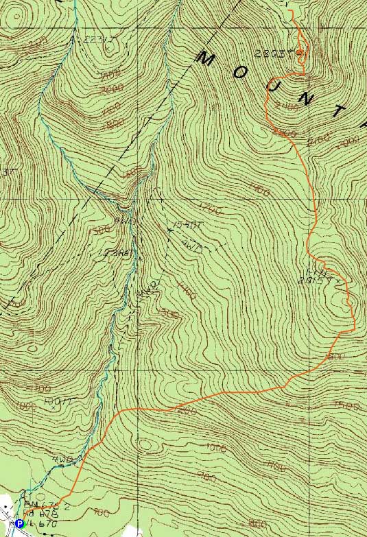

Directions to trailhead: Take 171 southeast from Route 25, past Castle in the Clouds. Shortly after crossing the Tuftonboro town line, there is a bridge/brook crossing. Immediately after this, there is an informal parking lot on the left (maybe 4 cars). The unmarked trail starts at the back of this lot.
Back to Big Ball Mountain Profile
Back to Black Snoot Profile
|