Home
States
Colorado
Connecticut
Maine
Massachusetts
New Hampshire
New York
Rhode Island
Utah
Vermont
View All
Lists
NE 4,000 Footers
NE 100 Highest
NH 4,000 Footers
NH 100 Highest
NH 52 With A View
NH Belknap Range
NH Ossipee 10
Links
Trail Conditions
Trip Log
Sunrises
Sunsets
About
|
Big Ball Mountain
Tuftonboro, NH
Trailheads, measurements, times, distances, and maps are all approximate and relative to the hike(s) as shown below.
The Tate Mountain Trail
Route: Mt. Shaw Trail, Tate Mountain Trail, Banana Trail, (Big Ball Mountain), Banana Trail, Tate Mountain Trail, Mt. Shaw Trail
Mt. Shaw Trail segment was dry and in good shape.
Tate Mountain Trail was also dry by virtue of ground frost. Recent logging has changed the lower half of it. Running up in the dark, I missed the turn off from the logging road (where the road/trail go through a cut-through berm; marked with a small cairn) and ended up continuing up it until it took a sharp turn left. The road parallels the trail, so I was able to bushwhack a short distance south (right) to get back on the corridor.
The Banana Trail was also mostly dry, though there was some ice forming on ledges, including the scramble ledge between the peaks.
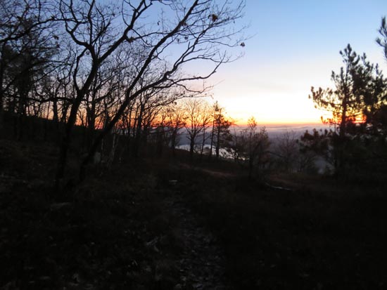
Chilly but nice sunrise from the false peak.
| Hike Ratings |
|
Getting To Trailhead: |
Easy |
| Destination: |
Big Ball Mountain |
|
Length: |
Moderate |
|
Steepness: |
Difficult |
|
Navigation: |
Moderate |
|
Views: |
Excellent |
|
Crowds: |
Minimal |
|
| Hike Stats |
|
Date Hiked: |
Tuesday, December 1, 2015 |
| Parking Elevation: |
670' |
| Destination: |
Big Ball Mountain |
| Time Elapsed: |
00:36 |
| Trailhead Elevation: |
675' |
| Summit Elevation: |
2,060' |
| Distance: |
1.7 miles |
| Vertical Gain: |
1,455' |
|
|
| Hike Time Elapsed: |
01:27 |
| Hike Distance: |
3.4 miles |
| Hike Vertical Gain: |
1,530' |
|
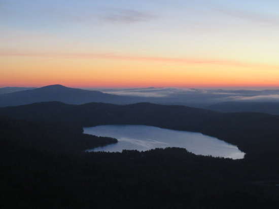
The sunrise from near the summit of Big Ball Mountain

The sunrise from near the summit of Big Ball Mountain
Directions to trailhead: Take 171 southeast from Route 25, past Castle in the Clouds. Shortly after crossing the Tuftonboro town line, there is a bridge/brook crossing. Immediately after this, there is an informal parking lot on the left (maybe 4 cars). The unmarked trail starts at the back of this lot.
Back to Big Ball Mountain Profile
|